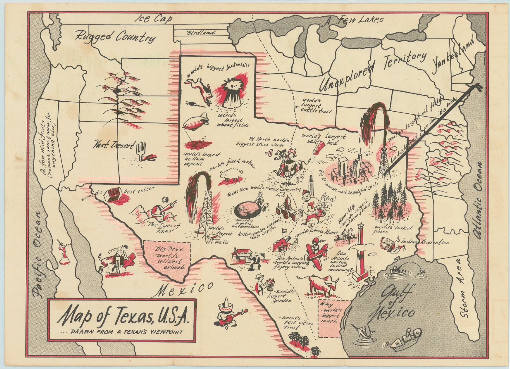
A Map of Texas, U.S.A... Drawn from a Texan’s Viewpoint: Texas Highway Dept. c. 1950
- Title: A Map of Texas, U.S.A... Drawn from a Texan’s Viewpoint
- Author: Texas Highway Dept.
- Date: c. 1950
- Medium: Printed
- Condition: Issued folding with a few light stains at left
- Inches: 11.5 x 8.6 [Paper]
- Centimeters: 29.21 x 21.84 [Paper]
- Product ID: 311003
This humorous map of North America was drawn with a vastly oversized Texas occupying approximately half of the United States, similar to the "Official Texas Brags Map" of 1948 on a smaller scale. Includes numerous vignettes within the state including "world's biggest jackrabbits", "world's largest oil field" and "Big D - world's most beautiful girls." Areas outside of Texas include "Storm Area", "Unexplored Territory", and "Yankeeland." Self-folding (4.3 x 9.0") with related text on verso. There are no past sales records and only one institutional example located on OCLC.
- Title: A Map of Texas, U.S.A... Drawn from a Texan’s Viewpoint
- Author: Texas Highway Dept.
- Date: c. 1950
- Medium: Printed
- Condition: Issued folding with a few light stains at left
- Inches: 11.5 x 8.6 [Paper]
- Centimeters: 29.21 x 21.84 [Paper]
- Product ID: 311003
This humorous map of North America was drawn with a vastly oversized Texas occupying approximately half of the United States, similar to the "Official Texas Brags Map" of 1948 on a smaller scale. Includes numerous vignettes within the state including "world's biggest jackrabbits", "world's largest oil field" and "Big D - world's most beautiful girls." Areas outside of Texas include "Storm Area", "Unexplored Territory", and "Yankeeland." Self-folding (4.3 x 9.0") with related text on verso. There are no past sales records and only one institutional example located on OCLC.
Original: $350.00
-65%$350.00
$122.50Description
- Title: A Map of Texas, U.S.A... Drawn from a Texan’s Viewpoint
- Author: Texas Highway Dept.
- Date: c. 1950
- Medium: Printed
- Condition: Issued folding with a few light stains at left
- Inches: 11.5 x 8.6 [Paper]
- Centimeters: 29.21 x 21.84 [Paper]
- Product ID: 311003
This humorous map of North America was drawn with a vastly oversized Texas occupying approximately half of the United States, similar to the "Official Texas Brags Map" of 1948 on a smaller scale. Includes numerous vignettes within the state including "world's biggest jackrabbits", "world's largest oil field" and "Big D - world's most beautiful girls." Areas outside of Texas include "Storm Area", "Unexplored Territory", and "Yankeeland." Self-folding (4.3 x 9.0") with related text on verso. There are no past sales records and only one institutional example located on OCLC.











