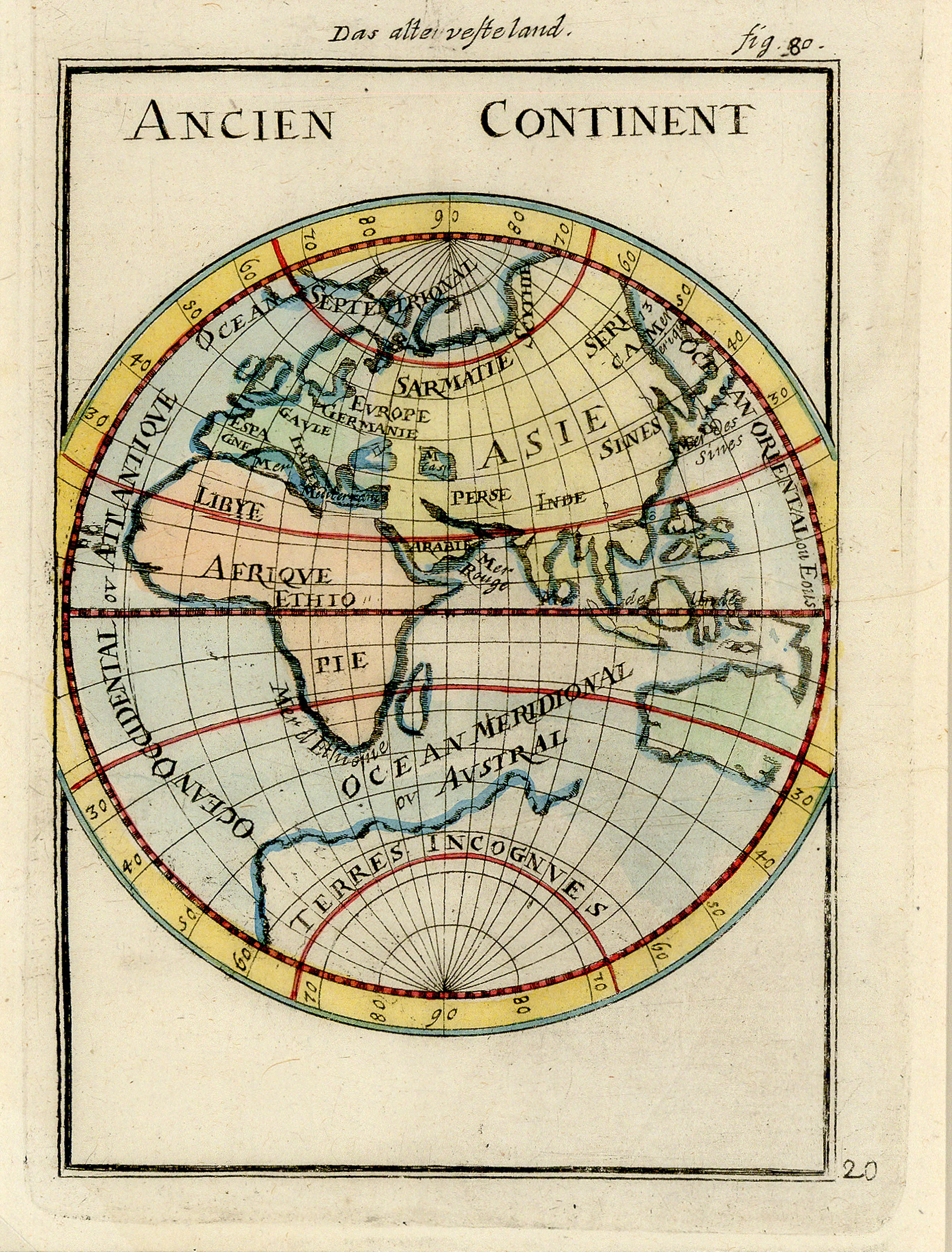
Ancien Continent: Mallet 1719
- Title: Ancien Continent
- Author: Alain Manesson Mallet
- Date: 1719
- Medium: Hand-colored copperplate engraving
- Condition: Very Good Plus - light scuffing, creasing extending from right margin into center of image
- Inches: 4 5/8 x 6 1/8 [Image]
- Centimeters: 11.75 x 15.56 [Image]
- Product ID: 102357
Map of the Eastern Hemisphere by Alain Manesson Mallet. Depicts the continents of Africa, Europe, Asia, and Antarctica ('Terres Incognues') with major regions labelled: Spain, France ('Gaule'), Libya, Ethiopia, Germany, Persia, India, and China ('Sines'), among others. Includes numbered lines of latitude, the major oceans, and the north and south poles.
Alain Manesson Mallet (1630-1706) was a French cartographer and engineer. He started his career as a soldier in the army of Louis XIV, became a Sergeant-Major in the artillery and an Inspector of Fortifications. He also served under the King of Portugal, before returning to France, and his appointment to the court of Louis XIV.
- Title: Ancien Continent
- Author: Alain Manesson Mallet
- Date: 1719
- Medium: Hand-colored copperplate engraving
- Condition: Very Good Plus - light scuffing, creasing extending from right margin into center of image
- Inches: 4 5/8 x 6 1/8 [Image]
- Centimeters: 11.75 x 15.56 [Image]
- Product ID: 102357
Map of the Eastern Hemisphere by Alain Manesson Mallet. Depicts the continents of Africa, Europe, Asia, and Antarctica ('Terres Incognues') with major regions labelled: Spain, France ('Gaule'), Libya, Ethiopia, Germany, Persia, India, and China ('Sines'), among others. Includes numbered lines of latitude, the major oceans, and the north and south poles.
Alain Manesson Mallet (1630-1706) was a French cartographer and engineer. He started his career as a soldier in the army of Louis XIV, became a Sergeant-Major in the artillery and an Inspector of Fortifications. He also served under the King of Portugal, before returning to France, and his appointment to the court of Louis XIV.
Description
- Title: Ancien Continent
- Author: Alain Manesson Mallet
- Date: 1719
- Medium: Hand-colored copperplate engraving
- Condition: Very Good Plus - light scuffing, creasing extending from right margin into center of image
- Inches: 4 5/8 x 6 1/8 [Image]
- Centimeters: 11.75 x 15.56 [Image]
- Product ID: 102357
Map of the Eastern Hemisphere by Alain Manesson Mallet. Depicts the continents of Africa, Europe, Asia, and Antarctica ('Terres Incognues') with major regions labelled: Spain, France ('Gaule'), Libya, Ethiopia, Germany, Persia, India, and China ('Sines'), among others. Includes numbered lines of latitude, the major oceans, and the north and south poles.
Alain Manesson Mallet (1630-1706) was a French cartographer and engineer. He started his career as a soldier in the army of Louis XIV, became a Sergeant-Major in the artillery and an Inspector of Fortifications. He also served under the King of Portugal, before returning to France, and his appointment to the court of Louis XIV.











