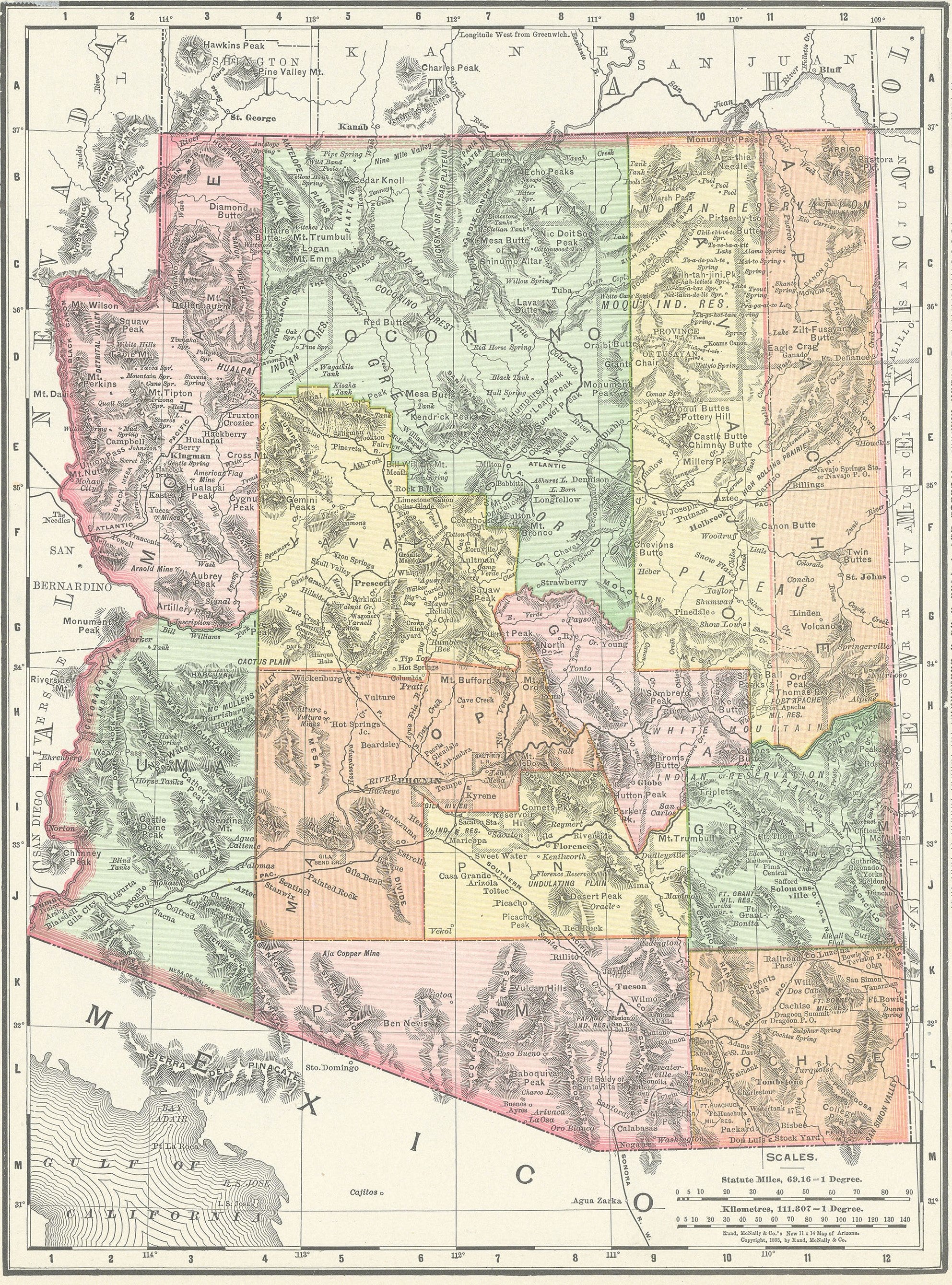
Arizona: Rand, McNally & Co. 1890
- Title: Arizona
- Author: Rand, McNally & Co.
- Date: 1890
- Medium: Wax engraving
- Condition: Very Good Plus - light age toning
- Inches: 14 1/4 x 11 [Paper]
- Centimeters: 36.2 x 27.9 [Paper]
- Product ID: 306014
Verso: Nevada
In 1856, William H. Rand opened a Chicago print shop, hiring Irish immigrant Andrew McNally as a printer two years later. They established a relationship with the Chicago Tribune’s predecessor, soon taking over its printing operation in full. Eventually, in 1868 Rand, McNally, and Rand’s nephew George Amos Poole bought out the Tribune and founded Rand, McNally & Co. Now with significant printing experience under their belt, the three men embarked on several publishing endeavors, capitalizing on the massive success of Chicago’s railroad industry by printing tickets, timetables, and railroad guides. Rand, McNally & Co.’s cartographic enterprise began as an offshoot of their existing publishing business; it was not until 1872 that the company printed its first map, a wax engraving that appeared in the company’s December Railroad Guide. Thanks to the low cost and ease of production associated with wax engravings, the firm quickly became the largest commercial publisher in the United States and to this day continues to produce quality atlases, maps, and globes.
- Title: Arizona
- Author: Rand, McNally & Co.
- Date: 1890
- Medium: Wax engraving
- Condition: Very Good Plus - light age toning
- Inches: 14 1/4 x 11 [Paper]
- Centimeters: 36.2 x 27.9 [Paper]
- Product ID: 306014
Verso: Nevada
In 1856, William H. Rand opened a Chicago print shop, hiring Irish immigrant Andrew McNally as a printer two years later. They established a relationship with the Chicago Tribune’s predecessor, soon taking over its printing operation in full. Eventually, in 1868 Rand, McNally, and Rand’s nephew George Amos Poole bought out the Tribune and founded Rand, McNally & Co. Now with significant printing experience under their belt, the three men embarked on several publishing endeavors, capitalizing on the massive success of Chicago’s railroad industry by printing tickets, timetables, and railroad guides. Rand, McNally & Co.’s cartographic enterprise began as an offshoot of their existing publishing business; it was not until 1872 that the company printed its first map, a wax engraving that appeared in the company’s December Railroad Guide. Thanks to the low cost and ease of production associated with wax engravings, the firm quickly became the largest commercial publisher in the United States and to this day continues to produce quality atlases, maps, and globes.
Description
- Title: Arizona
- Author: Rand, McNally & Co.
- Date: 1890
- Medium: Wax engraving
- Condition: Very Good Plus - light age toning
- Inches: 14 1/4 x 11 [Paper]
- Centimeters: 36.2 x 27.9 [Paper]
- Product ID: 306014
Verso: Nevada
In 1856, William H. Rand opened a Chicago print shop, hiring Irish immigrant Andrew McNally as a printer two years later. They established a relationship with the Chicago Tribune’s predecessor, soon taking over its printing operation in full. Eventually, in 1868 Rand, McNally, and Rand’s nephew George Amos Poole bought out the Tribune and founded Rand, McNally & Co. Now with significant printing experience under their belt, the three men embarked on several publishing endeavors, capitalizing on the massive success of Chicago’s railroad industry by printing tickets, timetables, and railroad guides. Rand, McNally & Co.’s cartographic enterprise began as an offshoot of their existing publishing business; it was not until 1872 that the company printed its first map, a wax engraving that appeared in the company’s December Railroad Guide. Thanks to the low cost and ease of production associated with wax engravings, the firm quickly became the largest commercial publisher in the United States and to this day continues to produce quality atlases, maps, and globes.











