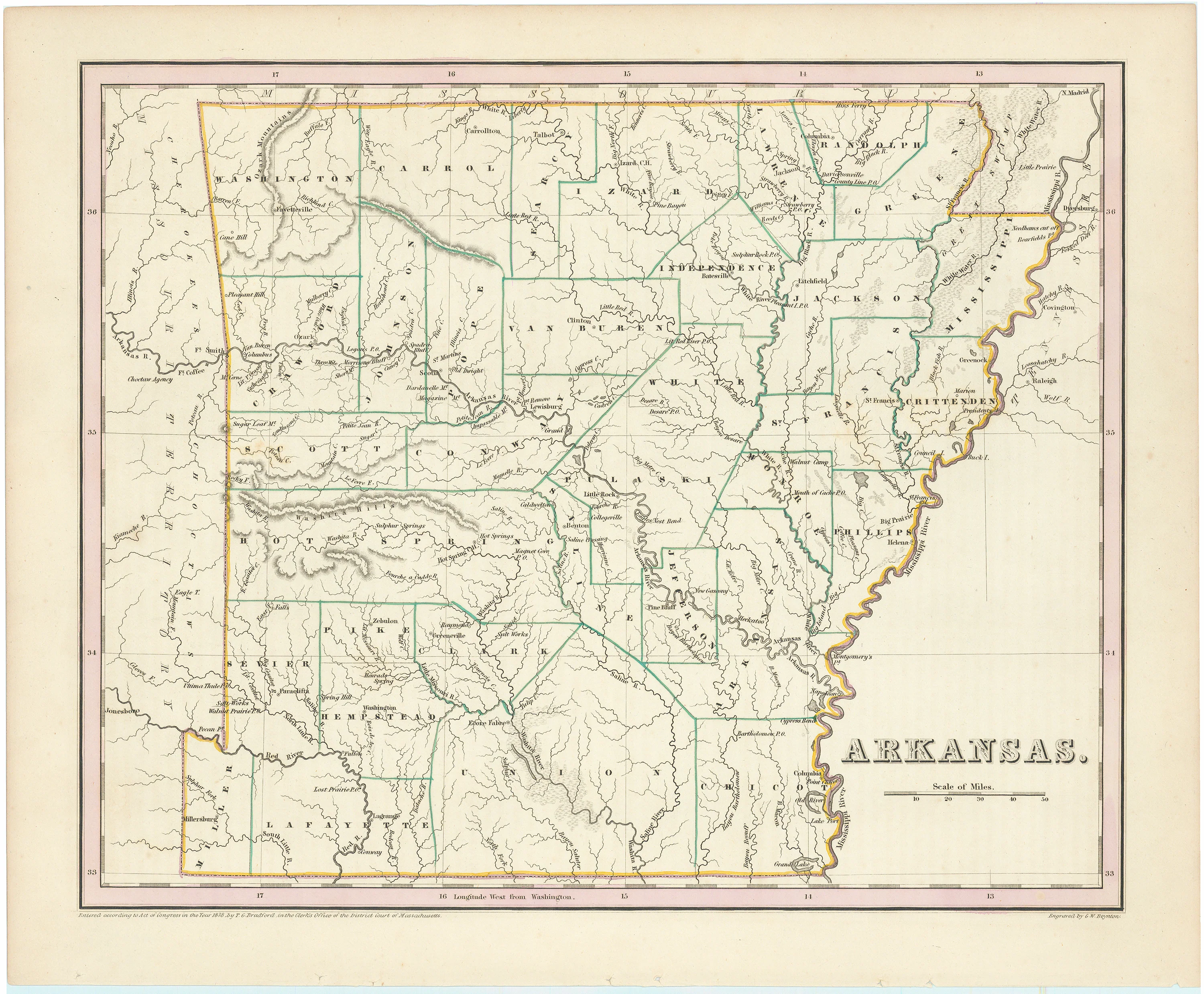
Arkansas: Bradford, 1838
- Title: Arkansas
- Author: Thomas G. Bradford
- Date: 1838
- Medium: Hand-colored lithograph
- Condition: Excellent - holes from original stab binding, very minor foxing
- Inches: 14 1/8 x 11 3/8 [Image]
- Centimeters: 35.87 x 28.89 [Image]
- Product ID: 308112
This map of Arkansas is from Bradford’s Illustrated Atlas Geographical, Statistical and Historical, 1838.
Thomas Gamaliel Bradford (1802-1887) was born in Boston, Massachusetts, where he worked as an assistant editor for the America Encyclopedia before entering the field of atlas publishing. Bradford focused his atlases on the United States and dispensed with the ornamental decoration common in European atlases in favor of a more informational approach, perhaps inspired by the efforts of the S.D.U.K.
Bradford's first major cartographic work was his revision and subsequent republication of an important French geography by Adrian Balbi, published in America as Atlas Designed to Illustrate the Abridgement of Universal Geography, Modern & Ancient, Boston, 1835. The atlas is extremely scarce, with only two known institutional copies, at Harvard and the University of Chicago. The maps are the same as in Bradford's more well-known Comprehensive Atlas, except for the coloring of the borders.
When Bradford published A Comprehensive Atlas: Geographical, Historical & Commercial in 1835, it was one of the first American atlases to include extensive geographical descriptions to supplement the maps, with sections on the physical view of the world, North America, South America, Europe, Africa, Asia, and ancient history and geography. The atlas included interesting charts, such as "Dwellings of Different Countries" and "Distribution of Vegetables, and Snow Line," and a great comparative chart of mountains and rivers.
Bradford revised and expanded the Comprehensive Atlas into his own important contribution to American cartography, the 1838 An Illustrated Atlas Geographical, Statistical and Historical of the United States and Adjacent Countries.
- Title: Arkansas
- Author: Thomas G. Bradford
- Date: 1838
- Medium: Hand-colored lithograph
- Condition: Excellent - holes from original stab binding, very minor foxing
- Inches: 14 1/8 x 11 3/8 [Image]
- Centimeters: 35.87 x 28.89 [Image]
- Product ID: 308112
This map of Arkansas is from Bradford’s Illustrated Atlas Geographical, Statistical and Historical, 1838.
Thomas Gamaliel Bradford (1802-1887) was born in Boston, Massachusetts, where he worked as an assistant editor for the America Encyclopedia before entering the field of atlas publishing. Bradford focused his atlases on the United States and dispensed with the ornamental decoration common in European atlases in favor of a more informational approach, perhaps inspired by the efforts of the S.D.U.K.
Bradford's first major cartographic work was his revision and subsequent republication of an important French geography by Adrian Balbi, published in America as Atlas Designed to Illustrate the Abridgement of Universal Geography, Modern & Ancient, Boston, 1835. The atlas is extremely scarce, with only two known institutional copies, at Harvard and the University of Chicago. The maps are the same as in Bradford's more well-known Comprehensive Atlas, except for the coloring of the borders.
When Bradford published A Comprehensive Atlas: Geographical, Historical & Commercial in 1835, it was one of the first American atlases to include extensive geographical descriptions to supplement the maps, with sections on the physical view of the world, North America, South America, Europe, Africa, Asia, and ancient history and geography. The atlas included interesting charts, such as "Dwellings of Different Countries" and "Distribution of Vegetables, and Snow Line," and a great comparative chart of mountains and rivers.
Bradford revised and expanded the Comprehensive Atlas into his own important contribution to American cartography, the 1838 An Illustrated Atlas Geographical, Statistical and Historical of the United States and Adjacent Countries.
Original: $295.00
-65%$295.00
$103.25Description
- Title: Arkansas
- Author: Thomas G. Bradford
- Date: 1838
- Medium: Hand-colored lithograph
- Condition: Excellent - holes from original stab binding, very minor foxing
- Inches: 14 1/8 x 11 3/8 [Image]
- Centimeters: 35.87 x 28.89 [Image]
- Product ID: 308112
This map of Arkansas is from Bradford’s Illustrated Atlas Geographical, Statistical and Historical, 1838.
Thomas Gamaliel Bradford (1802-1887) was born in Boston, Massachusetts, where he worked as an assistant editor for the America Encyclopedia before entering the field of atlas publishing. Bradford focused his atlases on the United States and dispensed with the ornamental decoration common in European atlases in favor of a more informational approach, perhaps inspired by the efforts of the S.D.U.K.
Bradford's first major cartographic work was his revision and subsequent republication of an important French geography by Adrian Balbi, published in America as Atlas Designed to Illustrate the Abridgement of Universal Geography, Modern & Ancient, Boston, 1835. The atlas is extremely scarce, with only two known institutional copies, at Harvard and the University of Chicago. The maps are the same as in Bradford's more well-known Comprehensive Atlas, except for the coloring of the borders.
When Bradford published A Comprehensive Atlas: Geographical, Historical & Commercial in 1835, it was one of the first American atlases to include extensive geographical descriptions to supplement the maps, with sections on the physical view of the world, North America, South America, Europe, Africa, Asia, and ancient history and geography. The atlas included interesting charts, such as "Dwellings of Different Countries" and "Distribution of Vegetables, and Snow Line," and a great comparative chart of mountains and rivers.
Bradford revised and expanded the Comprehensive Atlas into his own important contribution to American cartography, the 1838 An Illustrated Atlas Geographical, Statistical and Historical of the United States and Adjacent Countries.











