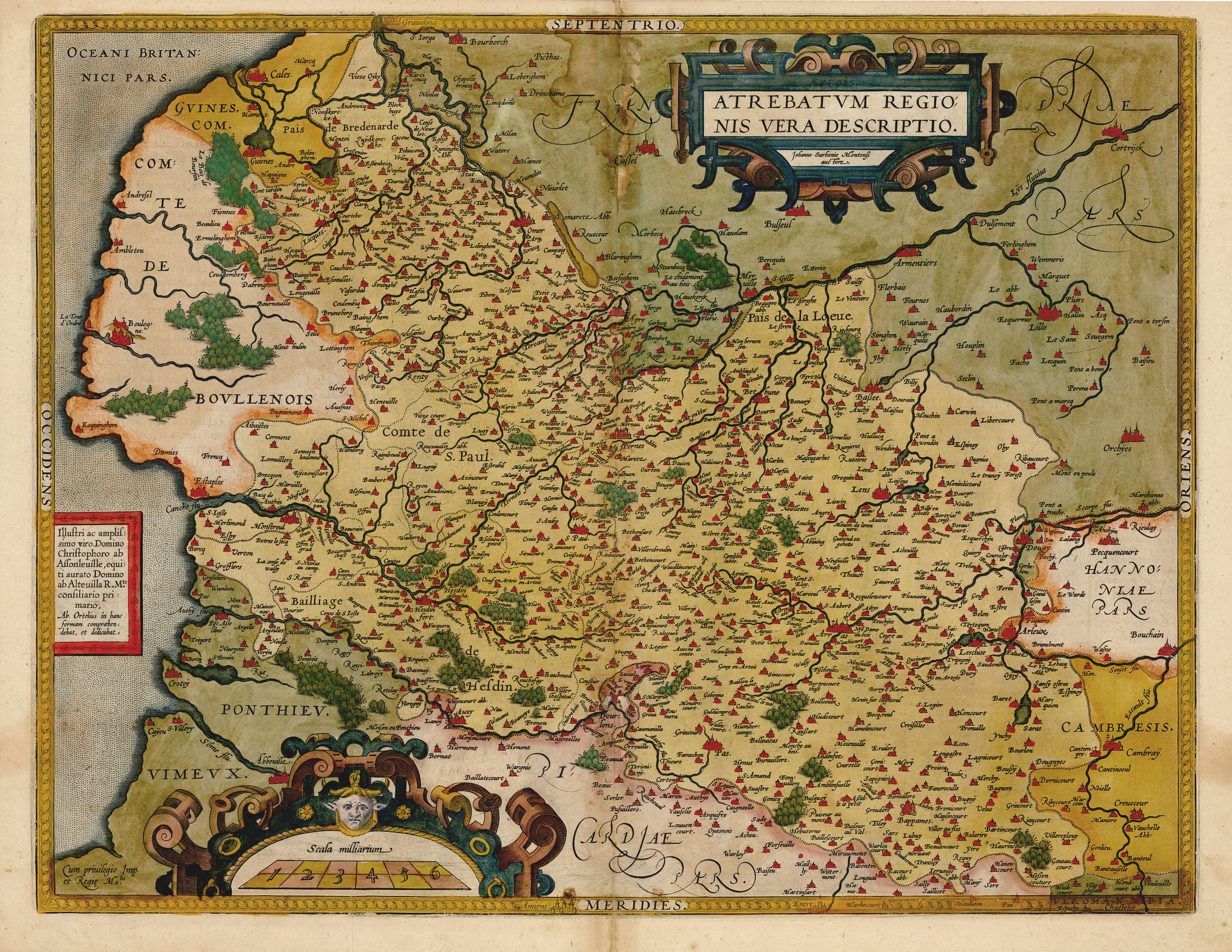
Atrebatum Regionis Vera Descriptio: Ortelius c. 1600
- Title: Atrebatum Regionis Vera Descriptio
- Author: Abraham Ortelius
- Date: c. 1600
- Medium: Hand-colored copperplate engraving
- Condition: Good - age toning, tide marks and discoloration along issued center fold, light foxing
- Inches: 19 1/4 x 14 7/8 [Image]
- Centimeters: 48.9 x 37.78 [Image]
- Product ID: 318004
Map of Atrebatum, present-day Artois in northern France. Shows part of the English Channel near the left-hand border.
Abraham Ortelius was a true Renaissance man. He served as Cosmographer to Phillip II, King of Spain, and in addition worked as a book dealer, cartographer, numismatist, naturalist, and historian. He had wide interests in classical scholarship and made his fortune in bookmaking and selling. He spoke six languages and had reasonable command of two others. He was without doubt one of the most prominent citizens of Antwerp in the late-sixteenth century, when the city stood as a global trading center, “the city of cities.” He had contacts throughout Europe from his extensive travels and counted the brightest intellectuals and entrepreneurs of his day among his friends.
Ortelius was the first to engrave maps in a uniform format, specifically for his atlas, and provide uniform content, with 53 maps in all. Prior to this, atlases were made-to-order affairs, with no consistency in size or content. His success was such that four printings occurred in 1570 to meet demand, and the publication of the Theatrum launched 100 years of Dutch supremacy in cartography.
- Title: Atrebatum Regionis Vera Descriptio
- Author: Abraham Ortelius
- Date: c. 1600
- Medium: Hand-colored copperplate engraving
- Condition: Good - age toning, tide marks and discoloration along issued center fold, light foxing
- Inches: 19 1/4 x 14 7/8 [Image]
- Centimeters: 48.9 x 37.78 [Image]
- Product ID: 318004
Map of Atrebatum, present-day Artois in northern France. Shows part of the English Channel near the left-hand border.
Abraham Ortelius was a true Renaissance man. He served as Cosmographer to Phillip II, King of Spain, and in addition worked as a book dealer, cartographer, numismatist, naturalist, and historian. He had wide interests in classical scholarship and made his fortune in bookmaking and selling. He spoke six languages and had reasonable command of two others. He was without doubt one of the most prominent citizens of Antwerp in the late-sixteenth century, when the city stood as a global trading center, “the city of cities.” He had contacts throughout Europe from his extensive travels and counted the brightest intellectuals and entrepreneurs of his day among his friends.
Ortelius was the first to engrave maps in a uniform format, specifically for his atlas, and provide uniform content, with 53 maps in all. Prior to this, atlases were made-to-order affairs, with no consistency in size or content. His success was such that four printings occurred in 1570 to meet demand, and the publication of the Theatrum launched 100 years of Dutch supremacy in cartography.
Original: $395.00
-65%$395.00
$138.25Description
- Title: Atrebatum Regionis Vera Descriptio
- Author: Abraham Ortelius
- Date: c. 1600
- Medium: Hand-colored copperplate engraving
- Condition: Good - age toning, tide marks and discoloration along issued center fold, light foxing
- Inches: 19 1/4 x 14 7/8 [Image]
- Centimeters: 48.9 x 37.78 [Image]
- Product ID: 318004
Map of Atrebatum, present-day Artois in northern France. Shows part of the English Channel near the left-hand border.
Abraham Ortelius was a true Renaissance man. He served as Cosmographer to Phillip II, King of Spain, and in addition worked as a book dealer, cartographer, numismatist, naturalist, and historian. He had wide interests in classical scholarship and made his fortune in bookmaking and selling. He spoke six languages and had reasonable command of two others. He was without doubt one of the most prominent citizens of Antwerp in the late-sixteenth century, when the city stood as a global trading center, “the city of cities.” He had contacts throughout Europe from his extensive travels and counted the brightest intellectuals and entrepreneurs of his day among his friends.
Ortelius was the first to engrave maps in a uniform format, specifically for his atlas, and provide uniform content, with 53 maps in all. Prior to this, atlases were made-to-order affairs, with no consistency in size or content. His success was such that four printings occurred in 1570 to meet demand, and the publication of the Theatrum launched 100 years of Dutch supremacy in cartography.