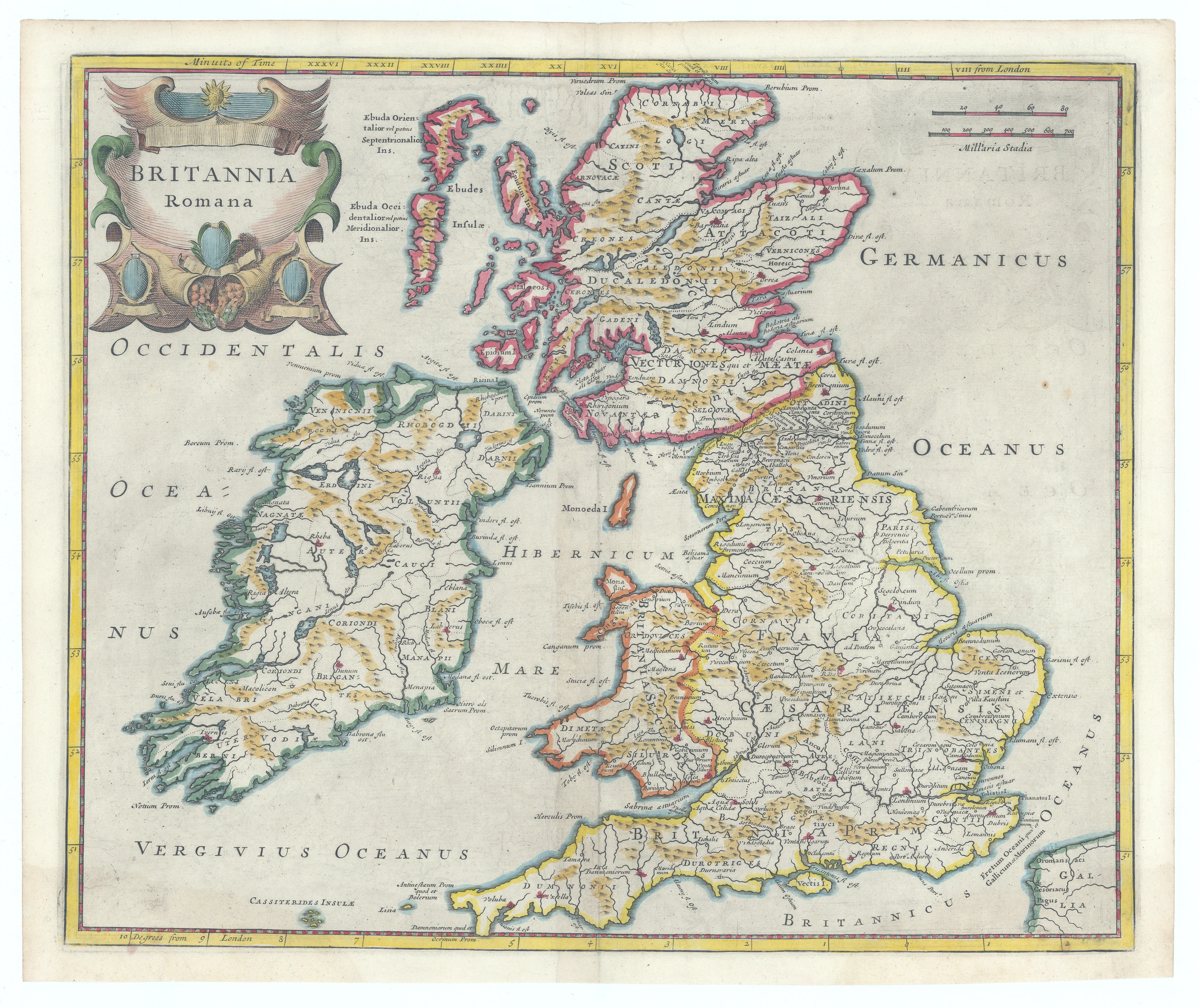
Britannia Romana: Morden, 1695
- Title: Britannia Romana
- Author: Robert Morden
- Date: 1695
- Condition: Excellent - Original refreshed color
- Inches: 16 5/8 x 14 [Image]
- Centimeters: 42.22 x 35.56 [Image]
- Product ID: 308651
An attractively engraved and finely colored map depicting the British Isles during the period of Roman occupation. The provinces are distinguished by color, with numerous towns and cities clearly labeled throughout. Along the frontier between present-day England and Scotland, Hadrian’s Wall is shown—a fortification built around 122 A.D. to protect Roman Britain from northern incursions.
The map is bordered by degrees of latitude and longitude, with the lower border calibrated in degrees from London. A mileage scale and an ornate title cartouche occupy the upper corners, enhancing the map’s decorative appeal.
Background on Creator
Robert Morden's (c.1650 – 1703) cartographic journey began in bustling London. From around 1675 until his death in 1703, he operated from his shop in Cornhill and New Cheapside. There, he honed his skills as an engraver and publisher, producing a vast and varied body of work.
Robert Morden's impact on cartography is undeniable. His detailed maps of England and Wales remain cornerstones of geographical history, while his miniature works reveal a passion for democratizing knowledge. Through his dedication and innovation, Morden charted a course for future generations of mapmakers, leaving behind a legacy that continues to inspire and inform our understanding of the world.
- Title: Britannia Romana
- Author: Robert Morden
- Date: 1695
- Condition: Excellent - Original refreshed color
- Inches: 16 5/8 x 14 [Image]
- Centimeters: 42.22 x 35.56 [Image]
- Product ID: 308651
An attractively engraved and finely colored map depicting the British Isles during the period of Roman occupation. The provinces are distinguished by color, with numerous towns and cities clearly labeled throughout. Along the frontier between present-day England and Scotland, Hadrian’s Wall is shown—a fortification built around 122 A.D. to protect Roman Britain from northern incursions.
The map is bordered by degrees of latitude and longitude, with the lower border calibrated in degrees from London. A mileage scale and an ornate title cartouche occupy the upper corners, enhancing the map’s decorative appeal.
Background on Creator
Robert Morden's (c.1650 – 1703) cartographic journey began in bustling London. From around 1675 until his death in 1703, he operated from his shop in Cornhill and New Cheapside. There, he honed his skills as an engraver and publisher, producing a vast and varied body of work.
Robert Morden's impact on cartography is undeniable. His detailed maps of England and Wales remain cornerstones of geographical history, while his miniature works reveal a passion for democratizing knowledge. Through his dedication and innovation, Morden charted a course for future generations of mapmakers, leaving behind a legacy that continues to inspire and inform our understanding of the world.
Original: $245.00
-65%$245.00
$85.75Description
- Title: Britannia Romana
- Author: Robert Morden
- Date: 1695
- Condition: Excellent - Original refreshed color
- Inches: 16 5/8 x 14 [Image]
- Centimeters: 42.22 x 35.56 [Image]
- Product ID: 308651
An attractively engraved and finely colored map depicting the British Isles during the period of Roman occupation. The provinces are distinguished by color, with numerous towns and cities clearly labeled throughout. Along the frontier between present-day England and Scotland, Hadrian’s Wall is shown—a fortification built around 122 A.D. to protect Roman Britain from northern incursions.
The map is bordered by degrees of latitude and longitude, with the lower border calibrated in degrees from London. A mileage scale and an ornate title cartouche occupy the upper corners, enhancing the map’s decorative appeal.
Background on Creator
Robert Morden's (c.1650 – 1703) cartographic journey began in bustling London. From around 1675 until his death in 1703, he operated from his shop in Cornhill and New Cheapside. There, he honed his skills as an engraver and publisher, producing a vast and varied body of work.
Robert Morden's impact on cartography is undeniable. His detailed maps of England and Wales remain cornerstones of geographical history, while his miniature works reveal a passion for democratizing knowledge. Through his dedication and innovation, Morden charted a course for future generations of mapmakers, leaving behind a legacy that continues to inspire and inform our understanding of the world.