Where to Go and What to See in the Texas Panhandle: c. 1930
- Title: Where to Go and What to See in the Texas Panhandle
- Date: c. 1930
- Medium: Printed
- Condition: Issued folding with a few light stains and several tiny splits at the fold junctions. Stamped on the front wrapper.
- Inches: 22.9 x 16.9 [Image]
- Centimeters: 58.17 x 42.93 [Image]
- Product ID: 311002
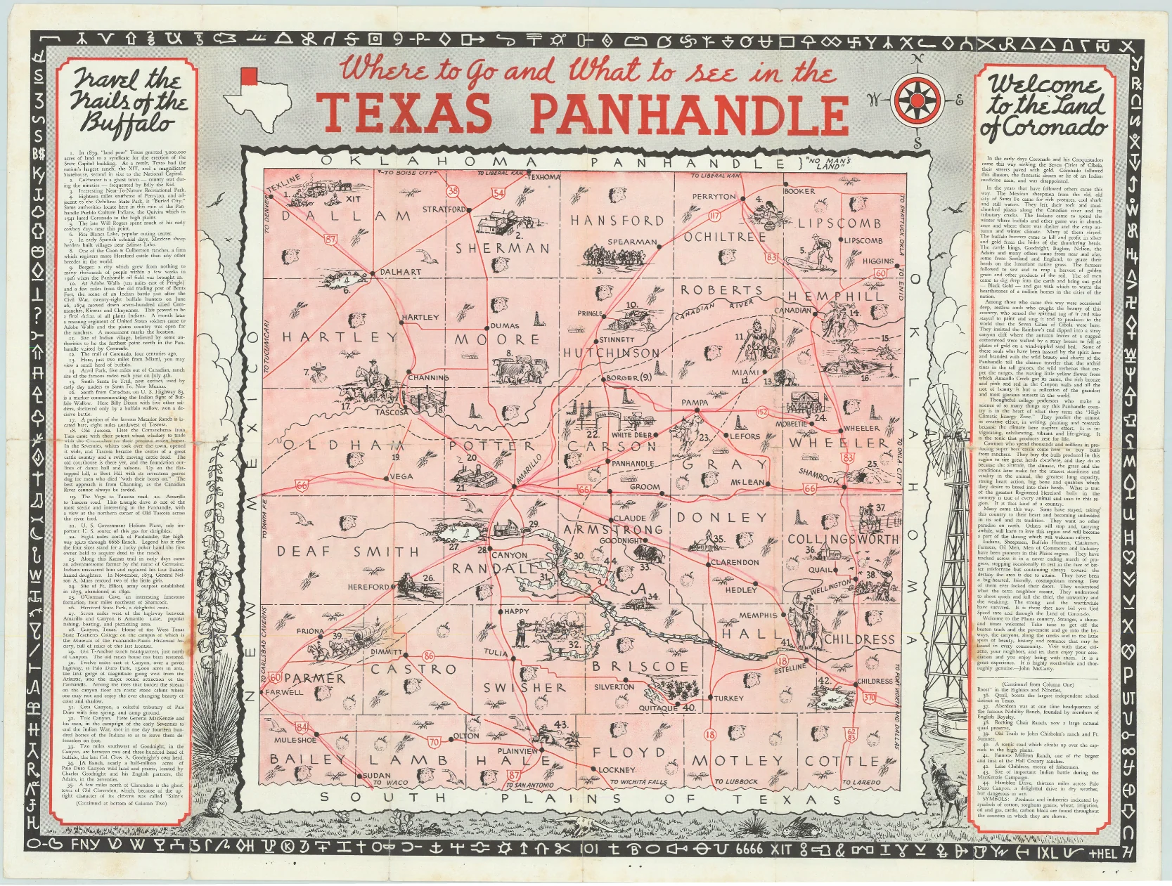
An unusual pictorial map of the panhandle filled with illustrations representing the region including cattle ranches, oil derricks, cowboys, and more. Flanked by panels of text and a hieroglyphics border. The verso is filled with illustrations including a striking 3-panel cover illustration of cowboys in action. This map was published by the Chamber of Commerce departments of the various towns located in the Texas panhandle. Self-folding (4.0 x 9.0"). One example located on OCLC.
- Title: Where to Go and What to See in the Texas Panhandle
- Date: c. 1930
- Medium: Printed
- Condition: Issued folding with a few light stains and several tiny splits at the fold junctions. Stamped on the front wrapper.
- Inches: 22.9 x 16.9 [Image]
- Centimeters: 58.17 x 42.93 [Image]
- Product ID: 311002
An unusual pictorial map of the panhandle filled with illustrations representing the region including cattle ranches, oil derricks, cowboys, and more. Flanked by panels of text and a hieroglyphics border. The verso is filled with illustrations including a striking 3-panel cover illustration of cowboys in action. This map was published by the Chamber of Commerce departments of the various towns located in the Texas panhandle. Self-folding (4.0 x 9.0"). One example located on OCLC.
Original: $195.00
-65%$195.00
$68.25Description
- Title: Where to Go and What to See in the Texas Panhandle
- Date: c. 1930
- Medium: Printed
- Condition: Issued folding with a few light stains and several tiny splits at the fold junctions. Stamped on the front wrapper.
- Inches: 22.9 x 16.9 [Image]
- Centimeters: 58.17 x 42.93 [Image]
- Product ID: 311002
An unusual pictorial map of the panhandle filled with illustrations representing the region including cattle ranches, oil derricks, cowboys, and more. Flanked by panels of text and a hieroglyphics border. The verso is filled with illustrations including a striking 3-panel cover illustration of cowboys in action. This map was published by the Chamber of Commerce departments of the various towns located in the Texas panhandle. Self-folding (4.0 x 9.0"). One example located on OCLC.











