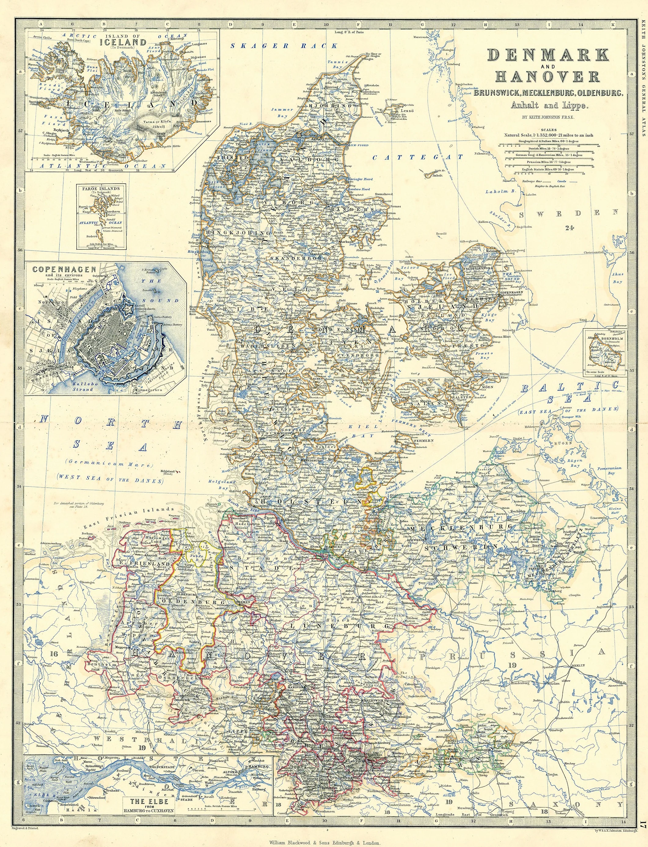
Denmark and Hanover: Johnston 1861
- Title: Denmark and Hanover
-
Author: Keith Johnston
- Date: 1861
- Medium: Hand-colored engraving
- Condition: Very Good - light age toning, wear and marginal separations at issued horizontal center fold, some areas of light surface dirt
- Inches: 19 3/8 x 24 1/2 [Paper]
- Centimeters: 49.21 x 62.23 [Paper]
- Product ID: 318047
Denmark and Hanover Brunswick, Mecklenburg, Oldenburg, Anhalt and Lippe.
Map of Denmark and Hanover published in Keith Johnston's General Atlas. Contains several inset maps, the two largest of which show the city of Copenhagen and the nation of Iceland. Other insets feature the River Elbe, the Faroe Islands, and the island of Bornholm.
Background on Creator
W. & A. K. Johnston was a leading Scottish cartographical and publishing firm founded around 1825 by brothers William Johnston and Alexander Keith Johnston in Edinburgh. Both began as apprentices to Scottish globe maker James Kirkwood before establishing their own business, which quickly became renowned for producing thematic atlases, educational maps, and high-quality globes. They were appointed engravers to King William IV in 1834 and made significant contributions to scientific and educational cartography throughout the 19th and early 20th centuries, with their works being influential and widely used in Britain and abroad.
- Title: Denmark and Hanover
-
Author: Keith Johnston
- Date: 1861
- Medium: Hand-colored engraving
- Condition: Very Good - light age toning, wear and marginal separations at issued horizontal center fold, some areas of light surface dirt
- Inches: 19 3/8 x 24 1/2 [Paper]
- Centimeters: 49.21 x 62.23 [Paper]
- Product ID: 318047
Denmark and Hanover Brunswick, Mecklenburg, Oldenburg, Anhalt and Lippe.
Map of Denmark and Hanover published in Keith Johnston's General Atlas. Contains several inset maps, the two largest of which show the city of Copenhagen and the nation of Iceland. Other insets feature the River Elbe, the Faroe Islands, and the island of Bornholm.
Background on Creator
W. & A. K. Johnston was a leading Scottish cartographical and publishing firm founded around 1825 by brothers William Johnston and Alexander Keith Johnston in Edinburgh. Both began as apprentices to Scottish globe maker James Kirkwood before establishing their own business, which quickly became renowned for producing thematic atlases, educational maps, and high-quality globes. They were appointed engravers to King William IV in 1834 and made significant contributions to scientific and educational cartography throughout the 19th and early 20th centuries, with their works being influential and widely used in Britain and abroad.
Description
- Title: Denmark and Hanover
-
Author: Keith Johnston
- Date: 1861
- Medium: Hand-colored engraving
- Condition: Very Good - light age toning, wear and marginal separations at issued horizontal center fold, some areas of light surface dirt
- Inches: 19 3/8 x 24 1/2 [Paper]
- Centimeters: 49.21 x 62.23 [Paper]
- Product ID: 318047
Denmark and Hanover Brunswick, Mecklenburg, Oldenburg, Anhalt and Lippe.
Map of Denmark and Hanover published in Keith Johnston's General Atlas. Contains several inset maps, the two largest of which show the city of Copenhagen and the nation of Iceland. Other insets feature the River Elbe, the Faroe Islands, and the island of Bornholm.
Background on Creator
W. & A. K. Johnston was a leading Scottish cartographical and publishing firm founded around 1825 by brothers William Johnston and Alexander Keith Johnston in Edinburgh. Both began as apprentices to Scottish globe maker James Kirkwood before establishing their own business, which quickly became renowned for producing thematic atlases, educational maps, and high-quality globes. They were appointed engravers to King William IV in 1834 and made significant contributions to scientific and educational cartography throughout the 19th and early 20th centuries, with their works being influential and widely used in Britain and abroad.