District of Columbia: Bradford, 1835
- Title: District of Columbia
- Author: Thomas Gamaliel Bradford
- Date: 1835
- Medium: Hand colored copperplate engraving
- Condition: Good - tide mark in lower left and up left edge of paper, some minor staining
- Inches: 12 3/4 x 10 1/4 [Paper]
- Centimeters: 32.38 x 26.03 [Paper]
- Product ID: 308082
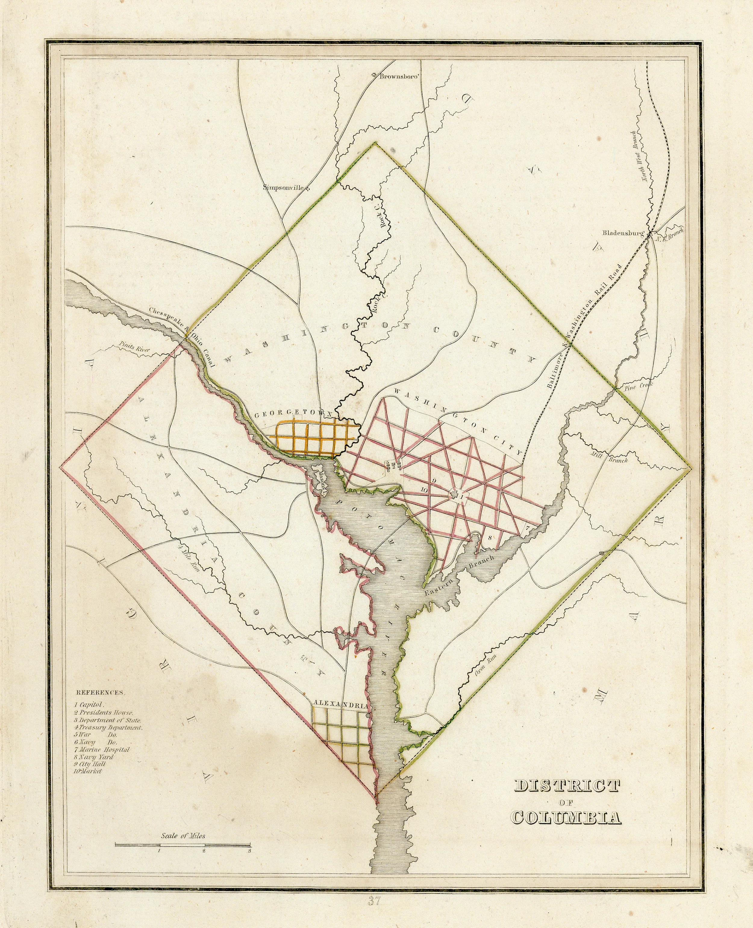
This map was published in Bradford’s 1835 Comprehensive Atlas Geographical, Historical and Commercial. Thomas Bradford’s map of the District of Columbia is one of the first maps available to describe the area. The plans for the cities of Washington as well as Georgetown and Alexandria are shown and in the left of the map, a legend presents points of interest.
Thomas Gamaliel Bradford was an American cartographer born in Boston, Massachusetts in 1802. Sometime in the early part of the 19th century, he began a publishing career at the America Encyclopedia. Following his tenure there, Bradford revised and republished the Atlas Designed to Illustrate the Abridgement of Universal Geography, Modern & Ancient. Originally published in French by Adrian Balbi, Bradford revised and republished it English. Bradford was a most successful publisher of atlases in the 19th century and is also known for his very successful 1835 work A Comprehensive Atlas: Geographical, Historical & Commercial.
- Title: District of Columbia
- Author: Thomas Gamaliel Bradford
- Date: 1835
- Medium: Hand colored copperplate engraving
- Condition: Good - tide mark in lower left and up left edge of paper, some minor staining
- Inches: 12 3/4 x 10 1/4 [Paper]
- Centimeters: 32.38 x 26.03 [Paper]
- Product ID: 308082
This map was published in Bradford’s 1835 Comprehensive Atlas Geographical, Historical and Commercial. Thomas Bradford’s map of the District of Columbia is one of the first maps available to describe the area. The plans for the cities of Washington as well as Georgetown and Alexandria are shown and in the left of the map, a legend presents points of interest.
Thomas Gamaliel Bradford was an American cartographer born in Boston, Massachusetts in 1802. Sometime in the early part of the 19th century, he began a publishing career at the America Encyclopedia. Following his tenure there, Bradford revised and republished the Atlas Designed to Illustrate the Abridgement of Universal Geography, Modern & Ancient. Originally published in French by Adrian Balbi, Bradford revised and republished it English. Bradford was a most successful publisher of atlases in the 19th century and is also known for his very successful 1835 work A Comprehensive Atlas: Geographical, Historical & Commercial.
Original: $175.00
-65%$175.00
$61.25Description
- Title: District of Columbia
- Author: Thomas Gamaliel Bradford
- Date: 1835
- Medium: Hand colored copperplate engraving
- Condition: Good - tide mark in lower left and up left edge of paper, some minor staining
- Inches: 12 3/4 x 10 1/4 [Paper]
- Centimeters: 32.38 x 26.03 [Paper]
- Product ID: 308082
This map was published in Bradford’s 1835 Comprehensive Atlas Geographical, Historical and Commercial. Thomas Bradford’s map of the District of Columbia is one of the first maps available to describe the area. The plans for the cities of Washington as well as Georgetown and Alexandria are shown and in the left of the map, a legend presents points of interest.
Thomas Gamaliel Bradford was an American cartographer born in Boston, Massachusetts in 1802. Sometime in the early part of the 19th century, he began a publishing career at the America Encyclopedia. Following his tenure there, Bradford revised and republished the Atlas Designed to Illustrate the Abridgement of Universal Geography, Modern & Ancient. Originally published in French by Adrian Balbi, Bradford revised and republished it English. Bradford was a most successful publisher of atlases in the 19th century and is also known for his very successful 1835 work A Comprehensive Atlas: Geographical, Historical & Commercial.