Gray's New Map of California: Gray 1884
- Title: Gray's New Map of California
- Author: O. W. Gray & Son
- Date: 1884
- Medium: Hand-colored lithograph
- Condition: Good - age toning, light foxing, areas of surface dirt, wear and discoloration along issued center fold, some marginal paper loss
- Inches: 17 1/4 x 28 1/4 [Paper]
- Centimeters: 43.82 x 71.76 [Paper]
- Product ID: 319082
Verso: Oregon and Washington, Gray's New Map of Nevada
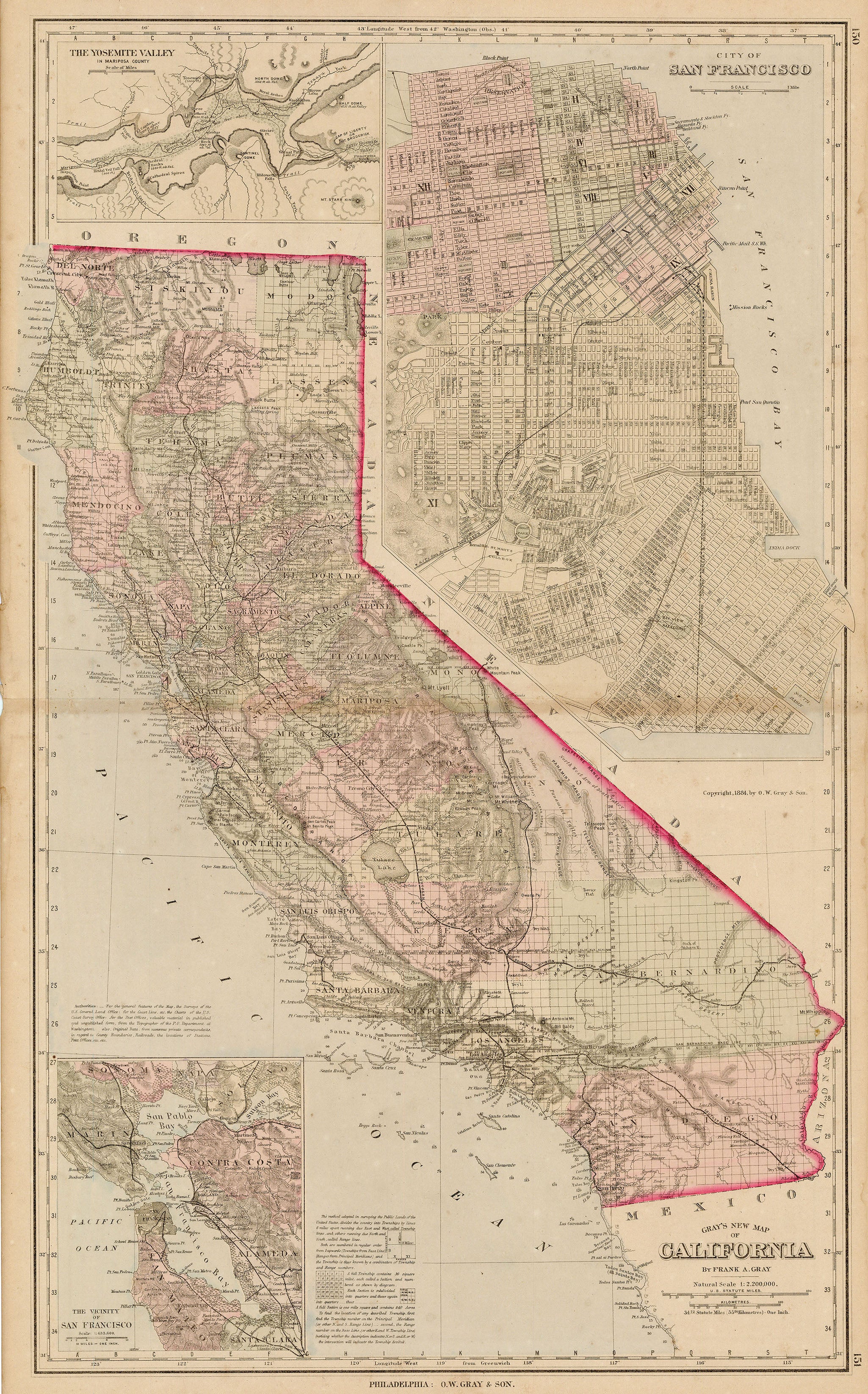
Map of California divided into counties. Marks rail lines within the region, and includes several inset maps: 'The Vicinity of San Francisco,' 'City of San Francisco,' and 'The Yosemite Valley in Mariposa County.' The Yosemite inset labels major features of the valley, such as El Capitan and Half Dome.
- Title: Gray's New Map of California
- Author: O. W. Gray & Son
- Date: 1884
- Medium: Hand-colored lithograph
- Condition: Good - age toning, light foxing, areas of surface dirt, wear and discoloration along issued center fold, some marginal paper loss
- Inches: 17 1/4 x 28 1/4 [Paper]
- Centimeters: 43.82 x 71.76 [Paper]
- Product ID: 319082
Verso: Oregon and Washington, Gray's New Map of Nevada
Map of California divided into counties. Marks rail lines within the region, and includes several inset maps: 'The Vicinity of San Francisco,' 'City of San Francisco,' and 'The Yosemite Valley in Mariposa County.' The Yosemite inset labels major features of the valley, such as El Capitan and Half Dome.
Original: $295.00
-65%$295.00
$103.25Description
- Title: Gray's New Map of California
- Author: O. W. Gray & Son
- Date: 1884
- Medium: Hand-colored lithograph
- Condition: Good - age toning, light foxing, areas of surface dirt, wear and discoloration along issued center fold, some marginal paper loss
- Inches: 17 1/4 x 28 1/4 [Paper]
- Centimeters: 43.82 x 71.76 [Paper]
- Product ID: 319082
Verso: Oregon and Washington, Gray's New Map of Nevada
Map of California divided into counties. Marks rail lines within the region, and includes several inset maps: 'The Vicinity of San Francisco,' 'City of San Francisco,' and 'The Yosemite Valley in Mariposa County.' The Yosemite inset labels major features of the valley, such as El Capitan and Half Dome.