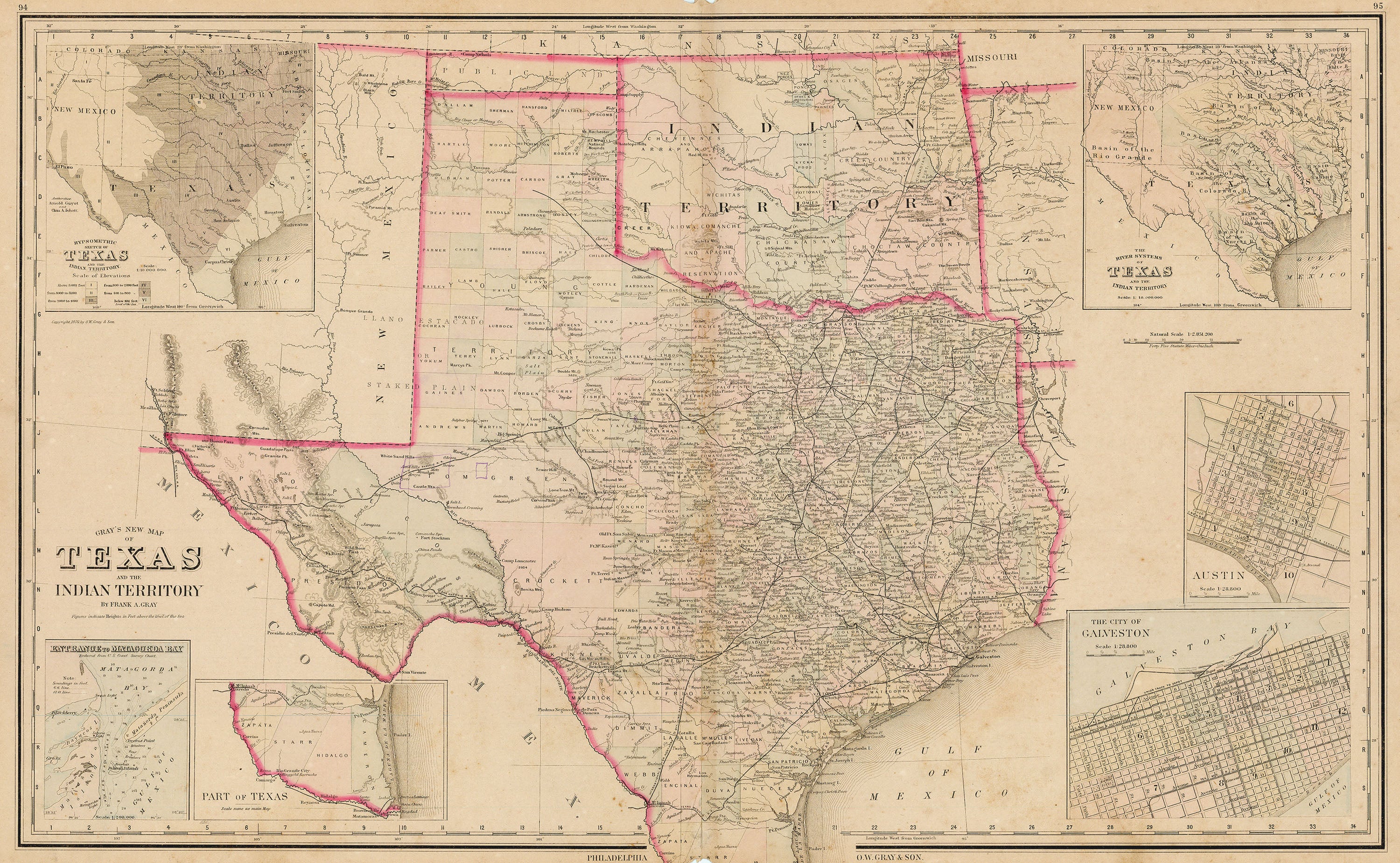
Gray's New Map of Texas and the Indian Territory: Gray 1884
- Title: Gray's New Map of Texas and the Indian Territory
- Author: O. W. Gray & Son
- Date: 1884
- Medium: Hand-colored engraving
- Condition: Good - age toning, foxing, areas of surface dirt, wear and marginal paper loss into image at issued center fold
- Inches: 27 3/8 x 17 3/8 [Paper]
- Centimeters: 69.53 x 44.13 [Paper]
- Product ID: 3110030
Map of Texas and Indian Territory including parts of Mexico, New Mexico, Kansas, Missouri, Arkansas, and Louisiana. Shows the region divided into counties and marks its railroad network. Includes several inset maps:
- Hypsometric Sketch of Texas and the Indian Territory
- Entrance to Matagorda Bay
- Part of Texas [Southern tip of Texas at the entrance to the Rio Grande]
- The City of Galveston
- Austin
- The River Systems of Texas and the Indian Territory
- Title: Gray's New Map of Texas and the Indian Territory
- Author: O. W. Gray & Son
- Date: 1884
- Medium: Hand-colored engraving
- Condition: Good - age toning, foxing, areas of surface dirt, wear and marginal paper loss into image at issued center fold
- Inches: 27 3/8 x 17 3/8 [Paper]
- Centimeters: 69.53 x 44.13 [Paper]
- Product ID: 3110030
Map of Texas and Indian Territory including parts of Mexico, New Mexico, Kansas, Missouri, Arkansas, and Louisiana. Shows the region divided into counties and marks its railroad network. Includes several inset maps:
- Hypsometric Sketch of Texas and the Indian Territory
- Entrance to Matagorda Bay
- Part of Texas [Southern tip of Texas at the entrance to the Rio Grande]
- The City of Galveston
- Austin
- The River Systems of Texas and the Indian Territory
Description
- Title: Gray's New Map of Texas and the Indian Territory
- Author: O. W. Gray & Son
- Date: 1884
- Medium: Hand-colored engraving
- Condition: Good - age toning, foxing, areas of surface dirt, wear and marginal paper loss into image at issued center fold
- Inches: 27 3/8 x 17 3/8 [Paper]
- Centimeters: 69.53 x 44.13 [Paper]
- Product ID: 3110030
Map of Texas and Indian Territory including parts of Mexico, New Mexico, Kansas, Missouri, Arkansas, and Louisiana. Shows the region divided into counties and marks its railroad network. Includes several inset maps:
- Hypsometric Sketch of Texas and the Indian Territory
- Entrance to Matagorda Bay
- Part of Texas [Southern tip of Texas at the entrance to the Rio Grande]
- The City of Galveston
- Austin
- The River Systems of Texas and the Indian Territory











