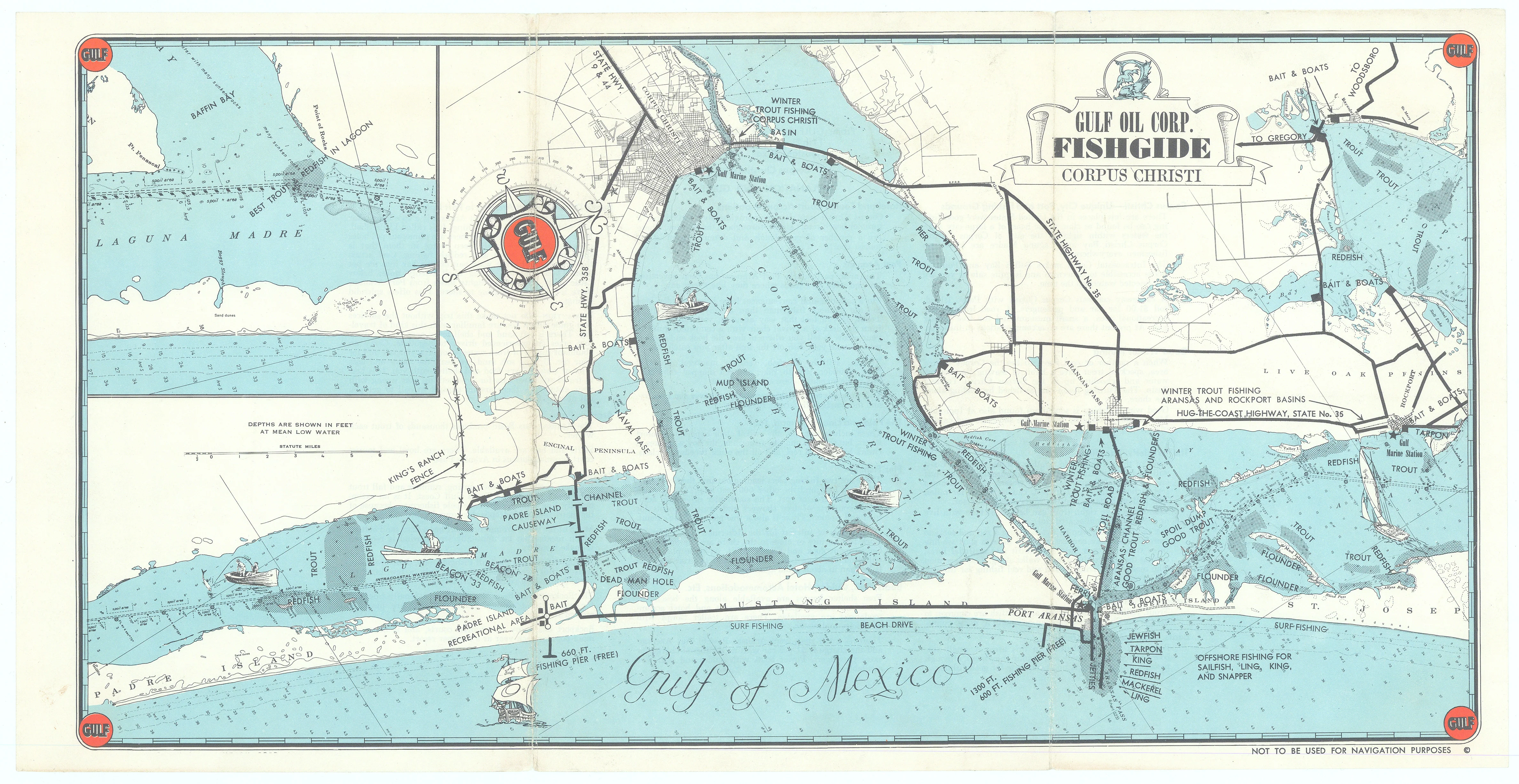
Gulf Oil Corp. Fishgide Corpus Christi: Gulf Oil Corp., c.1950
- Title: Gulf Oil Corp. Fishgide Corpus Christi
- Author: Gulf Oil Corp.
- Date: c.1950
- Condition: Very good - issued folds with some color loss, slight yellowing at folds
- Inches: 21 x 10 3/4 [Image]
- Centimeters: 23.34 x 27.30 [Image]
- Product ID: 308322
In 1939, the Gulf Oil Corporation began producing a set of maps focused on the Texas Gulf Coast that they called ‘fishgides’. These maps go to great lengths to indicate in detail productive fishing locations for fish of many species, depth soundings, areas productive in different seasons as well as locations of Gulf marine stations. For all their detail, the maps note that they are not to be used for navigation purposes and are decorated with whimsical images of fishermen and fish among others like wooden ships and compass roses.
The maps were updated in 1950 and then again in 1958 and are usually dated by an area’s existing infrastructure. For example, on the guide of Corpus Christi from the same set, the new causeway linking Flour Bluff to Padre Island can be seen which was completed in the summer of 1950.
The Gulf Oil Corporation was founded by a group of investors soon after the 1901 discovery of the legendary Texas oil field known as Spindletop. Through clever marketing and the innovation of drive-in service stations, Gulf Oil Corp. and their bright orange circular logo became a household name and gained recognition the world over.
- Title: Gulf Oil Corp. Fishgide Corpus Christi
- Author: Gulf Oil Corp.
- Date: c.1950
- Condition: Very good - issued folds with some color loss, slight yellowing at folds
- Inches: 21 x 10 3/4 [Image]
- Centimeters: 23.34 x 27.30 [Image]
- Product ID: 308322
In 1939, the Gulf Oil Corporation began producing a set of maps focused on the Texas Gulf Coast that they called ‘fishgides’. These maps go to great lengths to indicate in detail productive fishing locations for fish of many species, depth soundings, areas productive in different seasons as well as locations of Gulf marine stations. For all their detail, the maps note that they are not to be used for navigation purposes and are decorated with whimsical images of fishermen and fish among others like wooden ships and compass roses.
The maps were updated in 1950 and then again in 1958 and are usually dated by an area’s existing infrastructure. For example, on the guide of Corpus Christi from the same set, the new causeway linking Flour Bluff to Padre Island can be seen which was completed in the summer of 1950.
The Gulf Oil Corporation was founded by a group of investors soon after the 1901 discovery of the legendary Texas oil field known as Spindletop. Through clever marketing and the innovation of drive-in service stations, Gulf Oil Corp. and their bright orange circular logo became a household name and gained recognition the world over.
Original: $595.00
-65%$595.00
$208.25Description
- Title: Gulf Oil Corp. Fishgide Corpus Christi
- Author: Gulf Oil Corp.
- Date: c.1950
- Condition: Very good - issued folds with some color loss, slight yellowing at folds
- Inches: 21 x 10 3/4 [Image]
- Centimeters: 23.34 x 27.30 [Image]
- Product ID: 308322
In 1939, the Gulf Oil Corporation began producing a set of maps focused on the Texas Gulf Coast that they called ‘fishgides’. These maps go to great lengths to indicate in detail productive fishing locations for fish of many species, depth soundings, areas productive in different seasons as well as locations of Gulf marine stations. For all their detail, the maps note that they are not to be used for navigation purposes and are decorated with whimsical images of fishermen and fish among others like wooden ships and compass roses.
The maps were updated in 1950 and then again in 1958 and are usually dated by an area’s existing infrastructure. For example, on the guide of Corpus Christi from the same set, the new causeway linking Flour Bluff to Padre Island can be seen which was completed in the summer of 1950.
The Gulf Oil Corporation was founded by a group of investors soon after the 1901 discovery of the legendary Texas oil field known as Spindletop. Through clever marketing and the innovation of drive-in service stations, Gulf Oil Corp. and their bright orange circular logo became a household name and gained recognition the world over.











