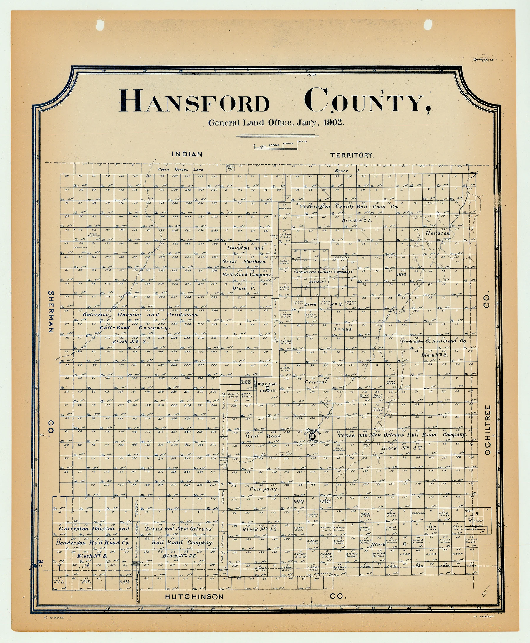
Hansford County - Texas General Land Office Map ca. 1926
- Title: Hansford Co.
- Author: Texas General Land Office
- Date: ca. 1925
- Medium: Lithograph
- Condition: Excellent
- Inches: 14 x 17 [Paper]
- Centimeters: 35.56 x 43.18 [Paper]
- Product ID: 3112115
Antique Texas county map published ca. 1925 by Wolf & Bennett for the Texas General Land Office. General Land Office maps show land patents, block and tract numbers, landowners, towns, railroads, and portions of adjacent counties where property boundaries extend beyond county limits.
This map shows Hansford County, est. 1876. The original county seat of Hansford shown at lower center, right. In 1929 the county seat was moved to the town of Spearman, which was founded in 1917. The county is bordered by Indian Territory on the north, and by Ochiltree, Hutchinson, and Sherman counties.
Survey date – 1902
Condition Notes:
- Uniform age toning, a bit darker along edges, paper somewhat fragile, original binding holes present.
- Excellent overall condition.
- Title: Hansford Co.
- Author: Texas General Land Office
- Date: ca. 1925
- Medium: Lithograph
- Condition: Excellent
- Inches: 14 x 17 [Paper]
- Centimeters: 35.56 x 43.18 [Paper]
- Product ID: 3112115
Antique Texas county map published ca. 1925 by Wolf & Bennett for the Texas General Land Office. General Land Office maps show land patents, block and tract numbers, landowners, towns, railroads, and portions of adjacent counties where property boundaries extend beyond county limits.
This map shows Hansford County, est. 1876. The original county seat of Hansford shown at lower center, right. In 1929 the county seat was moved to the town of Spearman, which was founded in 1917. The county is bordered by Indian Territory on the north, and by Ochiltree, Hutchinson, and Sherman counties.
Survey date – 1902
Condition Notes:
- Uniform age toning, a bit darker along edges, paper somewhat fragile, original binding holes present.
- Excellent overall condition.
Original: $200.00
-65%$200.00
$70.00Description
- Title: Hansford Co.
- Author: Texas General Land Office
- Date: ca. 1925
- Medium: Lithograph
- Condition: Excellent
- Inches: 14 x 17 [Paper]
- Centimeters: 35.56 x 43.18 [Paper]
- Product ID: 3112115
Antique Texas county map published ca. 1925 by Wolf & Bennett for the Texas General Land Office. General Land Office maps show land patents, block and tract numbers, landowners, towns, railroads, and portions of adjacent counties where property boundaries extend beyond county limits.
This map shows Hansford County, est. 1876. The original county seat of Hansford shown at lower center, right. In 1929 the county seat was moved to the town of Spearman, which was founded in 1917. The county is bordered by Indian Territory on the north, and by Ochiltree, Hutchinson, and Sherman counties.
Survey date – 1902
Condition Notes:
- Uniform age toning, a bit darker along edges, paper somewhat fragile, original binding holes present.
- Excellent overall condition.











