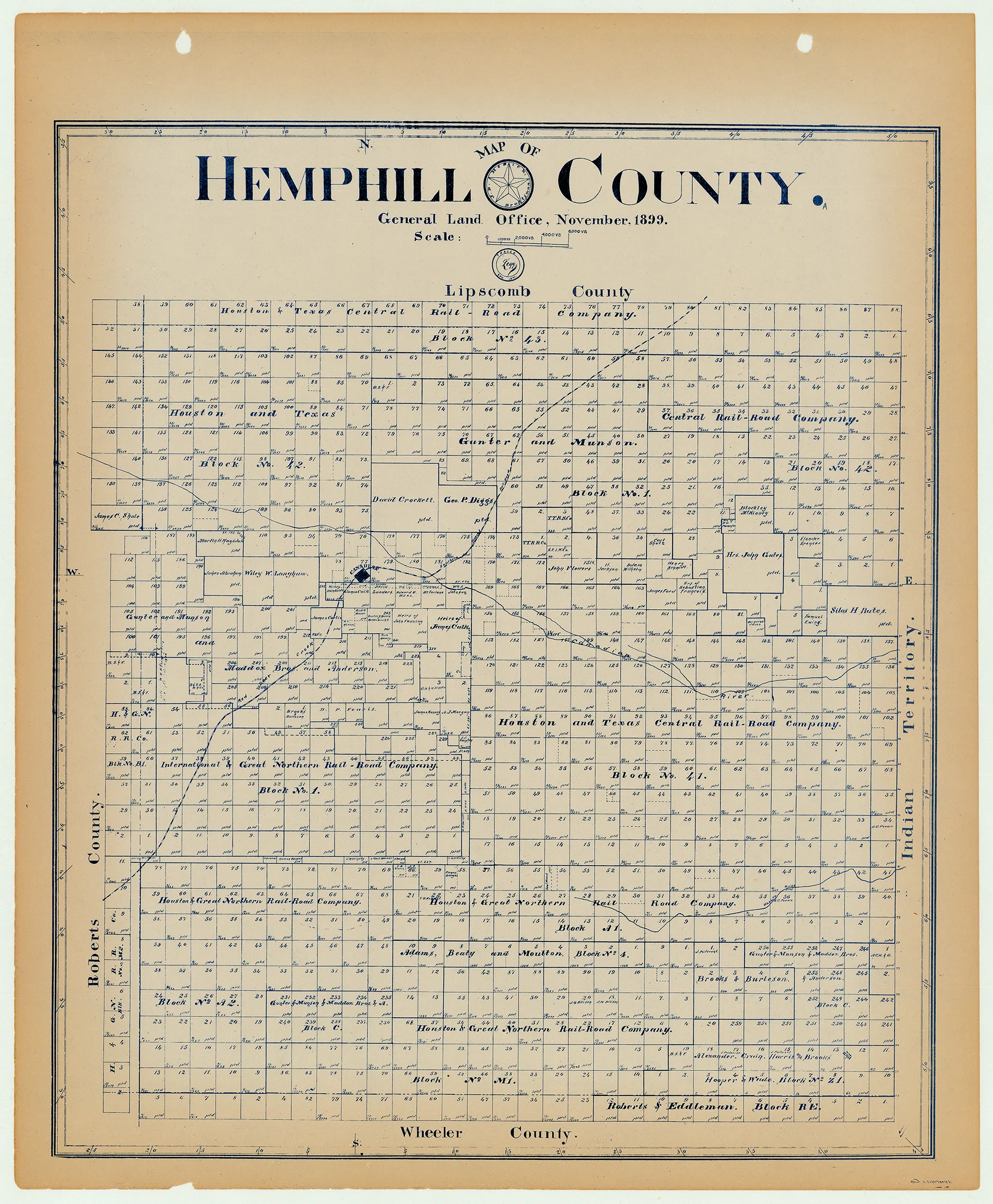
Hemphill County - Texas General Land Office Map ca. 1926
- Title: Hemphill Co.
- Author: Texas General Land Office
- Date: ca. 1925
- Medium: Lithograph
- Condition: Very Good
- Inches: 14 x 17 [Paper]
- Centimeters: 35.56 x 43.18 [Paper]
- Product ID: 3112121
Antique Texas county map published ca. 1925 by Wolf & Bennett for the Texas General Land Office. General Land Office maps show land patents, block and tract numbers, landowners, towns, railroads, and portions of adjacent counties where property boundaries extend beyond county limits.
This map shows Hemphill County, est. 1876. The county seat of Canadian is shown upper center, left, on the Southern Kansas Railroad. The county is bordered by Lipscomb, Roberts and Wheeler counties, as well as Oklahoma India Territory on the east.
Survey date – 1899
Condition Notes:
- Uniform age toning, a bit darker along edges, paper somewhat fragile, original binding holes present.
- Minimal marginal chipping
- Very good overall condition.
- Title: Hemphill Co.
- Author: Texas General Land Office
- Date: ca. 1925
- Medium: Lithograph
- Condition: Very Good
- Inches: 14 x 17 [Paper]
- Centimeters: 35.56 x 43.18 [Paper]
- Product ID: 3112121
Antique Texas county map published ca. 1925 by Wolf & Bennett for the Texas General Land Office. General Land Office maps show land patents, block and tract numbers, landowners, towns, railroads, and portions of adjacent counties where property boundaries extend beyond county limits.
This map shows Hemphill County, est. 1876. The county seat of Canadian is shown upper center, left, on the Southern Kansas Railroad. The county is bordered by Lipscomb, Roberts and Wheeler counties, as well as Oklahoma India Territory on the east.
Survey date – 1899
Condition Notes:
- Uniform age toning, a bit darker along edges, paper somewhat fragile, original binding holes present.
- Minimal marginal chipping
- Very good overall condition.
Original: $200.00
-65%$200.00
$70.00Description
- Title: Hemphill Co.
- Author: Texas General Land Office
- Date: ca. 1925
- Medium: Lithograph
- Condition: Very Good
- Inches: 14 x 17 [Paper]
- Centimeters: 35.56 x 43.18 [Paper]
- Product ID: 3112121
Antique Texas county map published ca. 1925 by Wolf & Bennett for the Texas General Land Office. General Land Office maps show land patents, block and tract numbers, landowners, towns, railroads, and portions of adjacent counties where property boundaries extend beyond county limits.
This map shows Hemphill County, est. 1876. The county seat of Canadian is shown upper center, left, on the Southern Kansas Railroad. The county is bordered by Lipscomb, Roberts and Wheeler counties, as well as Oklahoma India Territory on the east.
Survey date – 1899
Condition Notes:
- Uniform age toning, a bit darker along edges, paper somewhat fragile, original binding holes present.
- Minimal marginal chipping
- Very good overall condition.











