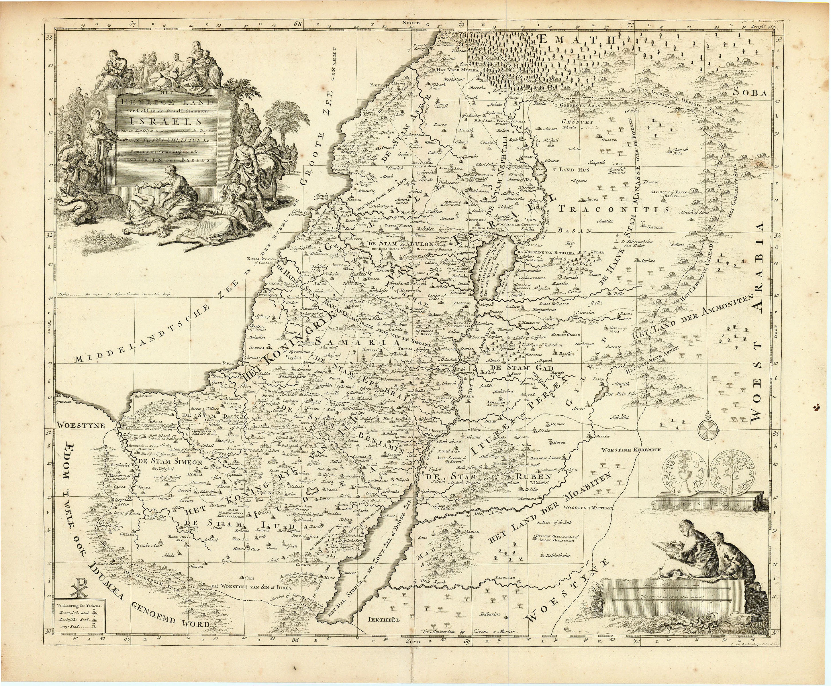
Het Heylige Land verdeeld in de Twaalf Stammen Israels: Covens & Mortier c. 1700
- Title: Het Heylige Land verdeeld in de Twaalf Stammen Israels
- Author: Covens & Mortier
- Date: c. 1700
- Medium: Copperplate engraving
- Condition: Very Good - age toning, light foxing, issued center fold
- Inches: 20 1/2 x 17 [Paper]
- Centimeters: 52.07 x 43.18 [Paper]
- Product ID: 100569
Het Heylige Land verdeeld in de Twaalf Stammen Israels waar in duydelyk is aan geweesen de Reysen van Iesus-Christus &c. Dienende tot Groot Light vande Historien des Bybels.
"The Holy Land divided into the Twelve Tribes of Israel in which occurred the Journeys of Jesus Christ & c. To Serve the Great Light of the History of the Bible."
Map of the Holy Land including parts of present-day Israel, Jordan, Syria, the West Bank, Lebanon, and the Gaza Strip. Includes decorative cartouche showing scenes from the life of Christ.
In 1719, Cornelis Mortier (1699-1783) inherited the publishing business of his father Pieter Mortier (1661-1711). In 1721, Cornelis joined with Johannes Covens the Elder (1697-1774) to form their eponymously titled Amsterdam firm, which would become one of the preeminent publishing houses of the eighteenth century. The firm reprinted and redistributed the maps of major cartographers such as Hubert Jaillot (1632-1712), Jan Jansson (1588-1664), Nicolas Sanson (1600-1667), Frederick de Wit (c. 1629-1706), and, of course, Guillaume De L'Isle (1675-1726).
- Title: Het Heylige Land verdeeld in de Twaalf Stammen Israels
- Author: Covens & Mortier
- Date: c. 1700
- Medium: Copperplate engraving
- Condition: Very Good - age toning, light foxing, issued center fold
- Inches: 20 1/2 x 17 [Paper]
- Centimeters: 52.07 x 43.18 [Paper]
- Product ID: 100569
Het Heylige Land verdeeld in de Twaalf Stammen Israels waar in duydelyk is aan geweesen de Reysen van Iesus-Christus &c. Dienende tot Groot Light vande Historien des Bybels.
"The Holy Land divided into the Twelve Tribes of Israel in which occurred the Journeys of Jesus Christ & c. To Serve the Great Light of the History of the Bible."
Map of the Holy Land including parts of present-day Israel, Jordan, Syria, the West Bank, Lebanon, and the Gaza Strip. Includes decorative cartouche showing scenes from the life of Christ.
In 1719, Cornelis Mortier (1699-1783) inherited the publishing business of his father Pieter Mortier (1661-1711). In 1721, Cornelis joined with Johannes Covens the Elder (1697-1774) to form their eponymously titled Amsterdam firm, which would become one of the preeminent publishing houses of the eighteenth century. The firm reprinted and redistributed the maps of major cartographers such as Hubert Jaillot (1632-1712), Jan Jansson (1588-1664), Nicolas Sanson (1600-1667), Frederick de Wit (c. 1629-1706), and, of course, Guillaume De L'Isle (1675-1726).
Original: $295.00
-65%$295.00
$103.25Description
- Title: Het Heylige Land verdeeld in de Twaalf Stammen Israels
- Author: Covens & Mortier
- Date: c. 1700
- Medium: Copperplate engraving
- Condition: Very Good - age toning, light foxing, issued center fold
- Inches: 20 1/2 x 17 [Paper]
- Centimeters: 52.07 x 43.18 [Paper]
- Product ID: 100569
Het Heylige Land verdeeld in de Twaalf Stammen Israels waar in duydelyk is aan geweesen de Reysen van Iesus-Christus &c. Dienende tot Groot Light vande Historien des Bybels.
"The Holy Land divided into the Twelve Tribes of Israel in which occurred the Journeys of Jesus Christ & c. To Serve the Great Light of the History of the Bible."
Map of the Holy Land including parts of present-day Israel, Jordan, Syria, the West Bank, Lebanon, and the Gaza Strip. Includes decorative cartouche showing scenes from the life of Christ.
In 1719, Cornelis Mortier (1699-1783) inherited the publishing business of his father Pieter Mortier (1661-1711). In 1721, Cornelis joined with Johannes Covens the Elder (1697-1774) to form their eponymously titled Amsterdam firm, which would become one of the preeminent publishing houses of the eighteenth century. The firm reprinted and redistributed the maps of major cartographers such as Hubert Jaillot (1632-1712), Jan Jansson (1588-1664), Nicolas Sanson (1600-1667), Frederick de Wit (c. 1629-1706), and, of course, Guillaume De L'Isle (1675-1726).