Houston, Texas: Houston Belt & Terminal Ry. Co. c. 1954
- Title: Houston, Texas
- Author: Houston Belt & Terminal Ry. Co.
- Date: c. 1954
- Medium: Lithograph
- Condition: Fair - heavy age toning, fading of image in some areas, separations in margins at folds, slight wear and image loss along folds, few small tears in margins
- Inches: 31 3/4 x 27 1/4 [Paper]
- Centimeters: 80.65 x 69.22 [Paper]
- Product ID: 317041
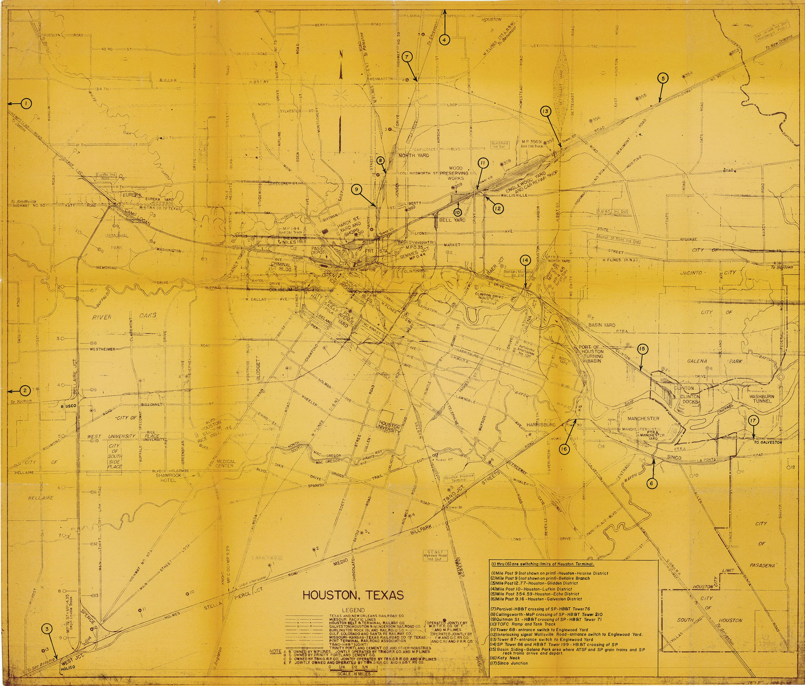
Original map of Houston, Texas from the 1950s showing the various railway lines running in and out of the city. Railroad companies listed include Southern Pacific, Gulf Colorado & Santa Fe, Missouri-Kansas-Texas Ry. Co., and Missouri Pacific. Map labels Houston sites such as the University of Houston, Rice University, the Shamrock Hotel, West University Place, Southside Place, River Oaks, Hermann Park, and the Medical Center.
- Title: Houston, Texas
- Author: Houston Belt & Terminal Ry. Co.
- Date: c. 1954
- Medium: Lithograph
- Condition: Fair - heavy age toning, fading of image in some areas, separations in margins at folds, slight wear and image loss along folds, few small tears in margins
- Inches: 31 3/4 x 27 1/4 [Paper]
- Centimeters: 80.65 x 69.22 [Paper]
- Product ID: 317041
Original map of Houston, Texas from the 1950s showing the various railway lines running in and out of the city. Railroad companies listed include Southern Pacific, Gulf Colorado & Santa Fe, Missouri-Kansas-Texas Ry. Co., and Missouri Pacific. Map labels Houston sites such as the University of Houston, Rice University, the Shamrock Hotel, West University Place, Southside Place, River Oaks, Hermann Park, and the Medical Center.
Original: $200.00
-65%$200.00
$70.00Description
- Title: Houston, Texas
- Author: Houston Belt & Terminal Ry. Co.
- Date: c. 1954
- Medium: Lithograph
- Condition: Fair - heavy age toning, fading of image in some areas, separations in margins at folds, slight wear and image loss along folds, few small tears in margins
- Inches: 31 3/4 x 27 1/4 [Paper]
- Centimeters: 80.65 x 69.22 [Paper]
- Product ID: 317041
Original map of Houston, Texas from the 1950s showing the various railway lines running in and out of the city. Railroad companies listed include Southern Pacific, Gulf Colorado & Santa Fe, Missouri-Kansas-Texas Ry. Co., and Missouri Pacific. Map labels Houston sites such as the University of Houston, Rice University, the Shamrock Hotel, West University Place, Southside Place, River Oaks, Hermann Park, and the Medical Center.