Indian Territory: General Land Office, 1887
- Title: Indian Territory
- Author: Department of the Interior, General Land Office
- Date: 1887
- Condition: Excellent - issued folds with minimal wear, some very mild toning
- Inches: 32 1/4 x 24 1/4 [Image]
- Centimeters: 81.91 x 61.59 [Image]
- Product ID: 308210
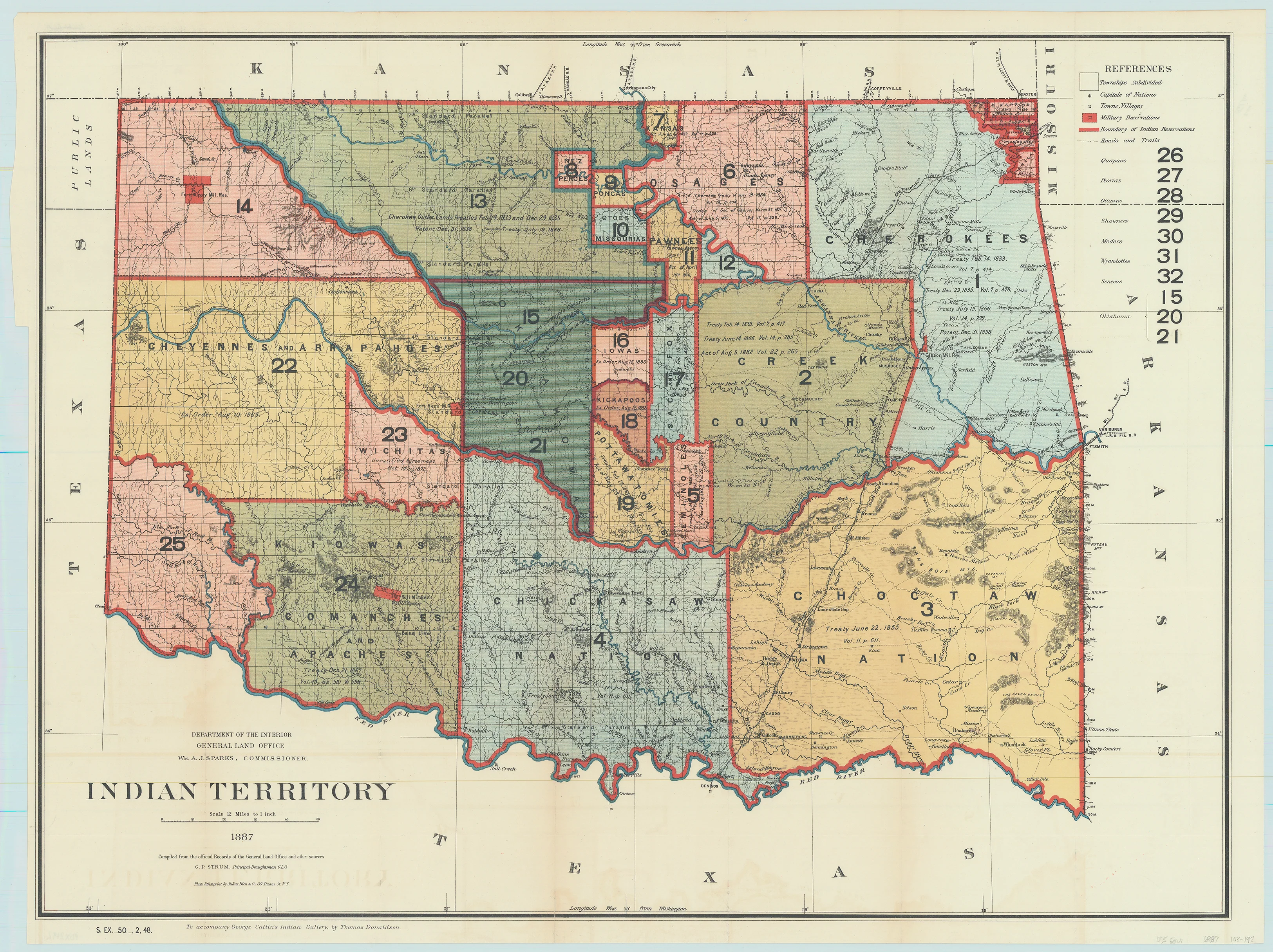
This interesting map is from the series of General Land Office maps reflecting the status of lands allocated to various tribes as shown through color-coding. The Indian Territory was initially established as a place to relocate the principal eastern Indian tribes and the Five Civilized Tribes formed the nucleus of an organized government. By 1887 however, representatives of some fifty tribes had settled on lands once promised to the original five. This map reflects many of these allocations and shows 25 separate regions and names seven more. A small portion of the panhandle is shown and labeled Public Lands. Drawn by G. P. Strum and published to accompany George Catlin's Indian Gallery, by Thomas Donaldson.
- Title: Indian Territory
- Author: Department of the Interior, General Land Office
- Date: 1887
- Condition: Excellent - issued folds with minimal wear, some very mild toning
- Inches: 32 1/4 x 24 1/4 [Image]
- Centimeters: 81.91 x 61.59 [Image]
- Product ID: 308210
This interesting map is from the series of General Land Office maps reflecting the status of lands allocated to various tribes as shown through color-coding. The Indian Territory was initially established as a place to relocate the principal eastern Indian tribes and the Five Civilized Tribes formed the nucleus of an organized government. By 1887 however, representatives of some fifty tribes had settled on lands once promised to the original five. This map reflects many of these allocations and shows 25 separate regions and names seven more. A small portion of the panhandle is shown and labeled Public Lands. Drawn by G. P. Strum and published to accompany George Catlin's Indian Gallery, by Thomas Donaldson.
Original: $950.00
-65%$950.00
$332.50Description
- Title: Indian Territory
- Author: Department of the Interior, General Land Office
- Date: 1887
- Condition: Excellent - issued folds with minimal wear, some very mild toning
- Inches: 32 1/4 x 24 1/4 [Image]
- Centimeters: 81.91 x 61.59 [Image]
- Product ID: 308210
This interesting map is from the series of General Land Office maps reflecting the status of lands allocated to various tribes as shown through color-coding. The Indian Territory was initially established as a place to relocate the principal eastern Indian tribes and the Five Civilized Tribes formed the nucleus of an organized government. By 1887 however, representatives of some fifty tribes had settled on lands once promised to the original five. This map reflects many of these allocations and shows 25 separate regions and names seven more. A small portion of the panhandle is shown and labeled Public Lands. Drawn by G. P. Strum and published to accompany George Catlin's Indian Gallery, by Thomas Donaldson.











