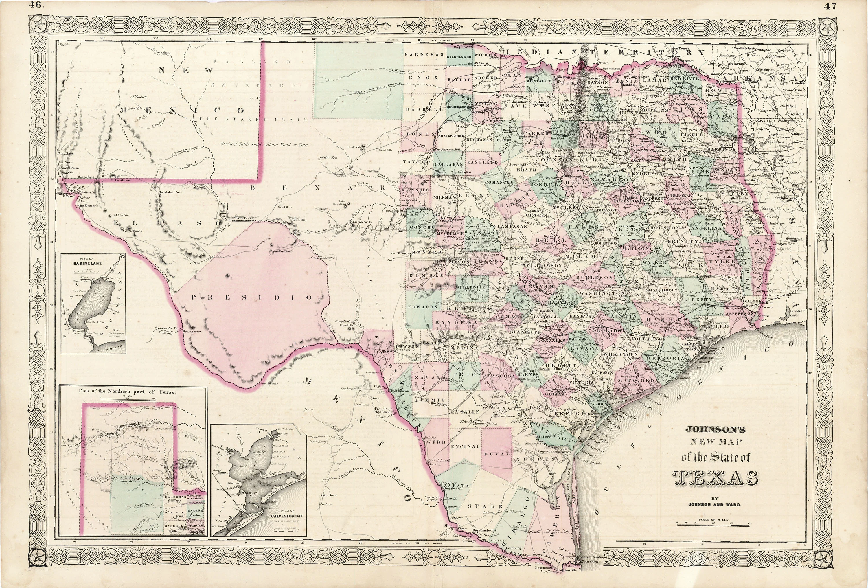
Johnson's New Map of the State of Texas: Johnson & Ward c. 1862
- Title: Johnson's New Map of the State of Texas
- Author: Johnson & Ward
- Date: c. 1862
- Medium: Hand-colored lithograph
- Condition: Very Good - light age toning, slight separations at issued center fold, tide marks in lower corners, light foxing
- Inches: 26 1/2 x 18 [Paper]
- Centimeters: 67.31 x 45.72 [Paper]
- Product ID: 317045
Map of Texas divided into its various counties published by Johnson & Ward. Includes an inset map of the 'Northern Part of Texas,' as well as a 'Plan of Galveston Bay' and a 'Plan of Lake Sabine.' Map includes parts of Mexico, New Mexico, Indian Territory, Arkansas, and Louisiana.
- Title: Johnson's New Map of the State of Texas
- Author: Johnson & Ward
- Date: c. 1862
- Medium: Hand-colored lithograph
- Condition: Very Good - light age toning, slight separations at issued center fold, tide marks in lower corners, light foxing
- Inches: 26 1/2 x 18 [Paper]
- Centimeters: 67.31 x 45.72 [Paper]
- Product ID: 317045
Map of Texas divided into its various counties published by Johnson & Ward. Includes an inset map of the 'Northern Part of Texas,' as well as a 'Plan of Galveston Bay' and a 'Plan of Lake Sabine.' Map includes parts of Mexico, New Mexico, Indian Territory, Arkansas, and Louisiana.
Original: $395.00
-65%$395.00
$138.25Description
- Title: Johnson's New Map of the State of Texas
- Author: Johnson & Ward
- Date: c. 1862
- Medium: Hand-colored lithograph
- Condition: Very Good - light age toning, slight separations at issued center fold, tide marks in lower corners, light foxing
- Inches: 26 1/2 x 18 [Paper]
- Centimeters: 67.31 x 45.72 [Paper]
- Product ID: 317045
Map of Texas divided into its various counties published by Johnson & Ward. Includes an inset map of the 'Northern Part of Texas,' as well as a 'Plan of Galveston Bay' and a 'Plan of Lake Sabine.' Map includes parts of Mexico, New Mexico, Indian Territory, Arkansas, and Louisiana.











