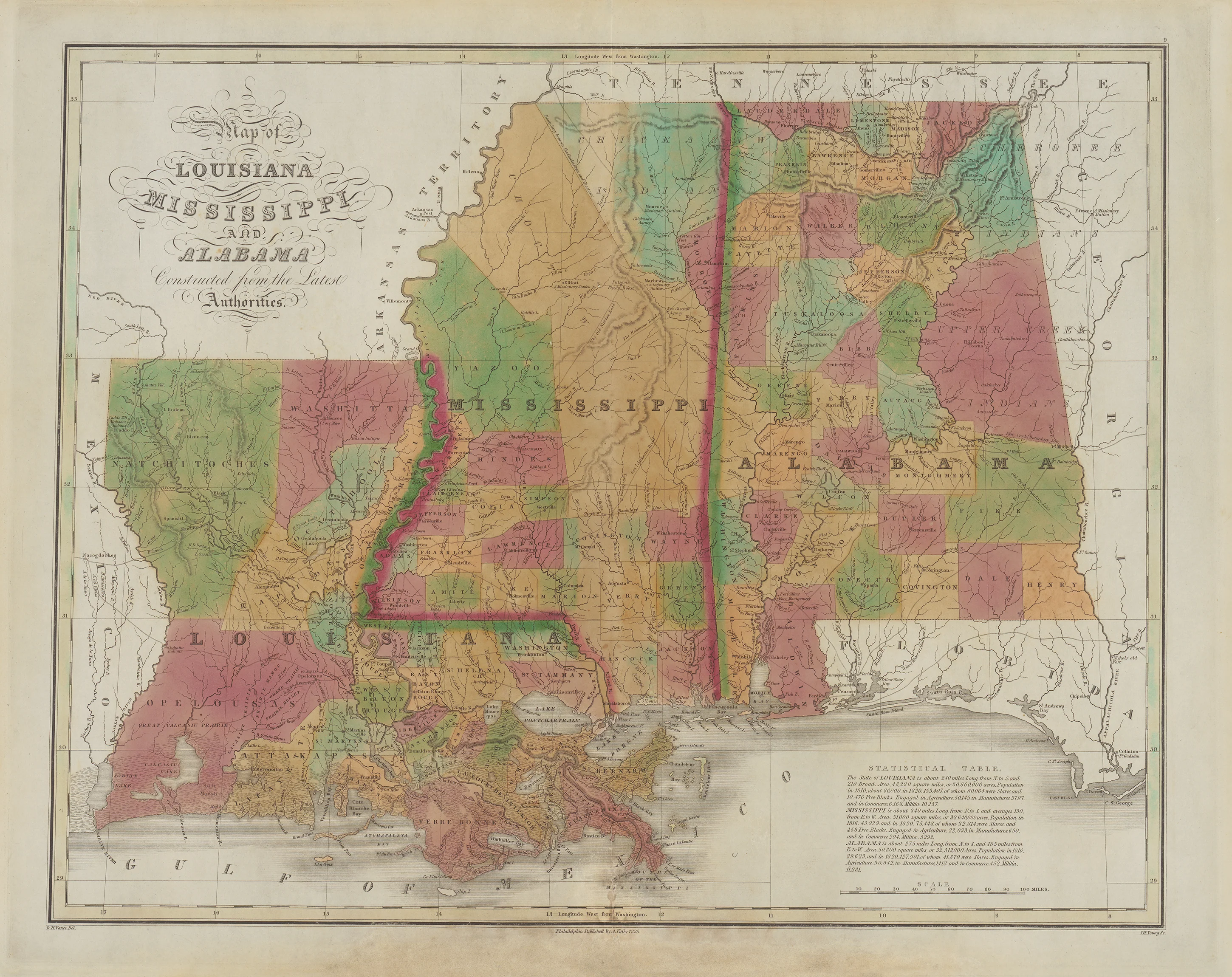
Map of Louisiana, Mississippi, and Alabama: Finley 1826
- Title: Map of Louisiana, Mississippi, and Alabama
- Author: Anthony Finley
- Date: 1826
- Medium: Hand-colored engraving
- Condition: Very Good - Foxing, wear along issued center fold, light scuffing in margins
- Inches: 21 3/4 x 17 1/4 [Image]
- Centimeters: 55.25 x 43.82 [Image]
- Product ID: 100090
Map of the states of Louisiana, Mississippi, and Alabama published by Anthony Finley in 1826. Map indicates various parishes and counties with different colors, and labels major cities and geographic features. It includes portions of East Texas, Arkansas, Tennessee, Georgia, and Florida, and contains a 'Statistical Table' in the bottom right corner of the page listing information about commerce and population in each of the three states pictured.
Anthony Finley (1784-1836) is recognized as an American cartographer and map publisher. Although not much is known about his personal life, it is presumed that he was born in Philadelphia, the same place he was buried. In addition to his work as a publisher, Finley was active in several civic and professional organizations within the city, notably the Philadelphia Apprentices’ Library. It's possible that he commenced his business ventures as early as 1809, with his first publication appearing around 1811.
- Title: Map of Louisiana, Mississippi, and Alabama
- Author: Anthony Finley
- Date: 1826
- Medium: Hand-colored engraving
- Condition: Very Good - Foxing, wear along issued center fold, light scuffing in margins
- Inches: 21 3/4 x 17 1/4 [Image]
- Centimeters: 55.25 x 43.82 [Image]
- Product ID: 100090
Map of the states of Louisiana, Mississippi, and Alabama published by Anthony Finley in 1826. Map indicates various parishes and counties with different colors, and labels major cities and geographic features. It includes portions of East Texas, Arkansas, Tennessee, Georgia, and Florida, and contains a 'Statistical Table' in the bottom right corner of the page listing information about commerce and population in each of the three states pictured.
Anthony Finley (1784-1836) is recognized as an American cartographer and map publisher. Although not much is known about his personal life, it is presumed that he was born in Philadelphia, the same place he was buried. In addition to his work as a publisher, Finley was active in several civic and professional organizations within the city, notably the Philadelphia Apprentices’ Library. It's possible that he commenced his business ventures as early as 1809, with his first publication appearing around 1811.
Description
- Title: Map of Louisiana, Mississippi, and Alabama
- Author: Anthony Finley
- Date: 1826
- Medium: Hand-colored engraving
- Condition: Very Good - Foxing, wear along issued center fold, light scuffing in margins
- Inches: 21 3/4 x 17 1/4 [Image]
- Centimeters: 55.25 x 43.82 [Image]
- Product ID: 100090
Map of the states of Louisiana, Mississippi, and Alabama published by Anthony Finley in 1826. Map indicates various parishes and counties with different colors, and labels major cities and geographic features. It includes portions of East Texas, Arkansas, Tennessee, Georgia, and Florida, and contains a 'Statistical Table' in the bottom right corner of the page listing information about commerce and population in each of the three states pictured.
Anthony Finley (1784-1836) is recognized as an American cartographer and map publisher. Although not much is known about his personal life, it is presumed that he was born in Philadelphia, the same place he was buried. In addition to his work as a publisher, Finley was active in several civic and professional organizations within the city, notably the Philadelphia Apprentices’ Library. It's possible that he commenced his business ventures as early as 1809, with his first publication appearing around 1811.











