Map of San Diego California City and County: Jones, c. 1930
-
Title: Map of San Diego California City and County
- Author: Lowell E. Jones
- Date: c. 1930
- Medium: Chromolithograph
- Condition: Very Good Plus - small separations along issued folds
- Inches: 21 3/4 x 15 7/8 [Paper]
- Centimeters: 55.25 x 40.32 [Paper]
- Product ID: 101399
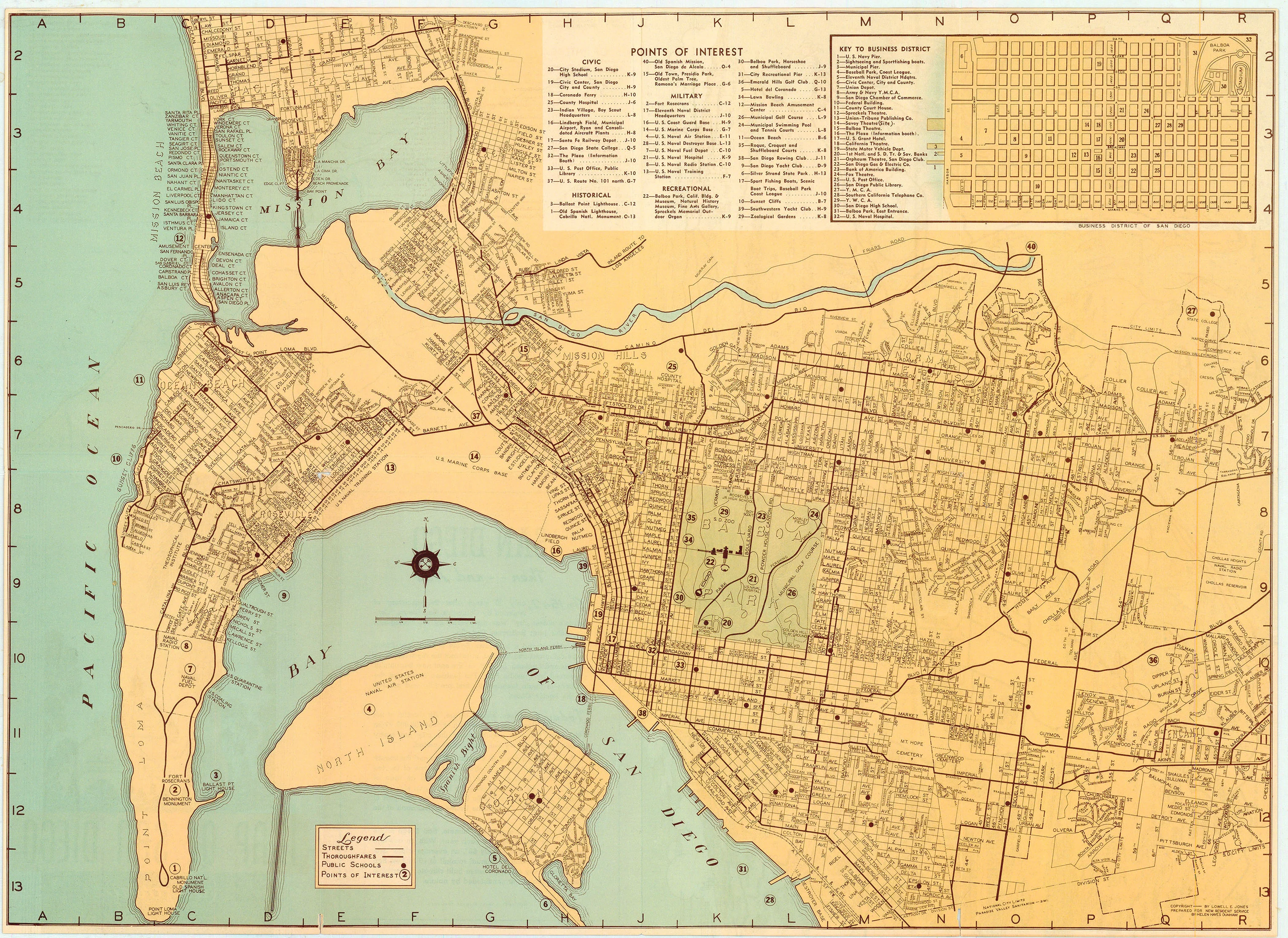
Tourist map of the city of San Diego, California c. 1930. Double-sided, contains pictorial map of San Diego County, map of southern California indicating major sites of interest, and map of the city of San Diego with a legend labelling various establishments and buildings in the city.
Background on Creator
Lowell E. Jones was a prolific cartographer and graphic artist based in Los Angeles, active primarily from the mid-1930s through the 1950s. He is especially well known for his detailed and whimsical pictorial maps of Southern California. His work includes pictorial and street maps of San Diego City and County, with notable maps published in 1935, 1940, and 1950. These maps often featured both practical street details and charming illustrations depicting local landmarks, culture, and tourist attractions.
Jones sold his pictorial maps at popular tourist spots, typically for twenty-five cents, making his artwork widely accessible to both locals and visitors. His maps are prized today for their blend of historical information, artistry, and insight into early-to-mid 20th-century Southern California.
-
Title: Map of San Diego California City and County
- Author: Lowell E. Jones
- Date: c. 1930
- Medium: Chromolithograph
- Condition: Very Good Plus - small separations along issued folds
- Inches: 21 3/4 x 15 7/8 [Paper]
- Centimeters: 55.25 x 40.32 [Paper]
- Product ID: 101399
Tourist map of the city of San Diego, California c. 1930. Double-sided, contains pictorial map of San Diego County, map of southern California indicating major sites of interest, and map of the city of San Diego with a legend labelling various establishments and buildings in the city.
Background on Creator
Lowell E. Jones was a prolific cartographer and graphic artist based in Los Angeles, active primarily from the mid-1930s through the 1950s. He is especially well known for his detailed and whimsical pictorial maps of Southern California. His work includes pictorial and street maps of San Diego City and County, with notable maps published in 1935, 1940, and 1950. These maps often featured both practical street details and charming illustrations depicting local landmarks, culture, and tourist attractions.
Jones sold his pictorial maps at popular tourist spots, typically for twenty-five cents, making his artwork widely accessible to both locals and visitors. His maps are prized today for their blend of historical information, artistry, and insight into early-to-mid 20th-century Southern California.
Description
-
Title: Map of San Diego California City and County
- Author: Lowell E. Jones
- Date: c. 1930
- Medium: Chromolithograph
- Condition: Very Good Plus - small separations along issued folds
- Inches: 21 3/4 x 15 7/8 [Paper]
- Centimeters: 55.25 x 40.32 [Paper]
- Product ID: 101399
Tourist map of the city of San Diego, California c. 1930. Double-sided, contains pictorial map of San Diego County, map of southern California indicating major sites of interest, and map of the city of San Diego with a legend labelling various establishments and buildings in the city.
Background on Creator
Lowell E. Jones was a prolific cartographer and graphic artist based in Los Angeles, active primarily from the mid-1930s through the 1950s. He is especially well known for his detailed and whimsical pictorial maps of Southern California. His work includes pictorial and street maps of San Diego City and County, with notable maps published in 1935, 1940, and 1950. These maps often featured both practical street details and charming illustrations depicting local landmarks, culture, and tourist attractions.
Jones sold his pictorial maps at popular tourist spots, typically for twenty-five cents, making his artwork widely accessible to both locals and visitors. His maps are prized today for their blend of historical information, artistry, and insight into early-to-mid 20th-century Southern California.