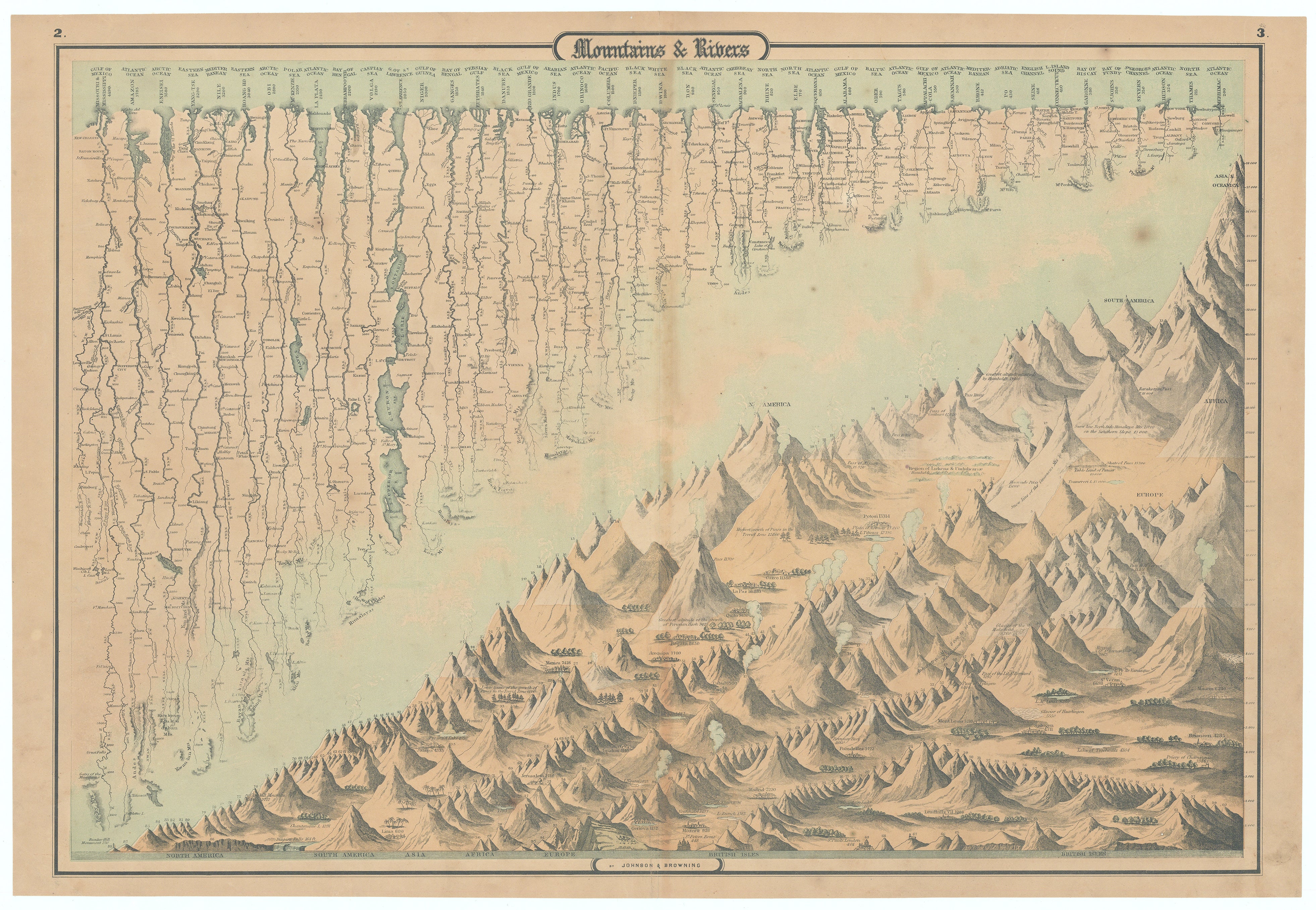
Mountains and Rivers: Johnson & Browning, 1860
- Title: Mountains and Rivers
-
Author: A.J. Johnson & Ross C. Browning
- Date: 1860
- Condition: See description
- Inches: 23 7/8 x 16 3/4 [Image]
- Centimeters: 60.64 x 42.54 [Image]
- Product ID: 308482
The inaugural edition of one of the most exceptional 19th-century charts depicting global mountain ranges and river systems. It employs a distinctive diagonal division creating an engaging compositional arrangement. The upper section identifies and illustrates numerous rivers, rendered proportionally to demonstrate their comparative lengths. The lower portion presents stylized representations of mountain systems organized by continents and scaled to reflect their relative elevations. Active volcanoes are depicted in eruption while major cities are positioned according to their corresponding altitudes.
Background on Creator(s)
Alvin Jewett Johnson (1827-1884) was a prolific American map publisher who was active from 1856 to the mid-1880s, born into a poor family in Wallingford, Vermont where he received only a basic public education. Despite his limited formal education, he served as a school teacher for several years before moving to Richmond, Virginia and then to New York City in 1857. Johnson led the New York City publishing company that published Johnson's Family Atlases from 1860 to 1887, which were published under his name alone or in partnership with others including Ross C. Browning and Benjamin P. Ward.
Ross C. Browning (1822-1899) was an agent who worked in Johnson's book canvassing business in New York, and from 1860 to early 1863, the name of the company which published the atlases was Johnson & Browning. Some of the 1860 and 1861 atlases indicate that Browning appears to have lived in Richmond at least for a period. The partnership between Johnson and Browning lasted from 1860 to 1862, after which Johnson continued publishing with Benjamin P. Ward until 1866.
Condition
Exhibits mild toning that is more pronounced along the central fold, scattered foxing, and brief professionally repaired centerfold splits within the upper and lower margins.
- Title: Mountains and Rivers
-
Author: A.J. Johnson & Ross C. Browning
- Date: 1860
- Condition: See description
- Inches: 23 7/8 x 16 3/4 [Image]
- Centimeters: 60.64 x 42.54 [Image]
- Product ID: 308482
The inaugural edition of one of the most exceptional 19th-century charts depicting global mountain ranges and river systems. It employs a distinctive diagonal division creating an engaging compositional arrangement. The upper section identifies and illustrates numerous rivers, rendered proportionally to demonstrate their comparative lengths. The lower portion presents stylized representations of mountain systems organized by continents and scaled to reflect their relative elevations. Active volcanoes are depicted in eruption while major cities are positioned according to their corresponding altitudes.
Background on Creator(s)
Alvin Jewett Johnson (1827-1884) was a prolific American map publisher who was active from 1856 to the mid-1880s, born into a poor family in Wallingford, Vermont where he received only a basic public education. Despite his limited formal education, he served as a school teacher for several years before moving to Richmond, Virginia and then to New York City in 1857. Johnson led the New York City publishing company that published Johnson's Family Atlases from 1860 to 1887, which were published under his name alone or in partnership with others including Ross C. Browning and Benjamin P. Ward.
Ross C. Browning (1822-1899) was an agent who worked in Johnson's book canvassing business in New York, and from 1860 to early 1863, the name of the company which published the atlases was Johnson & Browning. Some of the 1860 and 1861 atlases indicate that Browning appears to have lived in Richmond at least for a period. The partnership between Johnson and Browning lasted from 1860 to 1862, after which Johnson continued publishing with Benjamin P. Ward until 1866.
Condition
Exhibits mild toning that is more pronounced along the central fold, scattered foxing, and brief professionally repaired centerfold splits within the upper and lower margins.
Description
- Title: Mountains and Rivers
-
Author: A.J. Johnson & Ross C. Browning
- Date: 1860
- Condition: See description
- Inches: 23 7/8 x 16 3/4 [Image]
- Centimeters: 60.64 x 42.54 [Image]
- Product ID: 308482
The inaugural edition of one of the most exceptional 19th-century charts depicting global mountain ranges and river systems. It employs a distinctive diagonal division creating an engaging compositional arrangement. The upper section identifies and illustrates numerous rivers, rendered proportionally to demonstrate their comparative lengths. The lower portion presents stylized representations of mountain systems organized by continents and scaled to reflect their relative elevations. Active volcanoes are depicted in eruption while major cities are positioned according to their corresponding altitudes.
Background on Creator(s)
Alvin Jewett Johnson (1827-1884) was a prolific American map publisher who was active from 1856 to the mid-1880s, born into a poor family in Wallingford, Vermont where he received only a basic public education. Despite his limited formal education, he served as a school teacher for several years before moving to Richmond, Virginia and then to New York City in 1857. Johnson led the New York City publishing company that published Johnson's Family Atlases from 1860 to 1887, which were published under his name alone or in partnership with others including Ross C. Browning and Benjamin P. Ward.
Ross C. Browning (1822-1899) was an agent who worked in Johnson's book canvassing business in New York, and from 1860 to early 1863, the name of the company which published the atlases was Johnson & Browning. Some of the 1860 and 1861 atlases indicate that Browning appears to have lived in Richmond at least for a period. The partnership between Johnson and Browning lasted from 1860 to 1862, after which Johnson continued publishing with Benjamin P. Ward until 1866.
Condition
Exhibits mild toning that is more pronounced along the central fold, scattered foxing, and brief professionally repaired centerfold splits within the upper and lower margins.