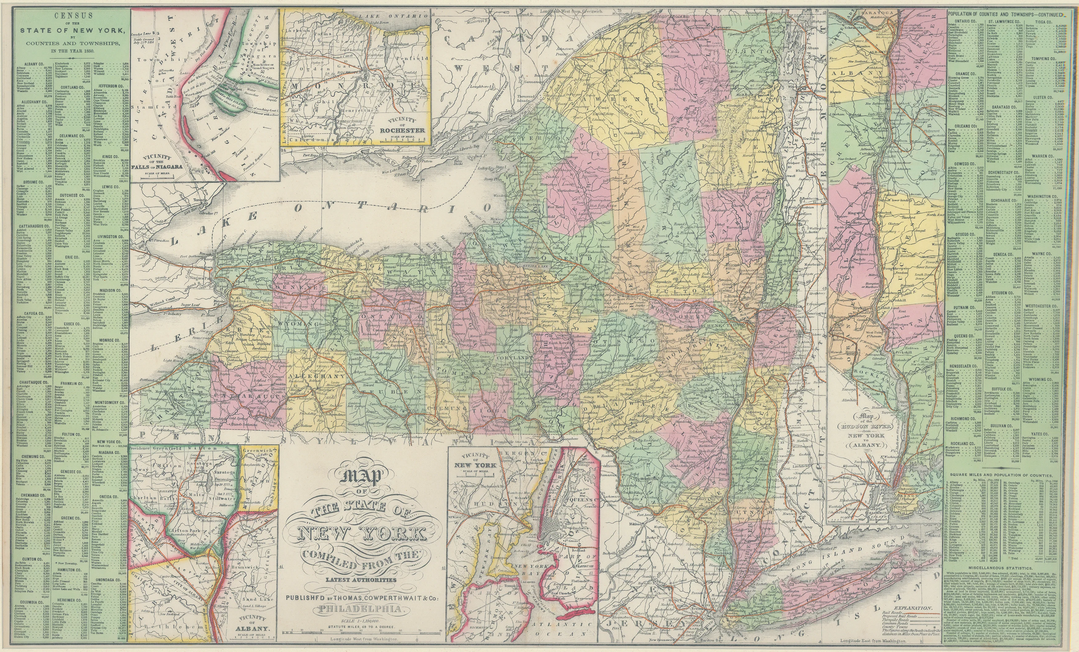
Map of the State of New York: Thomas, Cowperthwait & Co. 1852
- Title: Map of the State of New York
- Author: Thomas, Cowperthwait & Co.
- Date: 1852
- Medium: Hand-colored engraving
- Condition: Excellent
- Inches: 27 1/2 x 16 [Image]
- Centimeters: 70.51 x 41.03 [Image]
- Product ID: 003181
Map of New York state by Thomas, Cowperthwait & Co. - includes insets depicting the areas around Rochester, Albany, New York City, and Albany, as well as census data from all New York counties dating from 1850.
Thomas, Cowperthwait & Co. was a Philadelphia-based publishing company that was active in the mid-19th century. The company was founded by Joseph Thomas and H. C. Cowperthwait in 1835, with the goal of producing high-quality, affordable educational materials for American schools and families before expanding to sell a range of geographical materials, including their well-known New Universal Atlas.
- Title: Map of the State of New York
- Author: Thomas, Cowperthwait & Co.
- Date: 1852
- Medium: Hand-colored engraving
- Condition: Excellent
- Inches: 27 1/2 x 16 [Image]
- Centimeters: 70.51 x 41.03 [Image]
- Product ID: 003181
Map of New York state by Thomas, Cowperthwait & Co. - includes insets depicting the areas around Rochester, Albany, New York City, and Albany, as well as census data from all New York counties dating from 1850.
Thomas, Cowperthwait & Co. was a Philadelphia-based publishing company that was active in the mid-19th century. The company was founded by Joseph Thomas and H. C. Cowperthwait in 1835, with the goal of producing high-quality, affordable educational materials for American schools and families before expanding to sell a range of geographical materials, including their well-known New Universal Atlas.
Original: $175.00
-65%$175.00
$61.25Description
- Title: Map of the State of New York
- Author: Thomas, Cowperthwait & Co.
- Date: 1852
- Medium: Hand-colored engraving
- Condition: Excellent
- Inches: 27 1/2 x 16 [Image]
- Centimeters: 70.51 x 41.03 [Image]
- Product ID: 003181
Map of New York state by Thomas, Cowperthwait & Co. - includes insets depicting the areas around Rochester, Albany, New York City, and Albany, as well as census data from all New York counties dating from 1850.
Thomas, Cowperthwait & Co. was a Philadelphia-based publishing company that was active in the mid-19th century. The company was founded by Joseph Thomas and H. C. Cowperthwait in 1835, with the goal of producing high-quality, affordable educational materials for American schools and families before expanding to sell a range of geographical materials, including their well-known New Universal Atlas.











