Plan of Boston: William Bradley & Bros, 1887
- Title: Plan of Boston
-
Author: William Bradley & Bros.
- Date: 1887
- Condition: Even, overall age toning; 2": tear at the lower centerfold professionally repaired extending slightly into the image, with only minimal edge chipping.
- Inches: 20 7/8 x 13 3/8 [Image]
- Centimeters: 53.02 x 33.97 [Image]
- Product ID: 308637
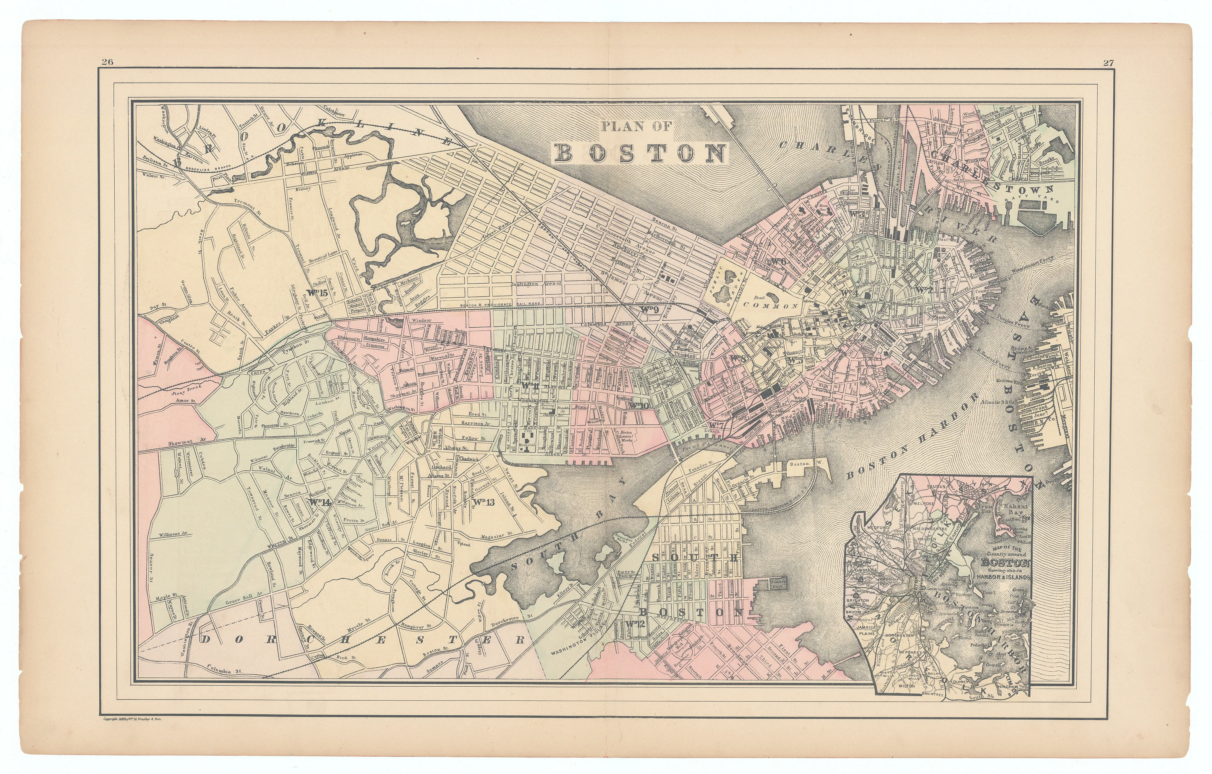
This late nineteenth‑century “Plan of Boston” presents a detailed street‑level view of the city and surrounding districts, with wards and neighborhoods distinguished by subtle pastel tints. The map highlights key urban features such as the Boston Common, wharves, rail lines, and ferry connections, and includes an inset showing Boston in relation to its harbor and neighboring towns. The crisp engraving and decorative double‑line border are characteristic of commercial atlas maps of the period issued by firms such as William M. Bradley & Bro., who specialized in accessible yet attractive city and regional plans for a broad American audience.
Background on Creator
William Bradley & Bros. (most often appearing as “Wm. M. Bradley & Bro.”) was a Philadelphia‑based American map and atlas publishing firm active mainly in the 1880s–1890s, producing pastel‑colored lithographed state, regional, and national maps—frequently as double‑page atlas plates showing counties and railroads—whose imprint is well documented on surviving maps and copyright lines, even though detailed biographical information on William M. Bradley and his brother remains scarce and is largely confined to what can be inferred from late‑19th‑century cartographic and business records. They effectively succeeded S. Augustus Mitchell’s firm as publisher of Mitchell’s atlases and continued issuing “Mitchell’s New General Atlas” and other Mitchell plates into the 1880s and 1890s.
- Title: Plan of Boston
-
Author: William Bradley & Bros.
- Date: 1887
- Condition: Even, overall age toning; 2": tear at the lower centerfold professionally repaired extending slightly into the image, with only minimal edge chipping.
- Inches: 20 7/8 x 13 3/8 [Image]
- Centimeters: 53.02 x 33.97 [Image]
- Product ID: 308637
This late nineteenth‑century “Plan of Boston” presents a detailed street‑level view of the city and surrounding districts, with wards and neighborhoods distinguished by subtle pastel tints. The map highlights key urban features such as the Boston Common, wharves, rail lines, and ferry connections, and includes an inset showing Boston in relation to its harbor and neighboring towns. The crisp engraving and decorative double‑line border are characteristic of commercial atlas maps of the period issued by firms such as William M. Bradley & Bro., who specialized in accessible yet attractive city and regional plans for a broad American audience.
Background on Creator
William Bradley & Bros. (most often appearing as “Wm. M. Bradley & Bro.”) was a Philadelphia‑based American map and atlas publishing firm active mainly in the 1880s–1890s, producing pastel‑colored lithographed state, regional, and national maps—frequently as double‑page atlas plates showing counties and railroads—whose imprint is well documented on surviving maps and copyright lines, even though detailed biographical information on William M. Bradley and his brother remains scarce and is largely confined to what can be inferred from late‑19th‑century cartographic and business records. They effectively succeeded S. Augustus Mitchell’s firm as publisher of Mitchell’s atlases and continued issuing “Mitchell’s New General Atlas” and other Mitchell plates into the 1880s and 1890s.
Description
- Title: Plan of Boston
-
Author: William Bradley & Bros.
- Date: 1887
- Condition: Even, overall age toning; 2": tear at the lower centerfold professionally repaired extending slightly into the image, with only minimal edge chipping.
- Inches: 20 7/8 x 13 3/8 [Image]
- Centimeters: 53.02 x 33.97 [Image]
- Product ID: 308637
This late nineteenth‑century “Plan of Boston” presents a detailed street‑level view of the city and surrounding districts, with wards and neighborhoods distinguished by subtle pastel tints. The map highlights key urban features such as the Boston Common, wharves, rail lines, and ferry connections, and includes an inset showing Boston in relation to its harbor and neighboring towns. The crisp engraving and decorative double‑line border are characteristic of commercial atlas maps of the period issued by firms such as William M. Bradley & Bro., who specialized in accessible yet attractive city and regional plans for a broad American audience.
Background on Creator
William Bradley & Bros. (most often appearing as “Wm. M. Bradley & Bro.”) was a Philadelphia‑based American map and atlas publishing firm active mainly in the 1880s–1890s, producing pastel‑colored lithographed state, regional, and national maps—frequently as double‑page atlas plates showing counties and railroads—whose imprint is well documented on surviving maps and copyright lines, even though detailed biographical information on William M. Bradley and his brother remains scarce and is largely confined to what can be inferred from late‑19th‑century cartographic and business records. They effectively succeeded S. Augustus Mitchell’s firm as publisher of Mitchell’s atlases and continued issuing “Mitchell’s New General Atlas” and other Mitchell plates into the 1880s and 1890s.