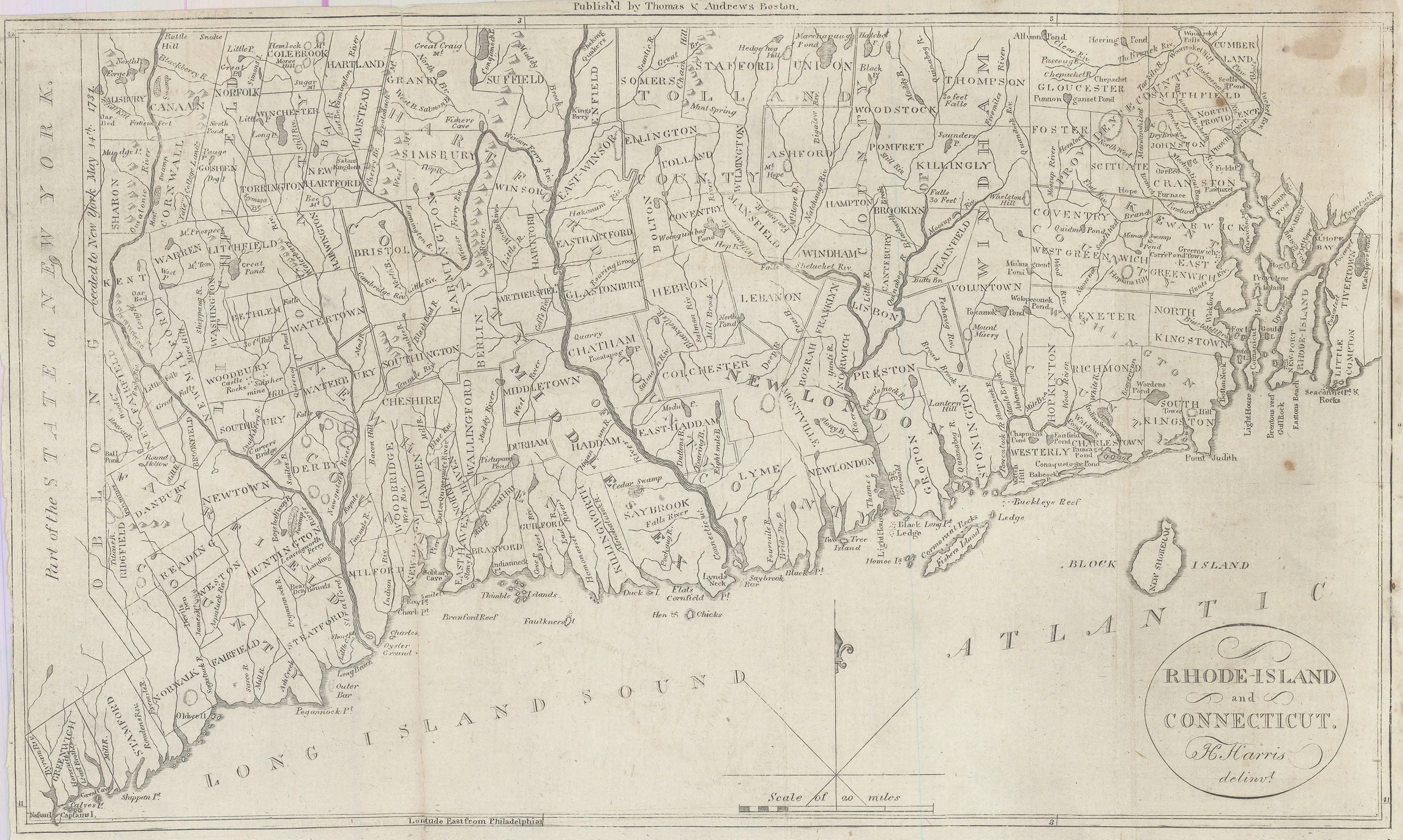
Rhode-Island and Connecticut: Morse 1802
- Title: Rhode-Island and Connecticut
- Author: Jedidiah Morse
- Date: 1802
- Medium: Copperplate engraving
- Condition: Very Good - age toning, foxing, trimmed margins, vertical fold lines
- Inches: 13 x 8 1/4 [Paper]
- Centimeters: 33.02 x 20.96 [Paper]
- Product ID: 318037
Map of Connecticut and Rhode Island bordering Long Island Sound. Published in Morse's American Universal Geography by Boston firm Thomas & Andrews. Longitude given from Philadelphia. Along the left-hand border appears 'Part of the State of New York' and an 'Oblong' territory 'ceeded to New York May 14th, 1731.' Single lines indicate borders of towns and cities, while double lines indicate county borders.
- Title: Rhode-Island and Connecticut
- Author: Jedidiah Morse
- Date: 1802
- Medium: Copperplate engraving
- Condition: Very Good - age toning, foxing, trimmed margins, vertical fold lines
- Inches: 13 x 8 1/4 [Paper]
- Centimeters: 33.02 x 20.96 [Paper]
- Product ID: 318037
Map of Connecticut and Rhode Island bordering Long Island Sound. Published in Morse's American Universal Geography by Boston firm Thomas & Andrews. Longitude given from Philadelphia. Along the left-hand border appears 'Part of the State of New York' and an 'Oblong' territory 'ceeded to New York May 14th, 1731.' Single lines indicate borders of towns and cities, while double lines indicate county borders.
Original: $295.00
-65%$295.00
$103.25Description
- Title: Rhode-Island and Connecticut
- Author: Jedidiah Morse
- Date: 1802
- Medium: Copperplate engraving
- Condition: Very Good - age toning, foxing, trimmed margins, vertical fold lines
- Inches: 13 x 8 1/4 [Paper]
- Centimeters: 33.02 x 20.96 [Paper]
- Product ID: 318037
Map of Connecticut and Rhode Island bordering Long Island Sound. Published in Morse's American Universal Geography by Boston firm Thomas & Andrews. Longitude given from Philadelphia. Along the left-hand border appears 'Part of the State of New York' and an 'Oblong' territory 'ceeded to New York May 14th, 1731.' Single lines indicate borders of towns and cities, while double lines indicate county borders.











