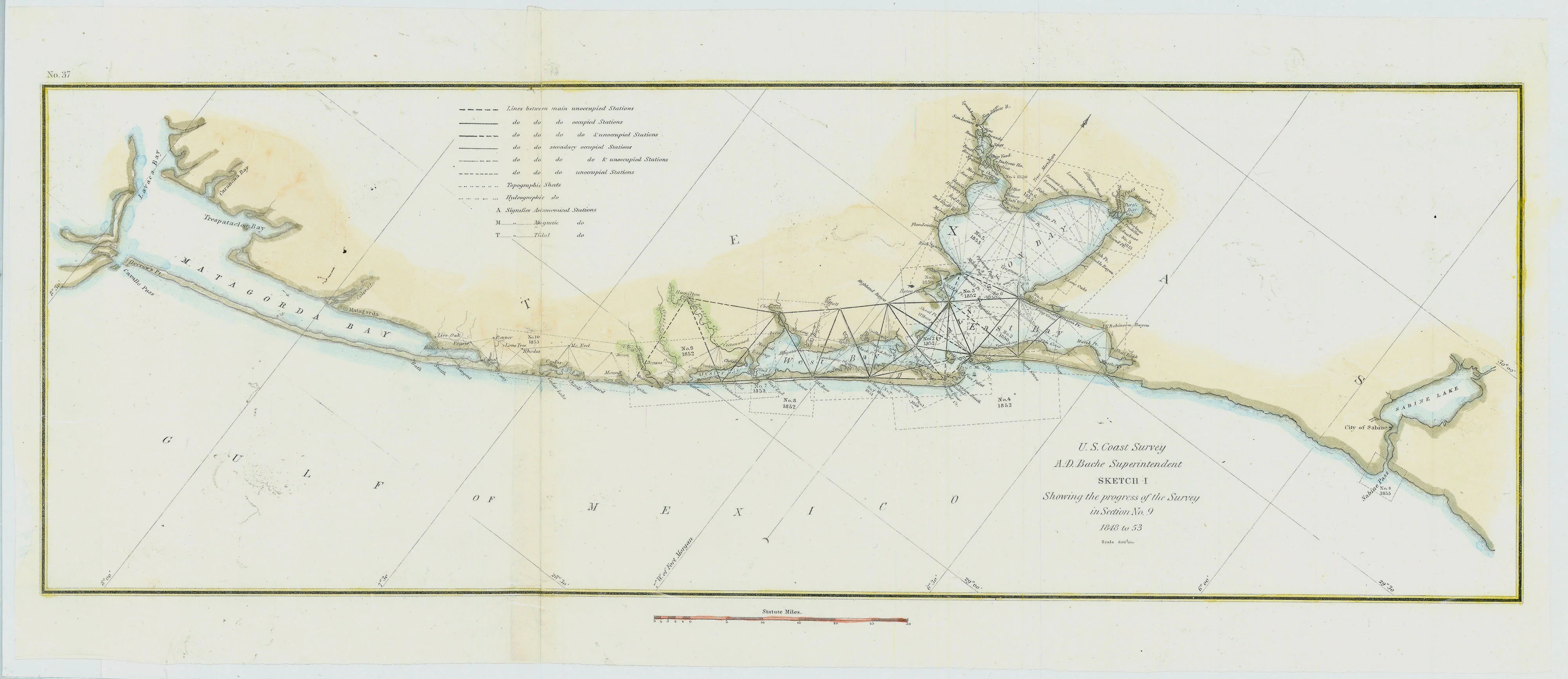
Sketch I (Matagorda Bay to Sabine Pass): Bache 1848-53
- Title: Sketch I Showing the progress of the Survey in Section No. 9
- Author: A. D. Bache
- Date: 1848-53
- Medium: Hand-colored engraving
- Condition: Very Good Plus - issued trifolds, light scuffing in areas, portion of left margin reinstated
- Inches: 22 1/2 x 9 1/2 [Paper]
- Centimeters: 57.15 x 24.13 [Paper]
- Product ID: 312013
U. S. Coast Survey
A. D. Bache Superintendent
SKETCH I
Showing the progress of the Survey in Section No. 9
1848 to 53
Scale 1/600,000
Map of the Texas coast stretching from Matagorda Bay to Sabine Pass. Includes triangulations superimposed on map, labeled by section number and date surveyed.
Surveyor, scientist, and pioneering oceanographer A. D. Bache (1806-1867) served as the 6th Superintendent of the U.S. Coast Survey. Born in Philadelphia, he came from a prominent political family, and was the great-grandson of Benjamin Franklin. Under his leadership, the Coast Survey’s operations grew significantly, expanding from nine to seventeen states as it surveyed the Gulf and West Coasts. Bache ran meticulous studies relating to ocean currents, tides, and the earth’s magnetic field, endeavors which provided in-depth knowledge about U.S. coastal geography. Thanks to Bache, the Coast Survey evolved into an immense resource for the U.S. government and one of the foremost scientific institutions in the country leading up to the Civil War.
- Title: Sketch I Showing the progress of the Survey in Section No. 9
- Author: A. D. Bache
- Date: 1848-53
- Medium: Hand-colored engraving
- Condition: Very Good Plus - issued trifolds, light scuffing in areas, portion of left margin reinstated
- Inches: 22 1/2 x 9 1/2 [Paper]
- Centimeters: 57.15 x 24.13 [Paper]
- Product ID: 312013
U. S. Coast Survey
A. D. Bache Superintendent
SKETCH I
Showing the progress of the Survey in Section No. 9
1848 to 53
Scale 1/600,000
Map of the Texas coast stretching from Matagorda Bay to Sabine Pass. Includes triangulations superimposed on map, labeled by section number and date surveyed.
Surveyor, scientist, and pioneering oceanographer A. D. Bache (1806-1867) served as the 6th Superintendent of the U.S. Coast Survey. Born in Philadelphia, he came from a prominent political family, and was the great-grandson of Benjamin Franklin. Under his leadership, the Coast Survey’s operations grew significantly, expanding from nine to seventeen states as it surveyed the Gulf and West Coasts. Bache ran meticulous studies relating to ocean currents, tides, and the earth’s magnetic field, endeavors which provided in-depth knowledge about U.S. coastal geography. Thanks to Bache, the Coast Survey evolved into an immense resource for the U.S. government and one of the foremost scientific institutions in the country leading up to the Civil War.
Description
- Title: Sketch I Showing the progress of the Survey in Section No. 9
- Author: A. D. Bache
- Date: 1848-53
- Medium: Hand-colored engraving
- Condition: Very Good Plus - issued trifolds, light scuffing in areas, portion of left margin reinstated
- Inches: 22 1/2 x 9 1/2 [Paper]
- Centimeters: 57.15 x 24.13 [Paper]
- Product ID: 312013
U. S. Coast Survey
A. D. Bache Superintendent
SKETCH I
Showing the progress of the Survey in Section No. 9
1848 to 53
Scale 1/600,000
Map of the Texas coast stretching from Matagorda Bay to Sabine Pass. Includes triangulations superimposed on map, labeled by section number and date surveyed.
Surveyor, scientist, and pioneering oceanographer A. D. Bache (1806-1867) served as the 6th Superintendent of the U.S. Coast Survey. Born in Philadelphia, he came from a prominent political family, and was the great-grandson of Benjamin Franklin. Under his leadership, the Coast Survey’s operations grew significantly, expanding from nine to seventeen states as it surveyed the Gulf and West Coasts. Bache ran meticulous studies relating to ocean currents, tides, and the earth’s magnetic field, endeavors which provided in-depth knowledge about U.S. coastal geography. Thanks to Bache, the Coast Survey evolved into an immense resource for the U.S. government and one of the foremost scientific institutions in the country leading up to the Civil War.











