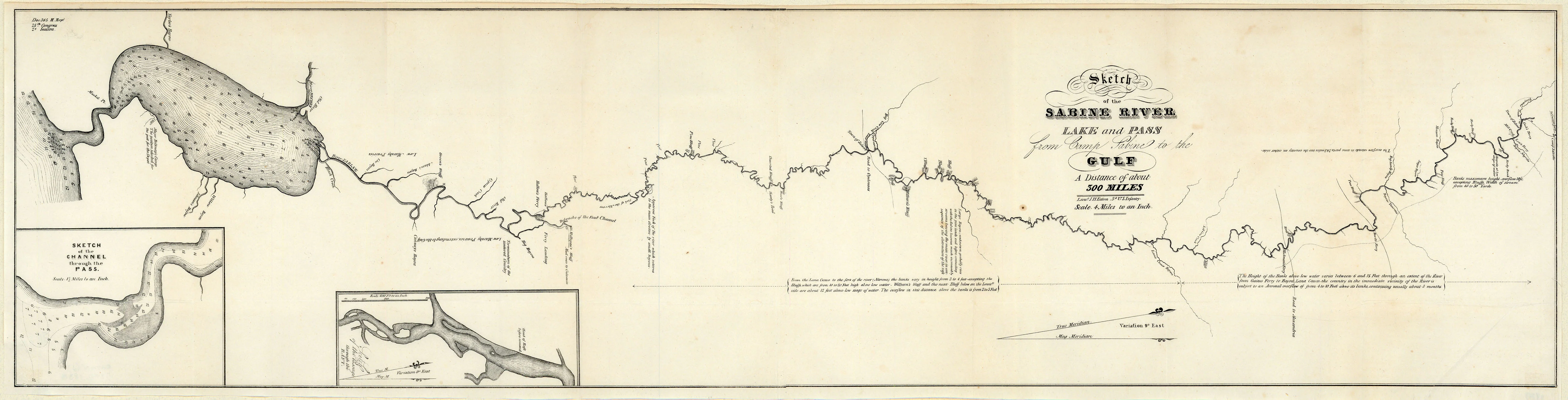
Sketch of the Sabine River Lake and Pass from Camp Sabine to the Gulf: Eaton 1838
- Title: Sketch of the Sabine River Lake and Pass from Camp Sabine to the Gulf
- Author: J. H. Eaton
- Date: 1838
- Medium: Uncolored engraving
- Condition: Excellent - issued folding, light creasing in areas, minor foxing and toning
- Inches: 35 1/8 x 8 3/4 [Paper]
- Centimeters: 89.22 x 22.23 [Paper]
- Product ID: 222034
Map of the course of the Sabine River in Texas flowing into the Gulf of Mexico. Includes two inset maps to the lower left: 'Sketch of the Channel through the Pass' and 'Sketch of the Passage through the Raft.' Eaton includes various annotations about features along the river, specific routes through the area, water depth and bank height, and magnetic variation.
- Title: Sketch of the Sabine River Lake and Pass from Camp Sabine to the Gulf
- Author: J. H. Eaton
- Date: 1838
- Medium: Uncolored engraving
- Condition: Excellent - issued folding, light creasing in areas, minor foxing and toning
- Inches: 35 1/8 x 8 3/4 [Paper]
- Centimeters: 89.22 x 22.23 [Paper]
- Product ID: 222034
Map of the course of the Sabine River in Texas flowing into the Gulf of Mexico. Includes two inset maps to the lower left: 'Sketch of the Channel through the Pass' and 'Sketch of the Passage through the Raft.' Eaton includes various annotations about features along the river, specific routes through the area, water depth and bank height, and magnetic variation.
Original: $695.00
-65%$695.00
$243.25Description
- Title: Sketch of the Sabine River Lake and Pass from Camp Sabine to the Gulf
- Author: J. H. Eaton
- Date: 1838
- Medium: Uncolored engraving
- Condition: Excellent - issued folding, light creasing in areas, minor foxing and toning
- Inches: 35 1/8 x 8 3/4 [Paper]
- Centimeters: 89.22 x 22.23 [Paper]
- Product ID: 222034
Map of the course of the Sabine River in Texas flowing into the Gulf of Mexico. Includes two inset maps to the lower left: 'Sketch of the Channel through the Pass' and 'Sketch of the Passage through the Raft.' Eaton includes various annotations about features along the river, specific routes through the area, water depth and bank height, and magnetic variation.











