Texas: Asher & Adams, 1871
-
Title: Asher & Adams Texas
- Author: Asher & Adams
- Date: 1871
- Condition: Good - Tears and splits throughout have been expertly mended, with some areas of paper loss confinded to the outer margins
- Inches: 16 x 22 1/2 [Image]
- Centimeters: 40.64 x 57.15 [Image]
- Product ID: 308693
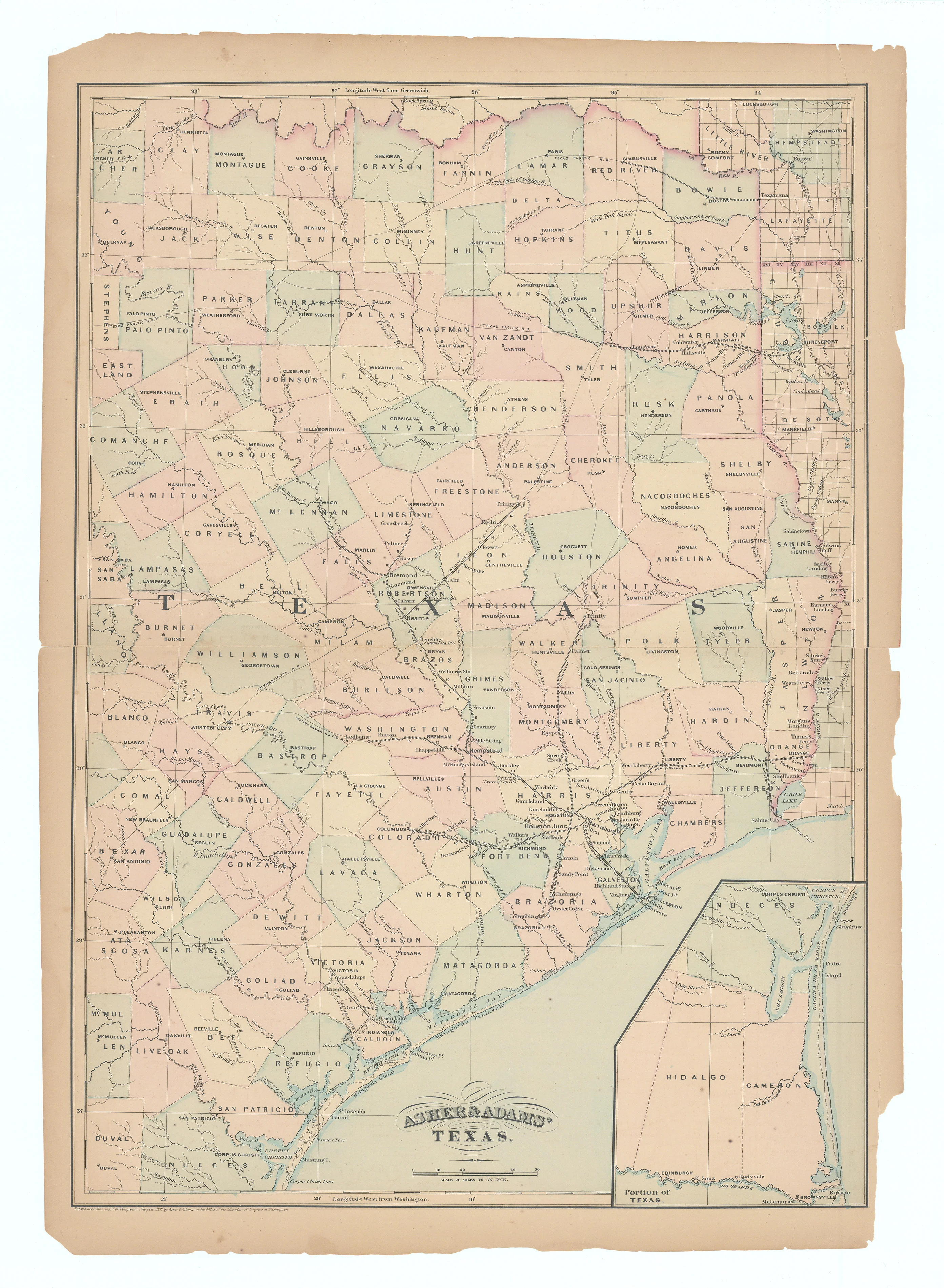
This Asher & Adams map of Texas presents the eastern and central parts of the state in pastel county colors, with county boundaries, seats, and numerous small towns clearly labeled. Railroads dominate the composition, with completed and proposed lines radiating from Houston, Galveston, and other Gulf Coast and interior hubs, reflecting the state’s rapidly expanding transportation network. A large inset in the lower right isolates the lower Rio Grande region, including Brownsville and the lower Gulf Coast counties, providing additional detail for this distant corner of the state.
Background on Creator
Asher & Adams was a New York–based map publishing firm, led by John R. Asher and George H. Adams, active mainly from the 1860s through the 1870s and known for large, vividly colored state and county atlases that emphasized the rapidly expanding American railroad network, often sacrificing detailed topography in order to highlight rail lines, townships, towns, and even individual rural properties, with major works including their New Commercial, Topographical, and Statistical Atlas and Gazetteer of the United States (notably the 1870s editions) and specialized state atlases such as their New York volume, all of which today are valued as important documentary records of post–Civil War transportation, settlement, and commercial development in the United States.
-
Title: Asher & Adams Texas
- Author: Asher & Adams
- Date: 1871
- Condition: Good - Tears and splits throughout have been expertly mended, with some areas of paper loss confinded to the outer margins
- Inches: 16 x 22 1/2 [Image]
- Centimeters: 40.64 x 57.15 [Image]
- Product ID: 308693
This Asher & Adams map of Texas presents the eastern and central parts of the state in pastel county colors, with county boundaries, seats, and numerous small towns clearly labeled. Railroads dominate the composition, with completed and proposed lines radiating from Houston, Galveston, and other Gulf Coast and interior hubs, reflecting the state’s rapidly expanding transportation network. A large inset in the lower right isolates the lower Rio Grande region, including Brownsville and the lower Gulf Coast counties, providing additional detail for this distant corner of the state.
Background on Creator
Asher & Adams was a New York–based map publishing firm, led by John R. Asher and George H. Adams, active mainly from the 1860s through the 1870s and known for large, vividly colored state and county atlases that emphasized the rapidly expanding American railroad network, often sacrificing detailed topography in order to highlight rail lines, townships, towns, and even individual rural properties, with major works including their New Commercial, Topographical, and Statistical Atlas and Gazetteer of the United States (notably the 1870s editions) and specialized state atlases such as their New York volume, all of which today are valued as important documentary records of post–Civil War transportation, settlement, and commercial development in the United States.
Description
-
Title: Asher & Adams Texas
- Author: Asher & Adams
- Date: 1871
- Condition: Good - Tears and splits throughout have been expertly mended, with some areas of paper loss confinded to the outer margins
- Inches: 16 x 22 1/2 [Image]
- Centimeters: 40.64 x 57.15 [Image]
- Product ID: 308693
This Asher & Adams map of Texas presents the eastern and central parts of the state in pastel county colors, with county boundaries, seats, and numerous small towns clearly labeled. Railroads dominate the composition, with completed and proposed lines radiating from Houston, Galveston, and other Gulf Coast and interior hubs, reflecting the state’s rapidly expanding transportation network. A large inset in the lower right isolates the lower Rio Grande region, including Brownsville and the lower Gulf Coast counties, providing additional detail for this distant corner of the state.
Background on Creator
Asher & Adams was a New York–based map publishing firm, led by John R. Asher and George H. Adams, active mainly from the 1860s through the 1870s and known for large, vividly colored state and county atlases that emphasized the rapidly expanding American railroad network, often sacrificing detailed topography in order to highlight rail lines, townships, towns, and even individual rural properties, with major works including their New Commercial, Topographical, and Statistical Atlas and Gazetteer of the United States (notably the 1870s editions) and specialized state atlases such as their New York volume, all of which today are valued as important documentary records of post–Civil War transportation, settlement, and commercial development in the United States.











