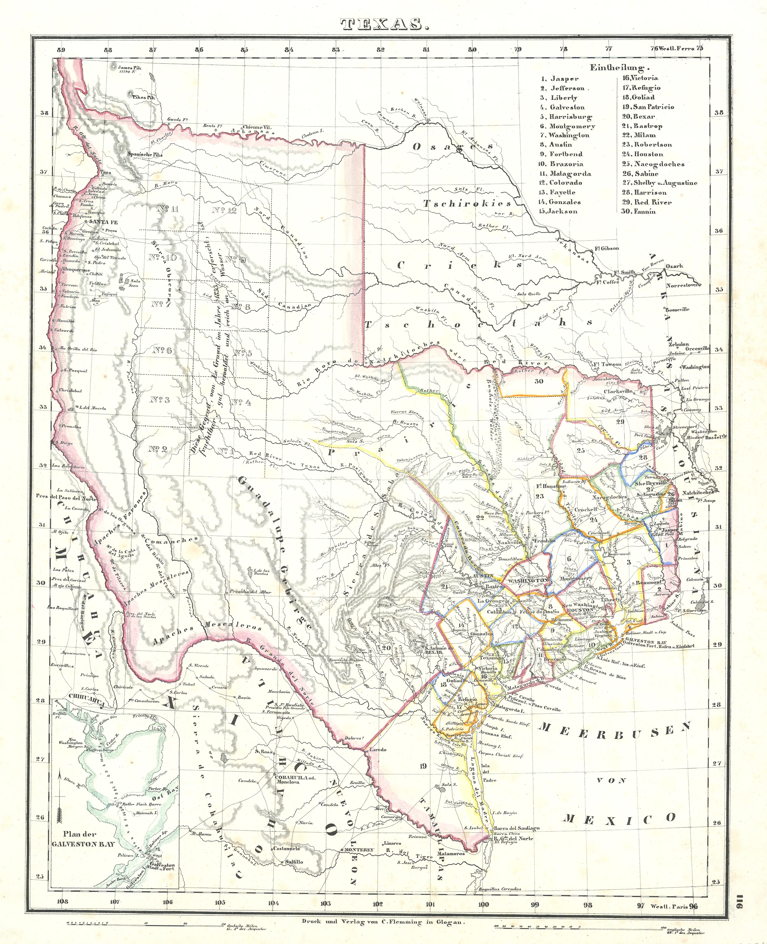
Republic of Texas: Flemming, 1844
- Author: Carl Flemming
- Date: 1844
- Medium: Hand-colored lithograph
- Condition: Very good, very mild toning throughout
- Inches: 17 1/2 x 14 1/2 [Paper]
- Centimeters: 44.45 x 36.83 [Paper]
- Product ID: 308084
German lithographic map of Texas, based on Arrowsmith's 1841 map, features thirty counties, outlined in color, and listed in a table in the upper right corner. Inset at lower left shows a plan of Galveston Bay. Relief is shown in hachures. Other features shown are towns, the locations of Indian tribes, and roads.
This map was published by Carl Flemming (1806-1878), a German publisher based in Glogau, Silesia. Flemming's map was one of the many works on Texas issued in Germany, where interest in the region was high, owing to the significant German emigration and settlement there.
- Author: Carl Flemming
- Date: 1844
- Medium: Hand-colored lithograph
- Condition: Very good, very mild toning throughout
- Inches: 17 1/2 x 14 1/2 [Paper]
- Centimeters: 44.45 x 36.83 [Paper]
- Product ID: 308084
German lithographic map of Texas, based on Arrowsmith's 1841 map, features thirty counties, outlined in color, and listed in a table in the upper right corner. Inset at lower left shows a plan of Galveston Bay. Relief is shown in hachures. Other features shown are towns, the locations of Indian tribes, and roads.
This map was published by Carl Flemming (1806-1878), a German publisher based in Glogau, Silesia. Flemming's map was one of the many works on Texas issued in Germany, where interest in the region was high, owing to the significant German emigration and settlement there.
Original: $1,900.00
-65%$1,900.00
$665.00Description
- Author: Carl Flemming
- Date: 1844
- Medium: Hand-colored lithograph
- Condition: Very good, very mild toning throughout
- Inches: 17 1/2 x 14 1/2 [Paper]
- Centimeters: 44.45 x 36.83 [Paper]
- Product ID: 308084
German lithographic map of Texas, based on Arrowsmith's 1841 map, features thirty counties, outlined in color, and listed in a table in the upper right corner. Inset at lower left shows a plan of Galveston Bay. Relief is shown in hachures. Other features shown are towns, the locations of Indian tribes, and roads.
This map was published by Carl Flemming (1806-1878), a German publisher based in Glogau, Silesia. Flemming's map was one of the many works on Texas issued in Germany, where interest in the region was high, owing to the significant German emigration and settlement there.











