[Texas]: Poates Engraving Company, 1922
- Title: [Texas]
- Author: Poates Engraving Company
- Date: 1922
- Condition: Very Good - Uniform age toning with right margin trimmed to image.
- Inches: 9 5/8 x 13 7/8 [Image]
- Centimeters: 24.44 x 35.24 [Image]
- Product ID: 308611
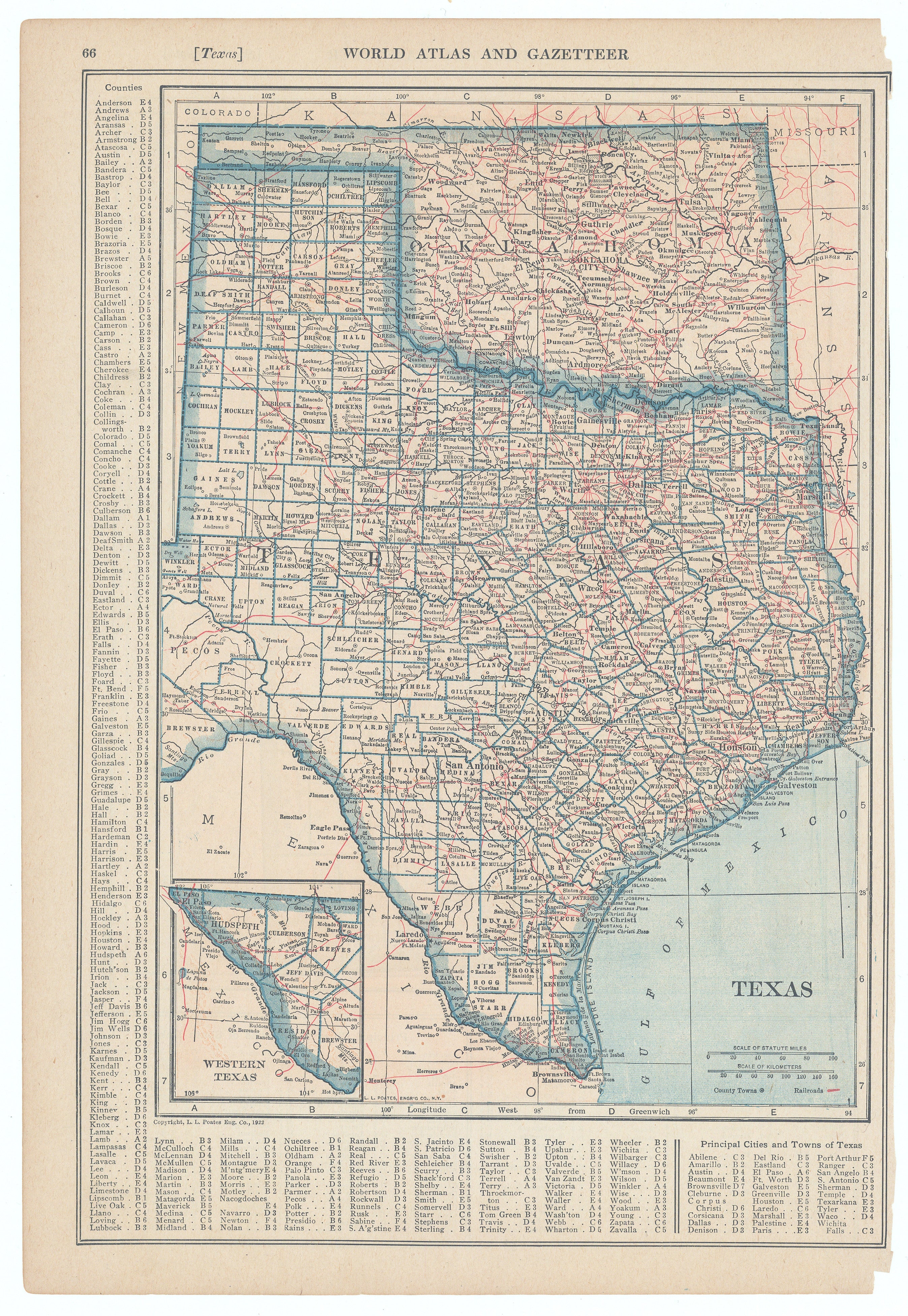
This map of Texas is from the "World Atlas and Gazetteer," published in 1922 by L.L. Poates Map Company. The map provides a detailed depiction of Texas counties, railroads, cities, and major transportation routes as they appeared in the early 1920s. It features an inset of Western Texas and extensive references of counties and principal cities, characteristic of Poates atlases and gazetteers from that period.
Background on Creator
The L.L. Poates Map Company, also known as L.L. Poates Engraving Company, was founded by Leonard L. Poates in New York City during the 1910s. The firm specialized in engraving and publishing detailed maps, atlases, and charts, and was especially active in producing state and regional maps in the early twentieth century. By the 1920s, the company had produced a variety of notable works, including complete atlases of the world and specialized maps for railways and industry, and Poates himself had relocated to Long Beach, California by 1921. Their maps are recognized for their clarity, detail, and use of the wax engraving technique, which was a leading map-printing process of that era.
- Title: [Texas]
- Author: Poates Engraving Company
- Date: 1922
- Condition: Very Good - Uniform age toning with right margin trimmed to image.
- Inches: 9 5/8 x 13 7/8 [Image]
- Centimeters: 24.44 x 35.24 [Image]
- Product ID: 308611
This map of Texas is from the "World Atlas and Gazetteer," published in 1922 by L.L. Poates Map Company. The map provides a detailed depiction of Texas counties, railroads, cities, and major transportation routes as they appeared in the early 1920s. It features an inset of Western Texas and extensive references of counties and principal cities, characteristic of Poates atlases and gazetteers from that period.
Background on Creator
The L.L. Poates Map Company, also known as L.L. Poates Engraving Company, was founded by Leonard L. Poates in New York City during the 1910s. The firm specialized in engraving and publishing detailed maps, atlases, and charts, and was especially active in producing state and regional maps in the early twentieth century. By the 1920s, the company had produced a variety of notable works, including complete atlases of the world and specialized maps for railways and industry, and Poates himself had relocated to Long Beach, California by 1921. Their maps are recognized for their clarity, detail, and use of the wax engraving technique, which was a leading map-printing process of that era.
Description
- Title: [Texas]
- Author: Poates Engraving Company
- Date: 1922
- Condition: Very Good - Uniform age toning with right margin trimmed to image.
- Inches: 9 5/8 x 13 7/8 [Image]
- Centimeters: 24.44 x 35.24 [Image]
- Product ID: 308611
This map of Texas is from the "World Atlas and Gazetteer," published in 1922 by L.L. Poates Map Company. The map provides a detailed depiction of Texas counties, railroads, cities, and major transportation routes as they appeared in the early 1920s. It features an inset of Western Texas and extensive references of counties and principal cities, characteristic of Poates atlases and gazetteers from that period.
Background on Creator
The L.L. Poates Map Company, also known as L.L. Poates Engraving Company, was founded by Leonard L. Poates in New York City during the 1910s. The firm specialized in engraving and publishing detailed maps, atlases, and charts, and was especially active in producing state and regional maps in the early twentieth century. By the 1920s, the company had produced a variety of notable works, including complete atlases of the world and specialized maps for railways and industry, and Poates himself had relocated to Long Beach, California by 1921. Their maps are recognized for their clarity, detail, and use of the wax engraving technique, which was a leading map-printing process of that era.











