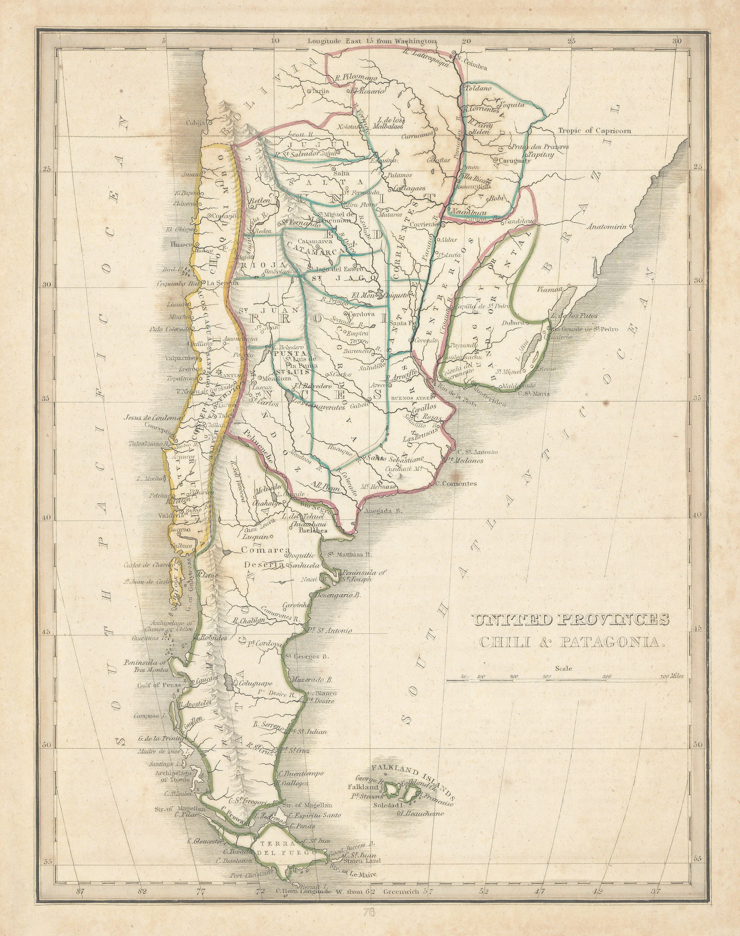
United Provinces Chili & Patagonia: Bradford c. 1835
- Title: United Provinces Chili & Patagonia
- Author: Thomas Bradford
- Date: c. 1835
- Medium: Hand-colored engraving
- Condition: Very Good - age toning, foxing
- Inches: 9 x 11 3/8 [Paper]
- Centimeters: 22.86 x 28.89 [Paper]
- Product ID: 318066
Map of South America showing present-day Chile, Argentina, Bolivia, Uruguay, the Falkland Islands, Paraguay, and part of Brazil. Longitude from the Washington and Greenwich Meridians. Also contains the cities of Montevideo, Buenos Aires, and Santiago, among others.
Thomas Gamaliel Bradford (1802-1887) was born in Boston, Massachusetts, where he worked as an assistant editor for the America Encyclopedia. Bradford's first major cartographic work was his revision and subsequent republication of an important French geography by Adrian Balbi, published in America as Atlas Designed to Illustrate the Abridgement of Universal Geography, Modern & Ancient.
Among other things, Bradford focused his atlas on the Americas and abandoned the classical decoration common in European atlases in favor of a more informational and inherently American approach. Afterwards, Bradford revised and expanded this work into his own important contribution to American cartography, the 1838 An Illustrated Atlas Geographical, Statistical and Historical of the United States and Adjacent Countries.
- Title: United Provinces Chili & Patagonia
- Author: Thomas Bradford
- Date: c. 1835
- Medium: Hand-colored engraving
- Condition: Very Good - age toning, foxing
- Inches: 9 x 11 3/8 [Paper]
- Centimeters: 22.86 x 28.89 [Paper]
- Product ID: 318066
Map of South America showing present-day Chile, Argentina, Bolivia, Uruguay, the Falkland Islands, Paraguay, and part of Brazil. Longitude from the Washington and Greenwich Meridians. Also contains the cities of Montevideo, Buenos Aires, and Santiago, among others.
Thomas Gamaliel Bradford (1802-1887) was born in Boston, Massachusetts, where he worked as an assistant editor for the America Encyclopedia. Bradford's first major cartographic work was his revision and subsequent republication of an important French geography by Adrian Balbi, published in America as Atlas Designed to Illustrate the Abridgement of Universal Geography, Modern & Ancient.
Among other things, Bradford focused his atlas on the Americas and abandoned the classical decoration common in European atlases in favor of a more informational and inherently American approach. Afterwards, Bradford revised and expanded this work into his own important contribution to American cartography, the 1838 An Illustrated Atlas Geographical, Statistical and Historical of the United States and Adjacent Countries.
Original: $145.00
-65%$145.00
$50.75Description
- Title: United Provinces Chili & Patagonia
- Author: Thomas Bradford
- Date: c. 1835
- Medium: Hand-colored engraving
- Condition: Very Good - age toning, foxing
- Inches: 9 x 11 3/8 [Paper]
- Centimeters: 22.86 x 28.89 [Paper]
- Product ID: 318066
Map of South America showing present-day Chile, Argentina, Bolivia, Uruguay, the Falkland Islands, Paraguay, and part of Brazil. Longitude from the Washington and Greenwich Meridians. Also contains the cities of Montevideo, Buenos Aires, and Santiago, among others.
Thomas Gamaliel Bradford (1802-1887) was born in Boston, Massachusetts, where he worked as an assistant editor for the America Encyclopedia. Bradford's first major cartographic work was his revision and subsequent republication of an important French geography by Adrian Balbi, published in America as Atlas Designed to Illustrate the Abridgement of Universal Geography, Modern & Ancient.
Among other things, Bradford focused his atlas on the Americas and abandoned the classical decoration common in European atlases in favor of a more informational and inherently American approach. Afterwards, Bradford revised and expanded this work into his own important contribution to American cartography, the 1838 An Illustrated Atlas Geographical, Statistical and Historical of the United States and Adjacent Countries.











