Map of the Atchison Topeka & Sante Fe Railroad System...: Rand McNally & Co., 1885
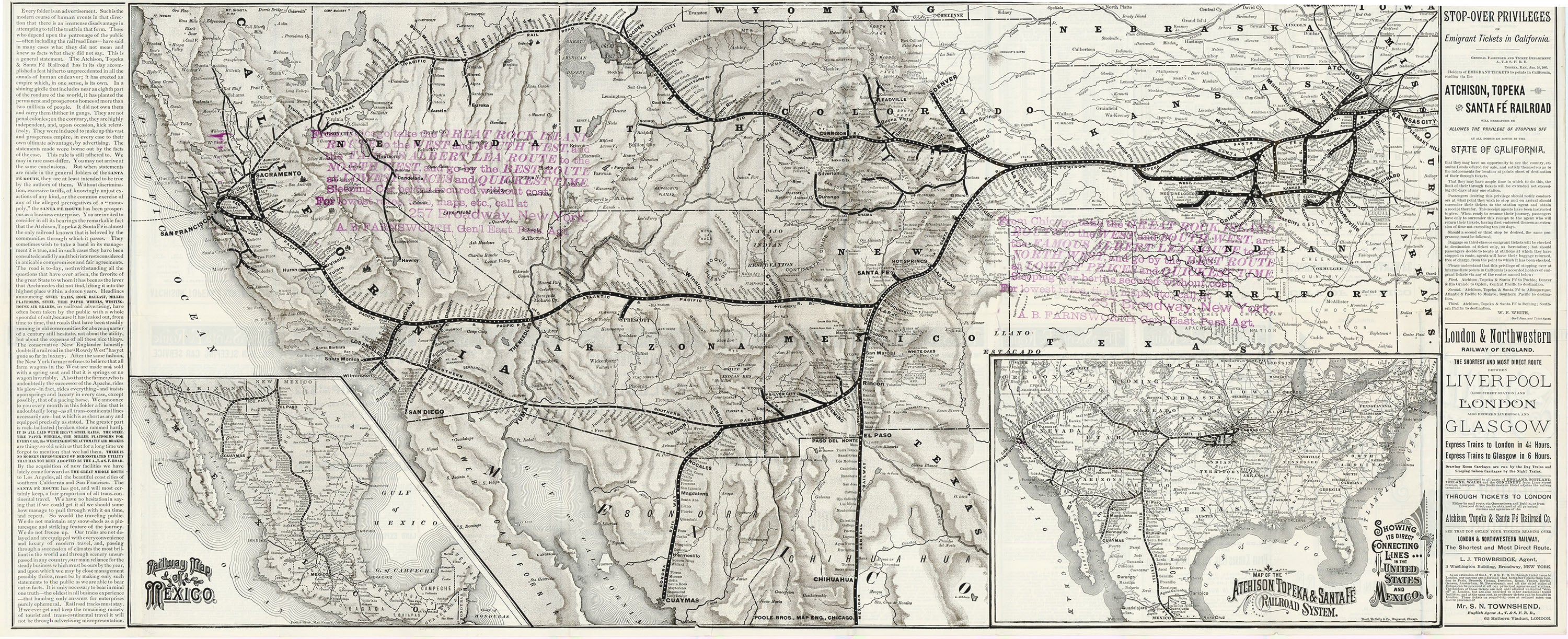
- Title: Map of the Atchison Topeka & Sante Fe Railroad System. Showing its direct connecting lines in the United States and Mexico.
- Author: Rand McNally & Co.
- Date: 1885
- Condition: Very Good - Folded as issued.
- Inches: 38.75 x 16.25 [Paper]
- Centimeters: 98.4 x 41.2 [Paper]
- Product ID: 307018
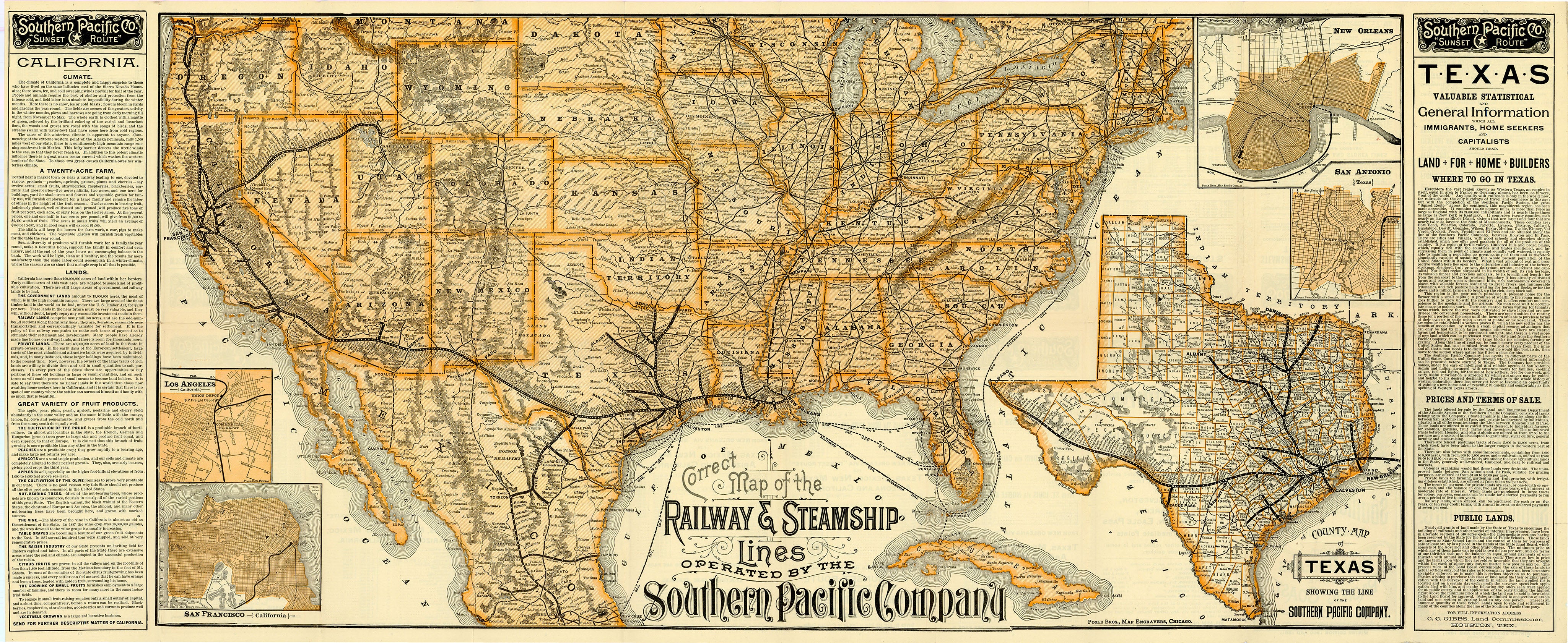
This is a late‑19th‑century promotional railroad map of the United States and Mexico, centered on the transcontinental system of the Atchison, Topeka & Santa Fe Railroad, showing its trunk line from Chicago across Kansas, Colorado, New Mexico, Arizona, and into California, with bold black lines differentiating owned and connecting routes, extensive labeling of towns, rivers, and topography in the West, inset maps of Mexico and of the eastern United States highlighting through connections to Gulf and Atlantic ports, and flanking letterpress text panels that advertise emigrant “stop‑over” privileges, ticketing from European gateways such as Liverpool and London, and the line’s claim to be the most direct and comfortable route to California and the Southwest.
In the 1880s the Atchison, Topeka & Santa Fe Railroad was a rapidly expanding western system that pushed its main line southwest into New Mexico and Arizona, reached Albuquerque in 1880 and connected with the Southern Pacific at Deming in 1881 to form a second transcontinental route, and then continued building and acquiring lines into Texas, California, and the Midwest so that by the late decade it controlled roughly 9,000 miles of track and linked Chicago, the Great Plains, the Southwest, the Gulf of Mexico, and the Pacific Coast under one aggressively promoted corporate network.
Background on Creator
In 1856, William H. Rand opened a Chicago print shop, hiring Irish immigrant Andrew McNally as a printer two years later. They established a relationship with the Chicago Tribune’s predecessor, soon taking over its printing operation in full. Eventually, in 1868 Rand, McNally, and Rand’s nephew George Amos Poole bought out the Tribune and founded Rand, McNally & Co. Now with significant printing experience under their belt, the three men embarked on several publishing endeavors, capitalizing on the massive success of Chicago’s railroad industry by printing tickets, timetables, and railroad guides. Rand, McNally & Co.’s cartographic enterprise began as an offshoot of their existing publishing business; it was not until 1872 that the company printed its first map, a wax engraving that appeared in the company’s December Railroad Guide. Thanks to the low cost and ease of production associated with wax engravings, the firm quickly became the largest commercial publisher in the United States and to this day continues to produce quality atlases, maps, and globes.
- Title: Map of the Atchison Topeka & Sante Fe Railroad System. Showing its direct connecting lines in the United States and Mexico.
- Author: Rand McNally & Co.
- Date: 1885
- Condition: Very Good - Folded as issued.
- Inches: 38.75 x 16.25 [Paper]
- Centimeters: 98.4 x 41.2 [Paper]
- Product ID: 307018
This is a late‑19th‑century promotional railroad map of the United States and Mexico, centered on the transcontinental system of the Atchison, Topeka & Santa Fe Railroad, showing its trunk line from Chicago across Kansas, Colorado, New Mexico, Arizona, and into California, with bold black lines differentiating owned and connecting routes, extensive labeling of towns, rivers, and topography in the West, inset maps of Mexico and of the eastern United States highlighting through connections to Gulf and Atlantic ports, and flanking letterpress text panels that advertise emigrant “stop‑over” privileges, ticketing from European gateways such as Liverpool and London, and the line’s claim to be the most direct and comfortable route to California and the Southwest.
In the 1880s the Atchison, Topeka & Santa Fe Railroad was a rapidly expanding western system that pushed its main line southwest into New Mexico and Arizona, reached Albuquerque in 1880 and connected with the Southern Pacific at Deming in 1881 to form a second transcontinental route, and then continued building and acquiring lines into Texas, California, and the Midwest so that by the late decade it controlled roughly 9,000 miles of track and linked Chicago, the Great Plains, the Southwest, the Gulf of Mexico, and the Pacific Coast under one aggressively promoted corporate network.
Background on Creator
In 1856, William H. Rand opened a Chicago print shop, hiring Irish immigrant Andrew McNally as a printer two years later. They established a relationship with the Chicago Tribune’s predecessor, soon taking over its printing operation in full. Eventually, in 1868 Rand, McNally, and Rand’s nephew George Amos Poole bought out the Tribune and founded Rand, McNally & Co. Now with significant printing experience under their belt, the three men embarked on several publishing endeavors, capitalizing on the massive success of Chicago’s railroad industry by printing tickets, timetables, and railroad guides. Rand, McNally & Co.’s cartographic enterprise began as an offshoot of their existing publishing business; it was not until 1872 that the company printed its first map, a wax engraving that appeared in the company’s December Railroad Guide. Thanks to the low cost and ease of production associated with wax engravings, the firm quickly became the largest commercial publisher in the United States and to this day continues to produce quality atlases, maps, and globes.
Original: $1,195.00
-65%$1,195.00
$418.25Description
- Title: Map of the Atchison Topeka & Sante Fe Railroad System. Showing its direct connecting lines in the United States and Mexico.
- Author: Rand McNally & Co.
- Date: 1885
- Condition: Very Good - Folded as issued.
- Inches: 38.75 x 16.25 [Paper]
- Centimeters: 98.4 x 41.2 [Paper]
- Product ID: 307018
This is a late‑19th‑century promotional railroad map of the United States and Mexico, centered on the transcontinental system of the Atchison, Topeka & Santa Fe Railroad, showing its trunk line from Chicago across Kansas, Colorado, New Mexico, Arizona, and into California, with bold black lines differentiating owned and connecting routes, extensive labeling of towns, rivers, and topography in the West, inset maps of Mexico and of the eastern United States highlighting through connections to Gulf and Atlantic ports, and flanking letterpress text panels that advertise emigrant “stop‑over” privileges, ticketing from European gateways such as Liverpool and London, and the line’s claim to be the most direct and comfortable route to California and the Southwest.
In the 1880s the Atchison, Topeka & Santa Fe Railroad was a rapidly expanding western system that pushed its main line southwest into New Mexico and Arizona, reached Albuquerque in 1880 and connected with the Southern Pacific at Deming in 1881 to form a second transcontinental route, and then continued building and acquiring lines into Texas, California, and the Midwest so that by the late decade it controlled roughly 9,000 miles of track and linked Chicago, the Great Plains, the Southwest, the Gulf of Mexico, and the Pacific Coast under one aggressively promoted corporate network.
Background on Creator
In 1856, William H. Rand opened a Chicago print shop, hiring Irish immigrant Andrew McNally as a printer two years later. They established a relationship with the Chicago Tribune’s predecessor, soon taking over its printing operation in full. Eventually, in 1868 Rand, McNally, and Rand’s nephew George Amos Poole bought out the Tribune and founded Rand, McNally & Co. Now with significant printing experience under their belt, the three men embarked on several publishing endeavors, capitalizing on the massive success of Chicago’s railroad industry by printing tickets, timetables, and railroad guides. Rand, McNally & Co.’s cartographic enterprise began as an offshoot of their existing publishing business; it was not until 1872 that the company printed its first map, a wax engraving that appeared in the company’s December Railroad Guide. Thanks to the low cost and ease of production associated with wax engravings, the firm quickly became the largest commercial publisher in the United States and to this day continues to produce quality atlases, maps, and globes.