Dvcatvs Silesiae Ligniciensis: Blaeu 1662
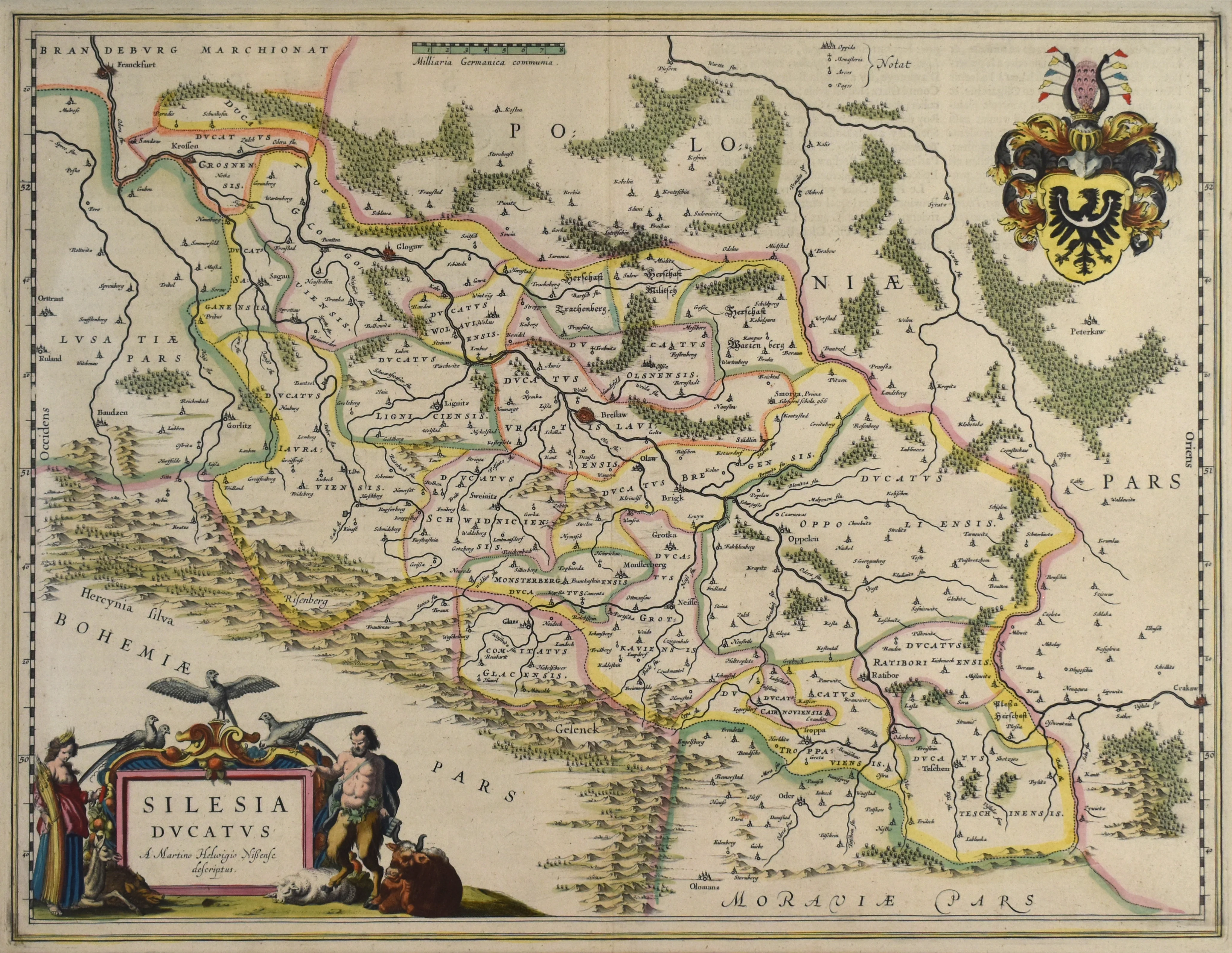
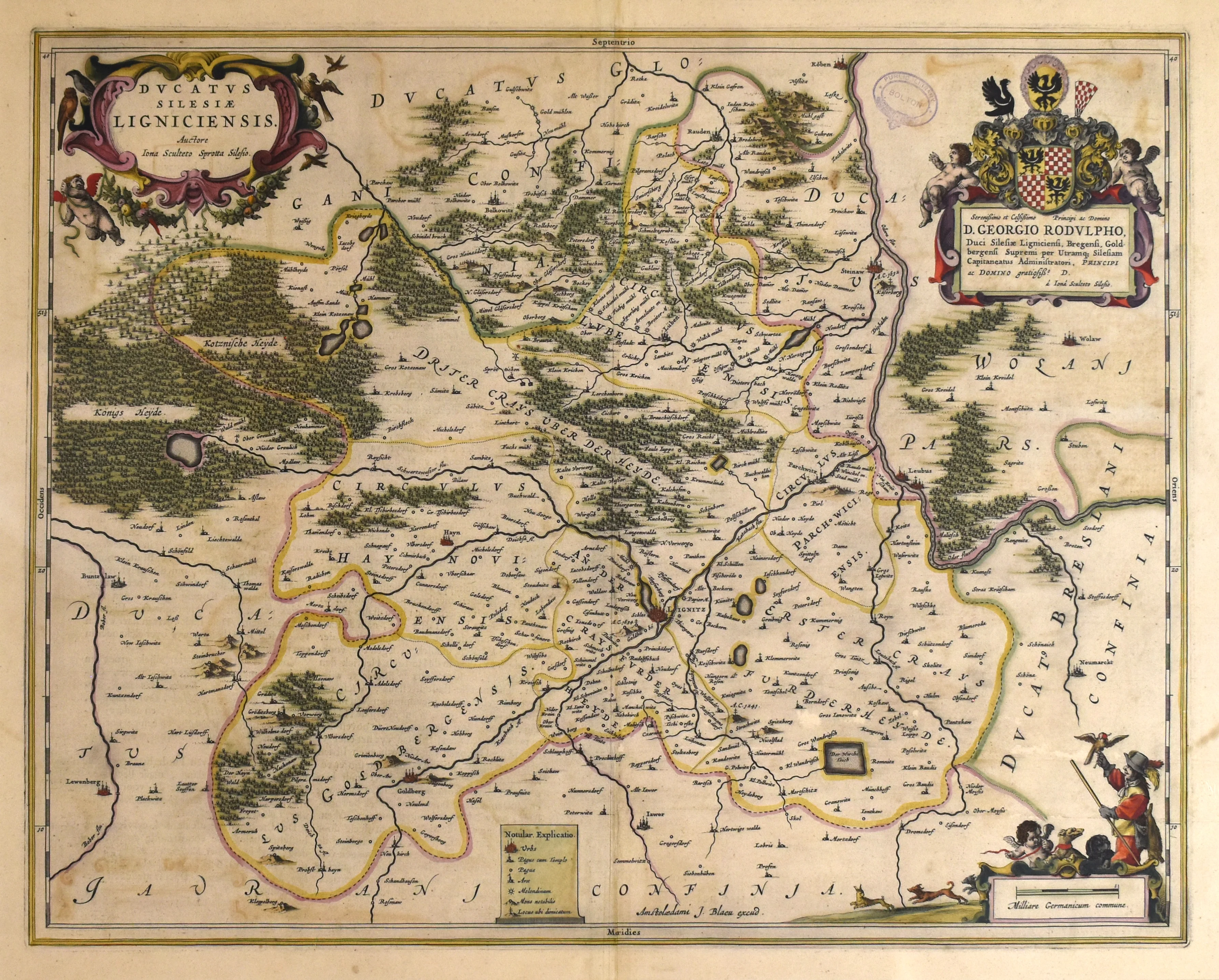
- Title: Dvcatvs Silesiae Ligniciensis
- Author: House of Blaeu
- Date: 1662
- Medium: Hand-Colored Copperplate Engraving
- Condition: Very Good, page fold visible
- Inches: 22 x 17.5 [Image]
- Centimeters: 55.9 x 44.5 [Image]
- Product ID: 233014
Dvcatvs Silesiae Ligniciensis Auctore Iona Sculteto Sprotta Silesio
Map of the region of Silesia in modern-day Poland, Germany, and the Czech Republic.
Dutch cartographer Willem Blaeu (1571-1638), and later his heirs, dominated the world cartographic landscape for much of the seventeenth century. Blaeu studied under Danish astronomer Tycho Brahe, one of the major figures in the history of modern astronomy. After returning to the Low Countries from Denmark in the late 1590s, Blaeu set up shop as a cartographer and globe maker. He produced numerous atlases, and in 1633 became the official mapmaker of the Dutch East India Company, the megacorporation which, thanks to Dutch naval prowess, controlled the seventeenth-century global economy. Numerous depictions of Blaeu maps appear in the work of Johannes Vermeer (1632-1675), one of the greatest painters of the Dutch Golden Age. Blaeu's sons, cartographers Cornelis and Joan (or Johannes) Blaeu, took over the family business after their father's death.
- Title: Dvcatvs Silesiae Ligniciensis
- Author: House of Blaeu
- Date: 1662
- Medium: Hand-Colored Copperplate Engraving
- Condition: Very Good, page fold visible
- Inches: 22 x 17.5 [Image]
- Centimeters: 55.9 x 44.5 [Image]
- Product ID: 233014
Dvcatvs Silesiae Ligniciensis Auctore Iona Sculteto Sprotta Silesio
Map of the region of Silesia in modern-day Poland, Germany, and the Czech Republic.
Dutch cartographer Willem Blaeu (1571-1638), and later his heirs, dominated the world cartographic landscape for much of the seventeenth century. Blaeu studied under Danish astronomer Tycho Brahe, one of the major figures in the history of modern astronomy. After returning to the Low Countries from Denmark in the late 1590s, Blaeu set up shop as a cartographer and globe maker. He produced numerous atlases, and in 1633 became the official mapmaker of the Dutch East India Company, the megacorporation which, thanks to Dutch naval prowess, controlled the seventeenth-century global economy. Numerous depictions of Blaeu maps appear in the work of Johannes Vermeer (1632-1675), one of the greatest painters of the Dutch Golden Age. Blaeu's sons, cartographers Cornelis and Joan (or Johannes) Blaeu, took over the family business after their father's death.
Description
- Title: Dvcatvs Silesiae Ligniciensis
- Author: House of Blaeu
- Date: 1662
- Medium: Hand-Colored Copperplate Engraving
- Condition: Very Good, page fold visible
- Inches: 22 x 17.5 [Image]
- Centimeters: 55.9 x 44.5 [Image]
- Product ID: 233014
Dvcatvs Silesiae Ligniciensis Auctore Iona Sculteto Sprotta Silesio
Map of the region of Silesia in modern-day Poland, Germany, and the Czech Republic.
Dutch cartographer Willem Blaeu (1571-1638), and later his heirs, dominated the world cartographic landscape for much of the seventeenth century. Blaeu studied under Danish astronomer Tycho Brahe, one of the major figures in the history of modern astronomy. After returning to the Low Countries from Denmark in the late 1590s, Blaeu set up shop as a cartographer and globe maker. He produced numerous atlases, and in 1633 became the official mapmaker of the Dutch East India Company, the megacorporation which, thanks to Dutch naval prowess, controlled the seventeenth-century global economy. Numerous depictions of Blaeu maps appear in the work of Johannes Vermeer (1632-1675), one of the greatest painters of the Dutch Golden Age. Blaeu's sons, cartographers Cornelis and Joan (or Johannes) Blaeu, took over the family business after their father's death.