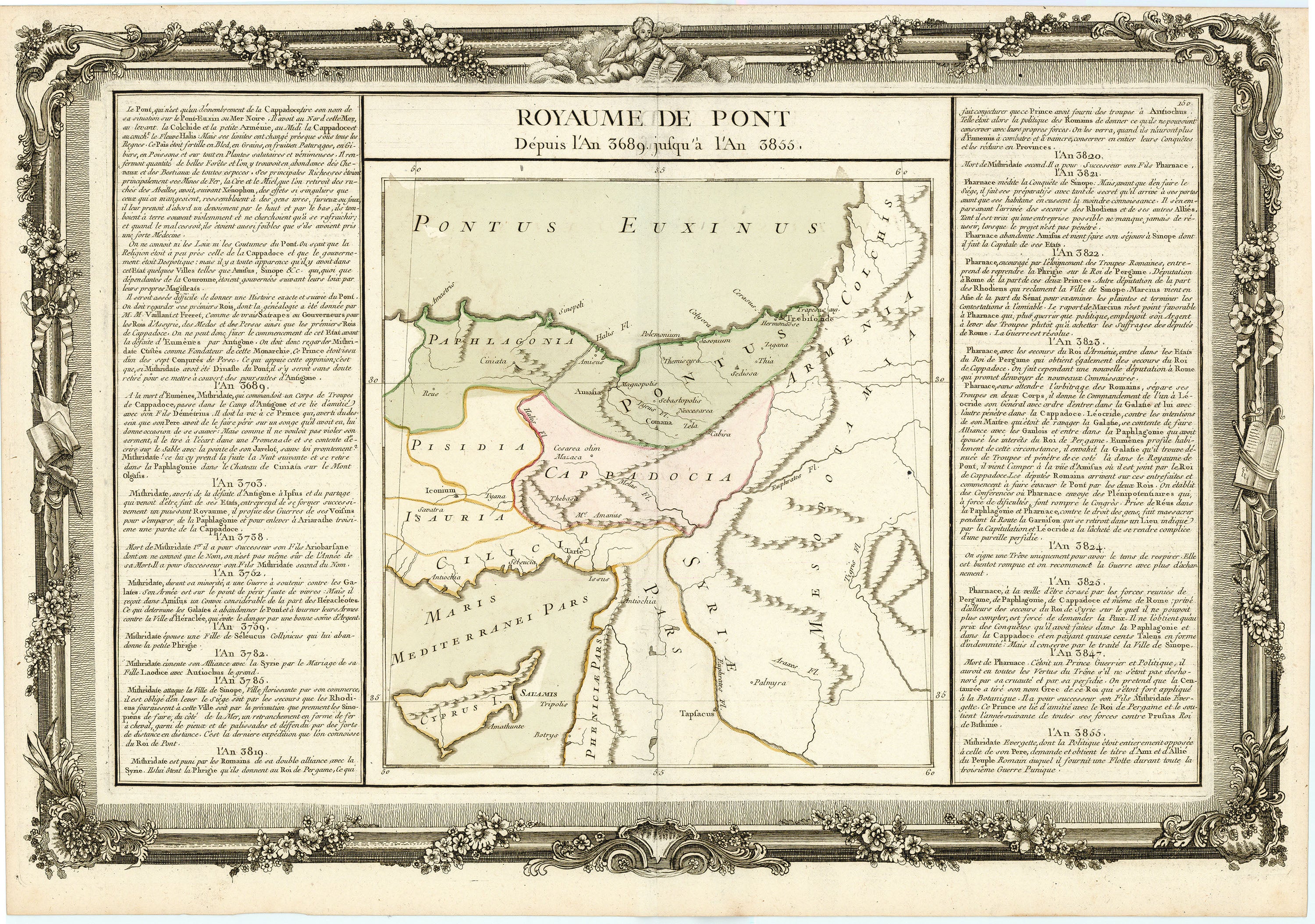
Royaume de Pont, Depuis l'An 3689, jusqu' à l'An 3855: Desnos c. 1770
- Title: Royaume de Pont, Depuis l'An 3689, jusqu' à l'An 3855
- Author: Louis Charles Desnos
- Date: c. 1770
- Medium: Hand-colored copperplate engraving
- Condition: Very Good Plus - light age toning and foxing, issued center fold
- Inches: 21 1/2 x 15 [Paper]
- Centimeters: 54.61 x 38.1 [Paper]
- Product ID: 315056
Map of the historical Kingdom of Pontus, a civilization which rose to power during the Hellenistic era in the region of present-day Turkey bordering the Black Sea.
Louis Charles Desnos (1725-1805) was a geographer, bookseller, engineer, and marketer for globes and spheres. Desnos held the coveted position of Royal Globemaker to the King of Denmark, Christian VII. The map features original hand color in outline as well as columns of French text, with remarks and details, to the left and right of the map.
- Title: Royaume de Pont, Depuis l'An 3689, jusqu' à l'An 3855
- Author: Louis Charles Desnos
- Date: c. 1770
- Medium: Hand-colored copperplate engraving
- Condition: Very Good Plus - light age toning and foxing, issued center fold
- Inches: 21 1/2 x 15 [Paper]
- Centimeters: 54.61 x 38.1 [Paper]
- Product ID: 315056
Map of the historical Kingdom of Pontus, a civilization which rose to power during the Hellenistic era in the region of present-day Turkey bordering the Black Sea.
Louis Charles Desnos (1725-1805) was a geographer, bookseller, engineer, and marketer for globes and spheres. Desnos held the coveted position of Royal Globemaker to the King of Denmark, Christian VII. The map features original hand color in outline as well as columns of French text, with remarks and details, to the left and right of the map.
Original: $150.00
-65%$150.00
$52.50Description
- Title: Royaume de Pont, Depuis l'An 3689, jusqu' à l'An 3855
- Author: Louis Charles Desnos
- Date: c. 1770
- Medium: Hand-colored copperplate engraving
- Condition: Very Good Plus - light age toning and foxing, issued center fold
- Inches: 21 1/2 x 15 [Paper]
- Centimeters: 54.61 x 38.1 [Paper]
- Product ID: 315056
Map of the historical Kingdom of Pontus, a civilization which rose to power during the Hellenistic era in the region of present-day Turkey bordering the Black Sea.
Louis Charles Desnos (1725-1805) was a geographer, bookseller, engineer, and marketer for globes and spheres. Desnos held the coveted position of Royal Globemaker to the King of Denmark, Christian VII. The map features original hand color in outline as well as columns of French text, with remarks and details, to the left and right of the map.