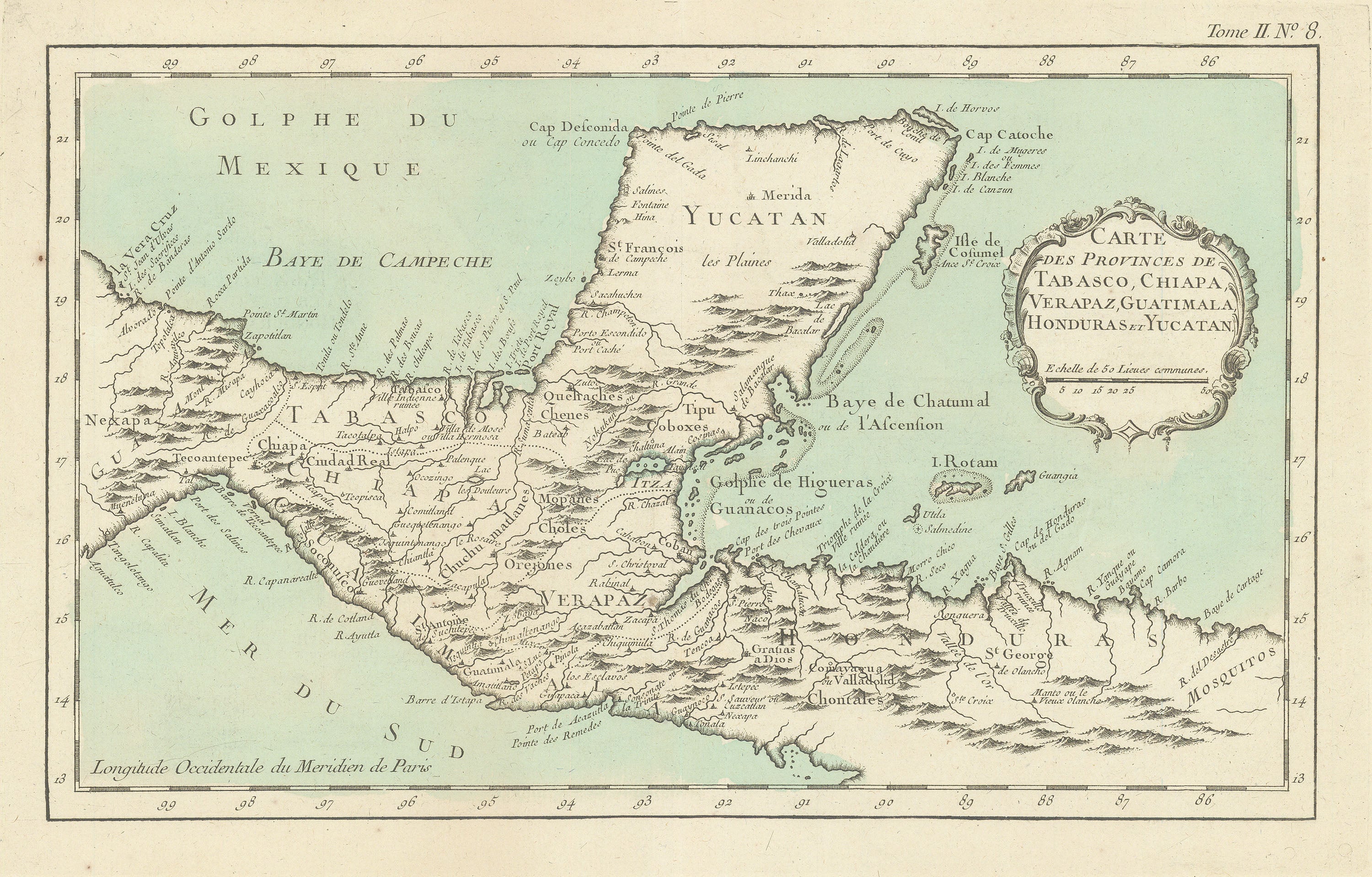
Carte des Provinces de Tabasco, Chiapa, Verapaz, Guatimala, Honduras et Yucatan: Bellin 1764
- Title: Carte des Provinces de Tabasco, Chiapa, Verapaz, Guatimala, Honduras et Yucatan
-
Author: Jacques-Nicolas Bellin
- Date: 1764
- Medium: Hand-colored copperplate engraving
- Condition: Very Good Plus - light age toning, creasing in margins, issued center fold
- Inches: 17 1/4 x 12 1/2 [Paper]
- Centimeters: 43.82 x 31.75 [Paper]
- Product ID: 318044
Map of Mexico's Yucatán Peninsula and environs by French hydrographer and geographer Jacques-Nicolas Bellin (1703-1772), who produced a prodigious body of work over a nearly fifty-year career. Includes present-day El Salvador, Belize, Guatemala, and Honduras. Longitude from the Paris Meridian.
Appointed hydrographer of the French Navy at the age of eighteen, Bellin eventually became Hydrographer to the King in 1741. He published numerous sea atlases and charts which would be reprinted into the nineteenth century, as well as many maps depicting French colonial territories in the New World. His craftsmanship and commitment to accuracy earned him a distinguished reputation as one of the world's leading cartographers, and many other European mapmakers turned to him for source material.
- Title: Carte des Provinces de Tabasco, Chiapa, Verapaz, Guatimala, Honduras et Yucatan
-
Author: Jacques-Nicolas Bellin
- Date: 1764
- Medium: Hand-colored copperplate engraving
- Condition: Very Good Plus - light age toning, creasing in margins, issued center fold
- Inches: 17 1/4 x 12 1/2 [Paper]
- Centimeters: 43.82 x 31.75 [Paper]
- Product ID: 318044
Map of Mexico's Yucatán Peninsula and environs by French hydrographer and geographer Jacques-Nicolas Bellin (1703-1772), who produced a prodigious body of work over a nearly fifty-year career. Includes present-day El Salvador, Belize, Guatemala, and Honduras. Longitude from the Paris Meridian.
Appointed hydrographer of the French Navy at the age of eighteen, Bellin eventually became Hydrographer to the King in 1741. He published numerous sea atlases and charts which would be reprinted into the nineteenth century, as well as many maps depicting French colonial territories in the New World. His craftsmanship and commitment to accuracy earned him a distinguished reputation as one of the world's leading cartographers, and many other European mapmakers turned to him for source material.
Description
- Title: Carte des Provinces de Tabasco, Chiapa, Verapaz, Guatimala, Honduras et Yucatan
-
Author: Jacques-Nicolas Bellin
- Date: 1764
- Medium: Hand-colored copperplate engraving
- Condition: Very Good Plus - light age toning, creasing in margins, issued center fold
- Inches: 17 1/4 x 12 1/2 [Paper]
- Centimeters: 43.82 x 31.75 [Paper]
- Product ID: 318044
Map of Mexico's Yucatán Peninsula and environs by French hydrographer and geographer Jacques-Nicolas Bellin (1703-1772), who produced a prodigious body of work over a nearly fifty-year career. Includes present-day El Salvador, Belize, Guatemala, and Honduras. Longitude from the Paris Meridian.
Appointed hydrographer of the French Navy at the age of eighteen, Bellin eventually became Hydrographer to the King in 1741. He published numerous sea atlases and charts which would be reprinted into the nineteenth century, as well as many maps depicting French colonial territories in the New World. His craftsmanship and commitment to accuracy earned him a distinguished reputation as one of the world's leading cartographers, and many other European mapmakers turned to him for source material.