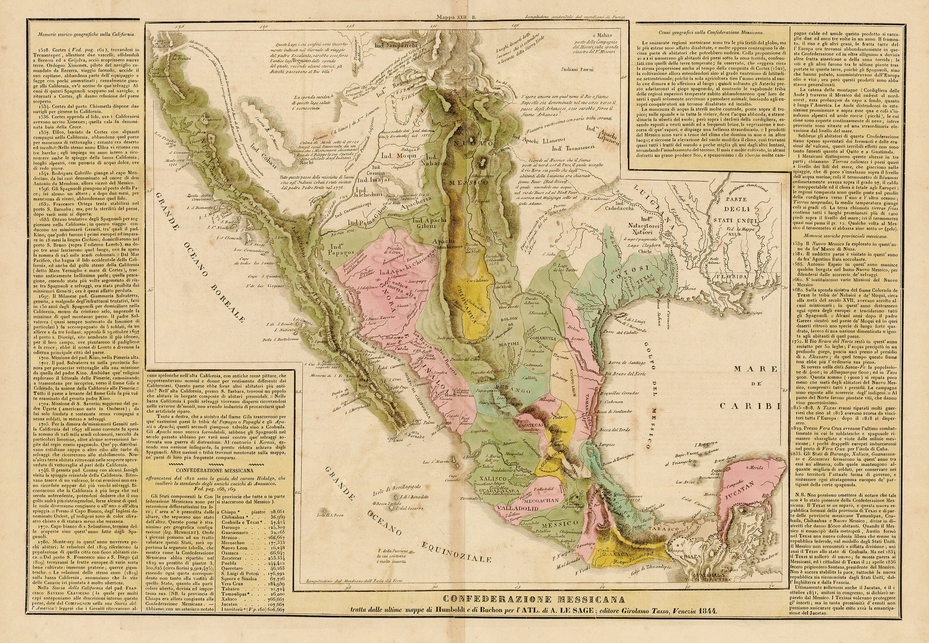
Confederazione Messicana: Tasso 1844
- Title: Confederazione Messicana
- Author: Girolamo Tasso
- Date: 1844
- Medium: Hand-colored engraving
- Condition: Very Good Plus - light age toning, areas of foxing
- Inches: 20 3/4 x 15 1/2 [Paper]
- Centimeters: 52.71 x 39.37 [Paper]
- Product ID: 319074
N.B. Non possiamo omettere di notre che tale non è lo stato presente della Confederazione Messicana. Il Texas se ne separò, e questa nuova repubblica formasi della provincia di Texas e di parte delle provincie messicane Tamaulipas, Coahuila, Chihuahua e Nuovo Messico, divise in distretti che danno 85000 abitanti. Quando il Messico si emancipò dalla metropoli, Austin formò nel Texas una nuova colonia libera che eresse in repubblica federale, sul modello degli Stati Uniti. Il Messico non acconsentì a siffatta divisione; unì anzi il Texas allo stato di Coahuila. Ma nel 1834 il Texas si sollevò di nuovo; fu mossa Guerra ai Messicani, ed i cittadini di Texas il 21 aprile 1836 fecero prigioniero Santana, president del Messico. Non è ancora stabilita la pace, tuttochè la nuova repubblica sia riconosciuta dagli Stati Uniti, dall’ Inghilterra e dalla Francia.
“N.B. We cannot fail to note that such is not the present state of the Mexican Confederation. Texas separated from it, and this new republic formed from the province of Texas and part of the Mexican provinces of Tamaulipas, Coahuila, Chihuahua and New Mexico, divided into districts with 85,000 inhabitants each. When Mexico emancipated itself from the metropolis [Madrid, capital of Spain], Austin formed a new free colony in Texas which he erected into a federal republic, modeled on the United States. Mexico did not consent to such a division; indeed, it united Texas with the state of Coahuila. But in 1834 Texas rose again; War was waged on the Mexicans, and the citizens of Texas on April 21, 1836, took Santana, president of Mexico, prisoner. Peace has not yet been established, although the new republic is recognized by the United States, England and France.”
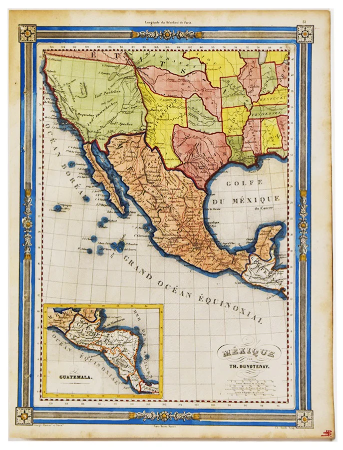
Italian map of Mexico published in 1844, eight years after Texas independence. However, an extensive note in the bottom right corner admits the map’s inaccuracy; though the map depicts Texas as a Mexican possession, Texas had, in fact, won its independence from Mexico in 1836. The publishers remain unsure as to the final resolution of this geo-political conflict, as the map states that although Texas has received recognition by the United States, England, and France, “Non è ancora stabilita la pace” (“Peace is not yet established”). Features extensive accompanying text having to do with the history and topography of the region, such as dates of European arrival. Along the bottom margin appears a list of the Mexican states with their populations.
- Title: Confederazione Messicana
- Author: Girolamo Tasso
- Date: 1844
- Medium: Hand-colored engraving
- Condition: Very Good Plus - light age toning, areas of foxing
- Inches: 20 3/4 x 15 1/2 [Paper]
- Centimeters: 52.71 x 39.37 [Paper]
- Product ID: 319074
N.B. Non possiamo omettere di notre che tale non è lo stato presente della Confederazione Messicana. Il Texas se ne separò, e questa nuova repubblica formasi della provincia di Texas e di parte delle provincie messicane Tamaulipas, Coahuila, Chihuahua e Nuovo Messico, divise in distretti che danno 85000 abitanti. Quando il Messico si emancipò dalla metropoli, Austin formò nel Texas una nuova colonia libera che eresse in repubblica federale, sul modello degli Stati Uniti. Il Messico non acconsentì a siffatta divisione; unì anzi il Texas allo stato di Coahuila. Ma nel 1834 il Texas si sollevò di nuovo; fu mossa Guerra ai Messicani, ed i cittadini di Texas il 21 aprile 1836 fecero prigioniero Santana, president del Messico. Non è ancora stabilita la pace, tuttochè la nuova repubblica sia riconosciuta dagli Stati Uniti, dall’ Inghilterra e dalla Francia.
“N.B. We cannot fail to note that such is not the present state of the Mexican Confederation. Texas separated from it, and this new republic formed from the province of Texas and part of the Mexican provinces of Tamaulipas, Coahuila, Chihuahua and New Mexico, divided into districts with 85,000 inhabitants each. When Mexico emancipated itself from the metropolis [Madrid, capital of Spain], Austin formed a new free colony in Texas which he erected into a federal republic, modeled on the United States. Mexico did not consent to such a division; indeed, it united Texas with the state of Coahuila. But in 1834 Texas rose again; War was waged on the Mexicans, and the citizens of Texas on April 21, 1836, took Santana, president of Mexico, prisoner. Peace has not yet been established, although the new republic is recognized by the United States, England and France.”
Italian map of Mexico published in 1844, eight years after Texas independence. However, an extensive note in the bottom right corner admits the map’s inaccuracy; though the map depicts Texas as a Mexican possession, Texas had, in fact, won its independence from Mexico in 1836. The publishers remain unsure as to the final resolution of this geo-political conflict, as the map states that although Texas has received recognition by the United States, England, and France, “Non è ancora stabilita la pace” (“Peace is not yet established”). Features extensive accompanying text having to do with the history and topography of the region, such as dates of European arrival. Along the bottom margin appears a list of the Mexican states with their populations.
Original: $650.00
-65%$650.00
$227.50Description
- Title: Confederazione Messicana
- Author: Girolamo Tasso
- Date: 1844
- Medium: Hand-colored engraving
- Condition: Very Good Plus - light age toning, areas of foxing
- Inches: 20 3/4 x 15 1/2 [Paper]
- Centimeters: 52.71 x 39.37 [Paper]
- Product ID: 319074
N.B. Non possiamo omettere di notre che tale non è lo stato presente della Confederazione Messicana. Il Texas se ne separò, e questa nuova repubblica formasi della provincia di Texas e di parte delle provincie messicane Tamaulipas, Coahuila, Chihuahua e Nuovo Messico, divise in distretti che danno 85000 abitanti. Quando il Messico si emancipò dalla metropoli, Austin formò nel Texas una nuova colonia libera che eresse in repubblica federale, sul modello degli Stati Uniti. Il Messico non acconsentì a siffatta divisione; unì anzi il Texas allo stato di Coahuila. Ma nel 1834 il Texas si sollevò di nuovo; fu mossa Guerra ai Messicani, ed i cittadini di Texas il 21 aprile 1836 fecero prigioniero Santana, president del Messico. Non è ancora stabilita la pace, tuttochè la nuova repubblica sia riconosciuta dagli Stati Uniti, dall’ Inghilterra e dalla Francia.
“N.B. We cannot fail to note that such is not the present state of the Mexican Confederation. Texas separated from it, and this new republic formed from the province of Texas and part of the Mexican provinces of Tamaulipas, Coahuila, Chihuahua and New Mexico, divided into districts with 85,000 inhabitants each. When Mexico emancipated itself from the metropolis [Madrid, capital of Spain], Austin formed a new free colony in Texas which he erected into a federal republic, modeled on the United States. Mexico did not consent to such a division; indeed, it united Texas with the state of Coahuila. But in 1834 Texas rose again; War was waged on the Mexicans, and the citizens of Texas on April 21, 1836, took Santana, president of Mexico, prisoner. Peace has not yet been established, although the new republic is recognized by the United States, England and France.”
Italian map of Mexico published in 1844, eight years after Texas independence. However, an extensive note in the bottom right corner admits the map’s inaccuracy; though the map depicts Texas as a Mexican possession, Texas had, in fact, won its independence from Mexico in 1836. The publishers remain unsure as to the final resolution of this geo-political conflict, as the map states that although Texas has received recognition by the United States, England, and France, “Non è ancora stabilita la pace” (“Peace is not yet established”). Features extensive accompanying text having to do with the history and topography of the region, such as dates of European arrival. Along the bottom margin appears a list of the Mexican states with their populations.