Major Industries, Waterways & Highways Port Arthur, Beaumont, Orange & Lake Charles Areas: Gulf Oil Corp. c. 1976
- Title: Major Industries, Waterways & Highways Port Arthur, Beaumont, Orange & Lake Charles Areas
- Author: Gulf Oil Corp.
- Date: c. 1976
- Condition: Very Good Plus - small separations at issued folding
- Inches: 32 3/4 x 21 [Paper]
- Centimeters: 83.19 x 53.34 [Paper]
- Product ID: 317039
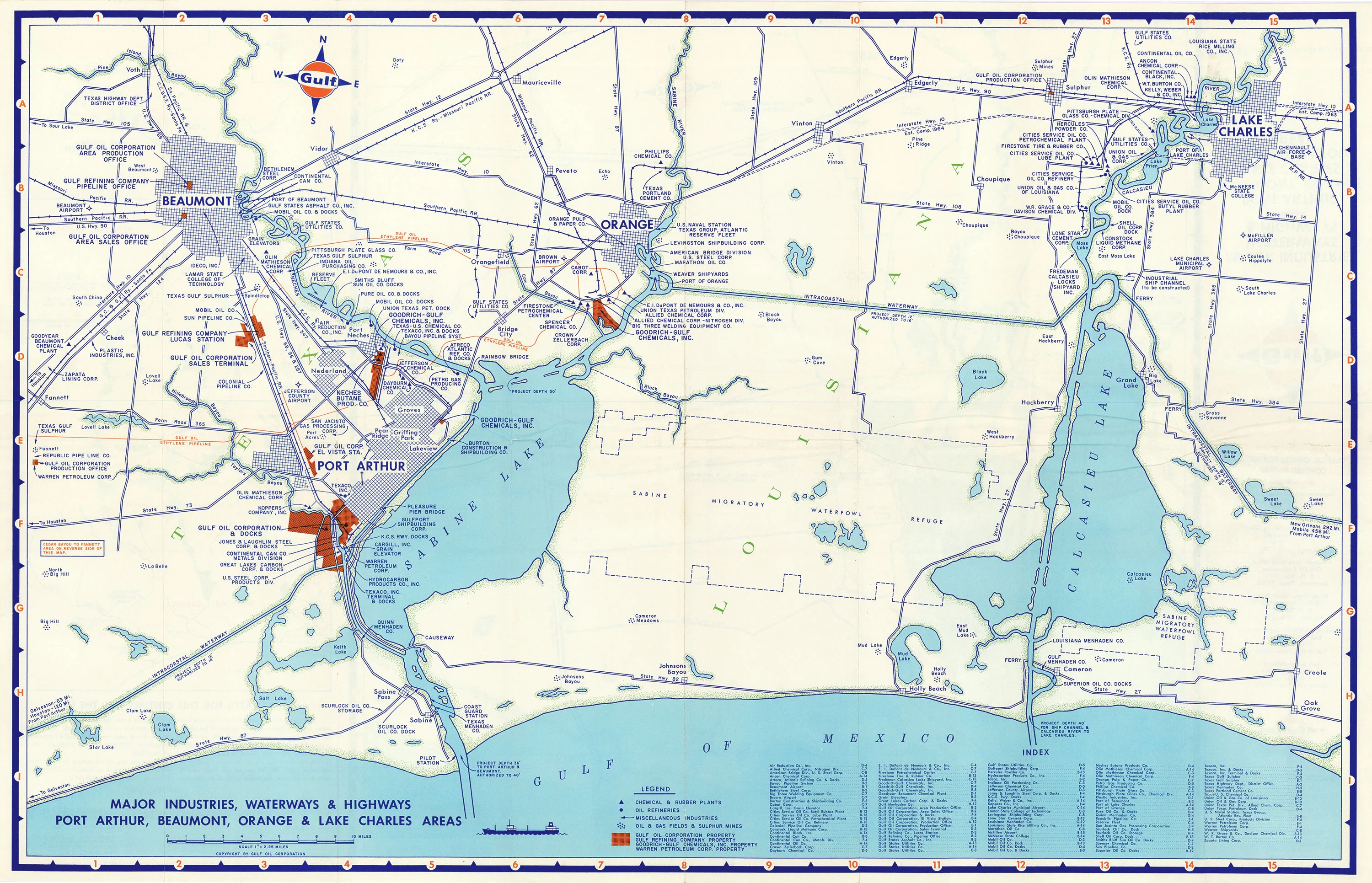
Folding map showing the Gulf Coast at the Texas-Louisiana border, published by the Gulf Oil Corporation in the 1970s. Map features Beaumont and Port Arthur, Texas, along with Lake Charles and Orange, Louisiana, and shows the various waterways, highways, railroads, docks, and ports within the region. Bodies of water include Sabine Lake and Calcasieu Lake. Verso shows Trinity Bay and environs farther west along the Gulf Coast, and contains an inset showing nearby fresh water deposits.
- Title: Major Industries, Waterways & Highways Port Arthur, Beaumont, Orange & Lake Charles Areas
- Author: Gulf Oil Corp.
- Date: c. 1976
- Condition: Very Good Plus - small separations at issued folding
- Inches: 32 3/4 x 21 [Paper]
- Centimeters: 83.19 x 53.34 [Paper]
- Product ID: 317039
Folding map showing the Gulf Coast at the Texas-Louisiana border, published by the Gulf Oil Corporation in the 1970s. Map features Beaumont and Port Arthur, Texas, along with Lake Charles and Orange, Louisiana, and shows the various waterways, highways, railroads, docks, and ports within the region. Bodies of water include Sabine Lake and Calcasieu Lake. Verso shows Trinity Bay and environs farther west along the Gulf Coast, and contains an inset showing nearby fresh water deposits.
Original: $395.00
-65%$395.00
$138.25Description
- Title: Major Industries, Waterways & Highways Port Arthur, Beaumont, Orange & Lake Charles Areas
- Author: Gulf Oil Corp.
- Date: c. 1976
- Condition: Very Good Plus - small separations at issued folding
- Inches: 32 3/4 x 21 [Paper]
- Centimeters: 83.19 x 53.34 [Paper]
- Product ID: 317039
Folding map showing the Gulf Coast at the Texas-Louisiana border, published by the Gulf Oil Corporation in the 1970s. Map features Beaumont and Port Arthur, Texas, along with Lake Charles and Orange, Louisiana, and shows the various waterways, highways, railroads, docks, and ports within the region. Bodies of water include Sabine Lake and Calcasieu Lake. Verso shows Trinity Bay and environs farther west along the Gulf Coast, and contains an inset showing nearby fresh water deposits.