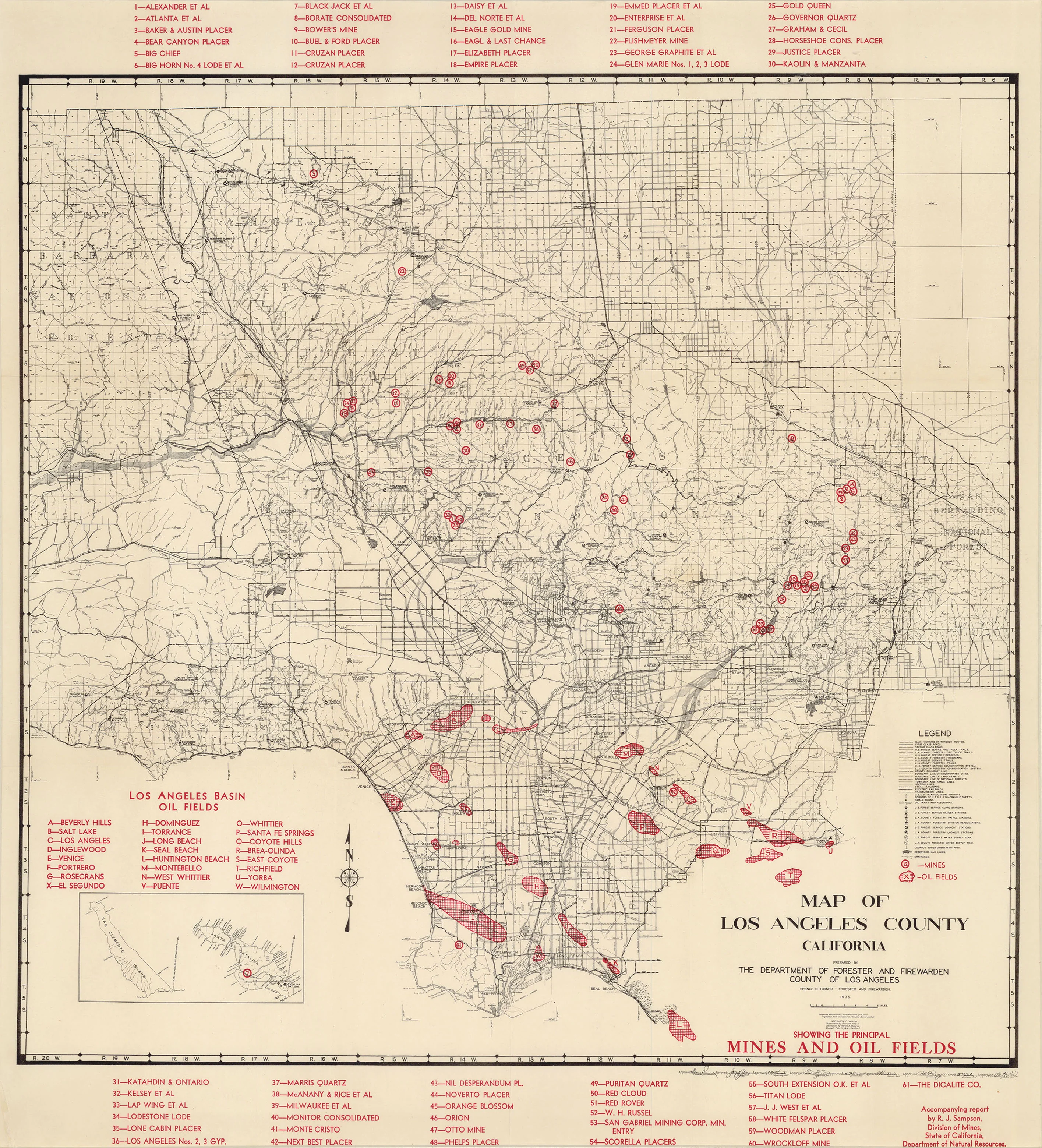
Map of Los Angeles County California... Showing the Principal Mines and Oil Fields: Turner c. 1935
- Title: Map of Los Angeles County California... Showing the Principal Mines and Oil Fields
- Author: Spence D. Turner
- Date: c. 1935
- Medium: Chromolithograph
- Condition: Very Good Plus - light age toning, creasing throughout
- Inches: 23 x 24 5/8 [Image]
- Centimeters: 58.42 x 62.55 [Image]
- Product ID: 100205
Map of Los Angeles County California
Prepared by the Department of Forester and Firewarden, County of Los Angeles
Spence D. Turner - Forester and Firewarden, 1935.
Showing the Principal Mines and Oil Fields.
Map of Los Angeles County, California. Includes numbered legend indicating the locations of major oil fields and mines, a compass rose, an inset in lower left showing San Clemente and Santa Catalina Islands, and a key along the lower right margin explaining the use of various symbols.
- Title: Map of Los Angeles County California... Showing the Principal Mines and Oil Fields
- Author: Spence D. Turner
- Date: c. 1935
- Medium: Chromolithograph
- Condition: Very Good Plus - light age toning, creasing throughout
- Inches: 23 x 24 5/8 [Image]
- Centimeters: 58.42 x 62.55 [Image]
- Product ID: 100205
Map of Los Angeles County California
Prepared by the Department of Forester and Firewarden, County of Los Angeles
Spence D. Turner - Forester and Firewarden, 1935.
Showing the Principal Mines and Oil Fields.
Map of Los Angeles County, California. Includes numbered legend indicating the locations of major oil fields and mines, a compass rose, an inset in lower left showing San Clemente and Santa Catalina Islands, and a key along the lower right margin explaining the use of various symbols.
Original: $400.00
-65%$400.00
$140.00Description
- Title: Map of Los Angeles County California... Showing the Principal Mines and Oil Fields
- Author: Spence D. Turner
- Date: c. 1935
- Medium: Chromolithograph
- Condition: Very Good Plus - light age toning, creasing throughout
- Inches: 23 x 24 5/8 [Image]
- Centimeters: 58.42 x 62.55 [Image]
- Product ID: 100205
Map of Los Angeles County California
Prepared by the Department of Forester and Firewarden, County of Los Angeles
Spence D. Turner - Forester and Firewarden, 1935.
Showing the Principal Mines and Oil Fields.
Map of Los Angeles County, California. Includes numbered legend indicating the locations of major oil fields and mines, a compass rose, an inset in lower left showing San Clemente and Santa Catalina Islands, and a key along the lower right margin explaining the use of various symbols.