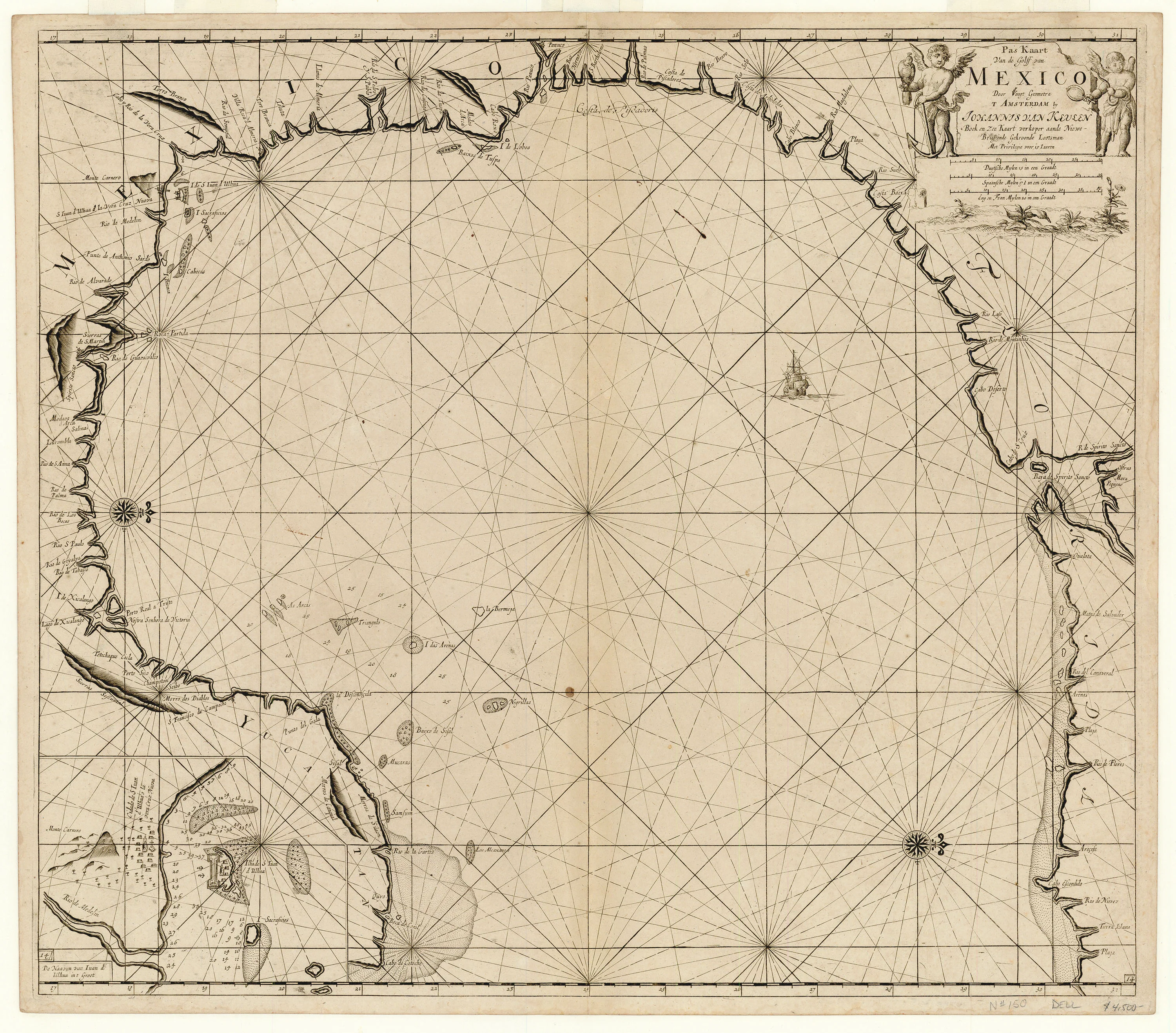
Pas Kaart Van de Golff van Mexico: Van Keulen 1695
- Title: Pas Kaart Van de Golff van Mexico
- Author: Johannes van Keulen
- Date: 1695
- Medium: Copperplate engraving
- Condition: Very Good Plus - evenly age toned, marginal tide marking, dust soiling, a few unobtrusive stains. A very good example
- Inches: 20 x 22.8 [Image]
- Centimeters: 50.8 x 57.91 [Image]
- Product ID: 315101
The Dutch commercial empire, an immense naval and economic force, reached the height of its power and size during the seventeenth century. The success of Dutch shipping relied on accurate navigational information from charts and pilot books such as Johannes van Keulen's five-part sea atlas Nieuwe Lichtende Zee-Fakkel (1681-1684). The apex of Dutch pilot books, Niewe Lichtende Zee-Fakkel enjoyed a considerable reputation for accuracy, recognized as superior to anything else on the market at the time. The House of van Keulen, active without break from 1678 to 1885, was the largest non-governmental hydrographic office in the world.
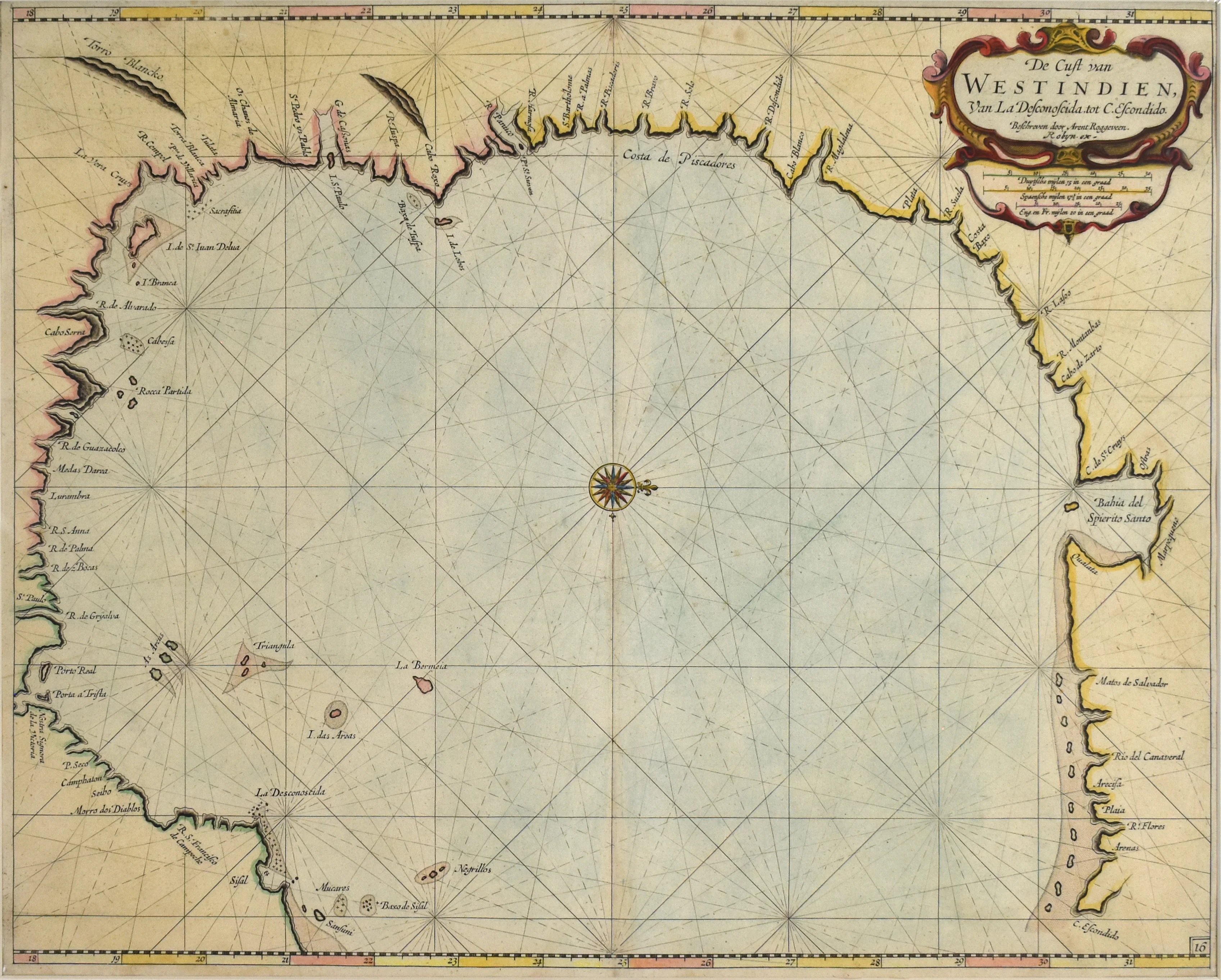
This important map from Niewe Lichtende Zee-Fakkel shows the navigational waters of the Gulf of Mexico from the Yucatán peninsula to present-day Florida, depicting the coastline of present-day Alabama, Mississippi, Louisiana, Texas, and Mexico. This was the most sophisticated rendering of the Texas coastline then available. Exclusively concerned with navigation, it includes no details of the interior. Van Keulen derived the map's geography from an earlier, exceedingly rare Hessel Gerritsz chart (published c. 1631). Because the region had not undergone significant cartographic developments for a period, all place names hail from earlier Spanish charts and maps. Cabo Escondido most likely relates to Cape San Blas near the site of Apalachicola, while the Baja de Spiritu Sancto represents the mouth of the Mississippi River and the inset at lower left show the waters of Vera Cruz. Van Keulen orients the Gulf Coast such that north corresponds to the map's right margin, a common convention in Dutch see charts of the era. This is an essential early chart perfect for a Texas or Gulf Coast collection.
- Title: Pas Kaart Van de Golff van Mexico
- Author: Johannes van Keulen
- Date: 1695
- Medium: Copperplate engraving
- Condition: Very Good Plus - evenly age toned, marginal tide marking, dust soiling, a few unobtrusive stains. A very good example
- Inches: 20 x 22.8 [Image]
- Centimeters: 50.8 x 57.91 [Image]
- Product ID: 315101
The Dutch commercial empire, an immense naval and economic force, reached the height of its power and size during the seventeenth century. The success of Dutch shipping relied on accurate navigational information from charts and pilot books such as Johannes van Keulen's five-part sea atlas Nieuwe Lichtende Zee-Fakkel (1681-1684). The apex of Dutch pilot books, Niewe Lichtende Zee-Fakkel enjoyed a considerable reputation for accuracy, recognized as superior to anything else on the market at the time. The House of van Keulen, active without break from 1678 to 1885, was the largest non-governmental hydrographic office in the world.
This important map from Niewe Lichtende Zee-Fakkel shows the navigational waters of the Gulf of Mexico from the Yucatán peninsula to present-day Florida, depicting the coastline of present-day Alabama, Mississippi, Louisiana, Texas, and Mexico. This was the most sophisticated rendering of the Texas coastline then available. Exclusively concerned with navigation, it includes no details of the interior. Van Keulen derived the map's geography from an earlier, exceedingly rare Hessel Gerritsz chart (published c. 1631). Because the region had not undergone significant cartographic developments for a period, all place names hail from earlier Spanish charts and maps. Cabo Escondido most likely relates to Cape San Blas near the site of Apalachicola, while the Baja de Spiritu Sancto represents the mouth of the Mississippi River and the inset at lower left show the waters of Vera Cruz. Van Keulen orients the Gulf Coast such that north corresponds to the map's right margin, a common convention in Dutch see charts of the era. This is an essential early chart perfect for a Texas or Gulf Coast collection.
Original: $5,500.00
-65%$5,500.00
$1,925.00Description
- Title: Pas Kaart Van de Golff van Mexico
- Author: Johannes van Keulen
- Date: 1695
- Medium: Copperplate engraving
- Condition: Very Good Plus - evenly age toned, marginal tide marking, dust soiling, a few unobtrusive stains. A very good example
- Inches: 20 x 22.8 [Image]
- Centimeters: 50.8 x 57.91 [Image]
- Product ID: 315101
The Dutch commercial empire, an immense naval and economic force, reached the height of its power and size during the seventeenth century. The success of Dutch shipping relied on accurate navigational information from charts and pilot books such as Johannes van Keulen's five-part sea atlas Nieuwe Lichtende Zee-Fakkel (1681-1684). The apex of Dutch pilot books, Niewe Lichtende Zee-Fakkel enjoyed a considerable reputation for accuracy, recognized as superior to anything else on the market at the time. The House of van Keulen, active without break from 1678 to 1885, was the largest non-governmental hydrographic office in the world.
This important map from Niewe Lichtende Zee-Fakkel shows the navigational waters of the Gulf of Mexico from the Yucatán peninsula to present-day Florida, depicting the coastline of present-day Alabama, Mississippi, Louisiana, Texas, and Mexico. This was the most sophisticated rendering of the Texas coastline then available. Exclusively concerned with navigation, it includes no details of the interior. Van Keulen derived the map's geography from an earlier, exceedingly rare Hessel Gerritsz chart (published c. 1631). Because the region had not undergone significant cartographic developments for a period, all place names hail from earlier Spanish charts and maps. Cabo Escondido most likely relates to Cape San Blas near the site of Apalachicola, while the Baja de Spiritu Sancto represents the mouth of the Mississippi River and the inset at lower left show the waters of Vera Cruz. Van Keulen orients the Gulf Coast such that north corresponds to the map's right margin, a common convention in Dutch see charts of the era. This is an essential early chart perfect for a Texas or Gulf Coast collection.