West Central and North Texas Wildcat Map: Midland Map Company 1956
- Title: West Central and North Texas Wildcat Map
- Author: Midland Map Company
- Date: 1956
- Medium: Chromolithograph
- Condition: Very Good Plus - light age toning, some wear and discoloration along issued folds
- Inches: 26 x 28 1/2 [Paper]
- Centimeters: 66.04 x 72.39 [Paper]
- Product ID: 233099
Midland Map Company
412 No. Big Spring Midland, Texas Phone 2-1603
West Central
and
North Texas Wildcat Map
Showing Oil Fields, County Seats, and All Major Highways
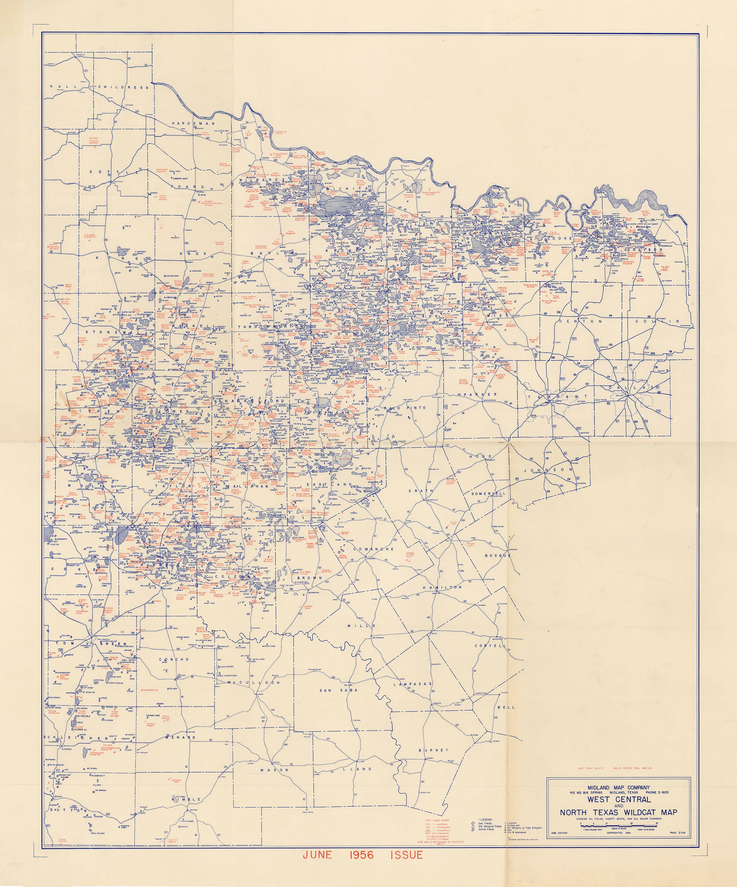
Wildcat map of oil fields and wells in northwest Texas around Midland and Dallas-Ft. Worth. Includes the Red River bordering Oklahoma in the map's upper portion. Legend indicates the locations of sites such as Gas Fields, Old Marginal Fields, and Active Fields.
- Title: West Central and North Texas Wildcat Map
- Author: Midland Map Company
- Date: 1956
- Medium: Chromolithograph
- Condition: Very Good Plus - light age toning, some wear and discoloration along issued folds
- Inches: 26 x 28 1/2 [Paper]
- Centimeters: 66.04 x 72.39 [Paper]
- Product ID: 233099
Midland Map Company
412 No. Big Spring Midland, Texas Phone 2-1603
West Central
and
North Texas Wildcat Map
Showing Oil Fields, County Seats, and All Major Highways
Wildcat map of oil fields and wells in northwest Texas around Midland and Dallas-Ft. Worth. Includes the Red River bordering Oklahoma in the map's upper portion. Legend indicates the locations of sites such as Gas Fields, Old Marginal Fields, and Active Fields.
$68.25
Original: $195.00
-65%West Central and North Texas Wildcat Map: Midland Map Company 1956—
$195.00
$68.25Description
- Title: West Central and North Texas Wildcat Map
- Author: Midland Map Company
- Date: 1956
- Medium: Chromolithograph
- Condition: Very Good Plus - light age toning, some wear and discoloration along issued folds
- Inches: 26 x 28 1/2 [Paper]
- Centimeters: 66.04 x 72.39 [Paper]
- Product ID: 233099
Midland Map Company
412 No. Big Spring Midland, Texas Phone 2-1603
West Central
and
North Texas Wildcat Map
Showing Oil Fields, County Seats, and All Major Highways
Wildcat map of oil fields and wells in northwest Texas around Midland and Dallas-Ft. Worth. Includes the Red River bordering Oklahoma in the map's upper portion. Legend indicates the locations of sites such as Gas Fields, Old Marginal Fields, and Active Fields.